


.jpg?w=305&h=230&dpr)


- 9D/8N
- 9D/8N
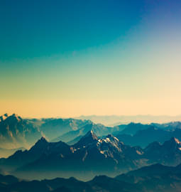
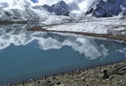
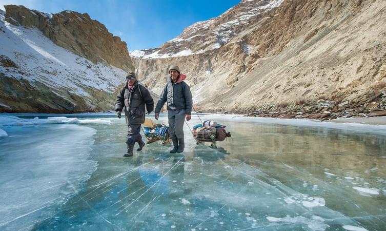
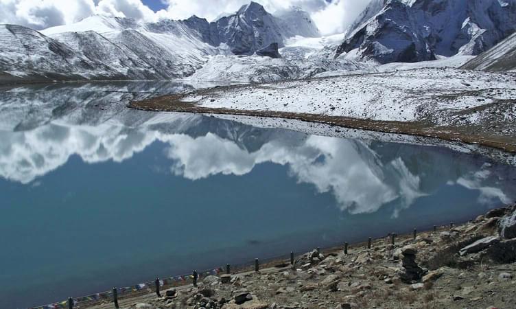
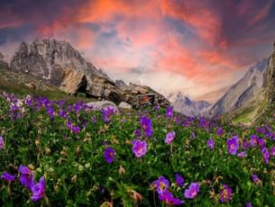
About Chadar Frozen River Trek :
The Chadar Trek, also known as the Zanskar River Chadar Trek, is a thrilling winter adventure over the frozen Zanskar River in Ladakh, India. This spectacular journey takes trekkers through breathtaking landscapes of icy cliffs and snow-covered mountains. Starting near the village of Chilling, the trek unfolds the mystery of the Himalayas as adventurers navigate the frozen river, experiencing the unique challenges and beauty of the region. With temperatures dropping significantly, the trek requires careful preparation and endurance but rewards participants with an unforgettable experience amidst the untouched wilderness of the Zanskar region.
Departure Dates:
➔ Jan '25: 5th, 7th, 8th, 10th, 12th, 16th, 18th, 20th, 25th.
➔ Feb '25: 1st & 2nd
Chadar Trek Quick Facts:
- Chadar River Trek Duration: 9D/8N
- Chadar Trek Distance: 62 km
- Maximum Altitude: 11,123ft
- Difficulty Level: Difficult
- Chadar Trek Temperature: -5 to -15 degrees (during the day) and -15 to -25 degrees (during the night)
- Chadar Trek Best Time: Early January-Early February.
- Start and End Point of the Trek: Guest House in Leh.
- Nearest Airport: Leh airport. (Kushok Bakula Rimpochee Airport)
- Last ATM: Leh Market and Airport.
How to Reach Leh :
By Air: The most convenient way to reach Leh is by taking a direct flight to Kushok Bakula Rimpochee Airport from New Delhi. This journey can take around 1 hour and 15 minutes and is offered by various airlines including SpiceJet, Air India, and IndiGo.
By Road: Delhi is approximately 930 kilometres and it takes around 24 hours to reach depending on the road conditions. You can take an HRTC bus from Delhi to Leh via Manali which takes approximately 30 hours to reach. Similarly, you can opt for a road trip to Leh from Delhi via NH 3 which can take around 25 hours depending on the route and halts.
Best of

.jpg?gravity=center&width=90&height=90&crop=fill&quality=auto&fetch_format=auto&flags=strip_profile&format=jpg&sign_url=true)


- 12D/11N
- Kathmandu
- 12D/11N
• Cost with stay in Kathmandu and airport transfers: INR 42,500 per person
• Cost with stay in Kathmandu, airport transfers and all meals: INR 58,500 per person
Best of


Best Offers on Himalayan Treks: Enquire Now

Best of


- 2D/1N
- Mcleodganj
- 2D/1N
Start/End Point: Bhagsu Nag Taxi Stand
Start/End Time: 09:000 AM (Day1) & 12:00 PM (Day2)
Camp Location: Leta/Mana village Village (2.5 km before Triund)
About Triund:
- Triund is the easiest Himalayan trek. With breathtaking views of the Kangra valley and the snow covered Dhauladhar ranges, it is also very picturesque.
- Triund is the ideal destination for those seeking a hassle-free taste of trekking in the Himalayas. The trek can easily be done over a weekend.
- The trail to Triund is short but steep. The steep climb is well-compensated by refreshing walks amongst rhododendron and oak trees. There are also various songbirds in the forests along the trail which make it a birdwatcher’s delight.
About the Triund Trek:
- Get a chance to witness the many small hamlets and stream through the trek to Triund.
- Feast your eyes at the majestic view of the Dhauladhar ranges on one side and Kangra valley on the other
- Enjoy camping at a high summit and the clear night sky under the billions of stars.
- Also, enjoy a small bonfire with your friends and the other trekkers in Alpine tents on double/triple sharing basis.
- Trek through some of the most beautiful forests of alpine and fir, Rhododendron and Oak.
- Get a chance to witness the rare flora and fauna of this region as you continue your Triund trek.
- Also, taste the local cuisine of this region while you head out for the trek to Triund.
Quick Facts:
Maximum Altitude: 9,432 ft
Difficulty Level: Easy
Electricity: Electricity is available at the campsite
ATM: Mcleodganj is the last point where you will find an ATM
Trekking Gradient: Steep throughout the trail
How to reach the campsite?
You have to report at Bhagsu Nag Taxi Stand which is the starting point of the trek and it is around 3 km from Mcleodganj. Many local transports and private cabs are available from Mcleodganj to reach Bhagsu Nag.
Note: If the snow at the top of base camp is beyond the operator's control, the camping for the day will be organized in Dharamkot instead.
Best of


- 2D/1N
- Dehradun
- 2D/1N
Quick facts about Nag Tibba Trek:
- Nag Tibba Temperature: 14 to 22 degrees (days) and 6 to14 degrees (nights) between September and December and 16 to 25 degrees (days) and - 8 to 16 degrees (nights) during other months
- Nag Tibba Trek distance: 15 km
- Maximum Altitude: 9,910 ft.
- Starting and Ending Point: The trek to Nag Tibba starts and ends at Dehradun/Delhi depending on the variant you choose.
- Nearest Railway Station: Dehradun is the nearest railway station
- Nearest Airport: Jolly Grant Airport, Dehradun
- ATM: You will find ATM's in Mussoorie and Naianbagh.
- Nag Tibba Trek Difficulty Level: Easy
Best of


- 2D/1N
- Mandi
- 2D/1N
Starting & Ending Point: Panarsa
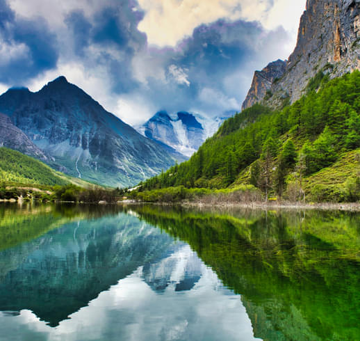
About Prashar Lake:
With views fit for a king, the trail, leading to the lake region i.e. from the city of Mandi to the little village of Apple village Jawalapur, become private and exclusive to every group that visits. The setting of the campsite in Prashar Lake location is yet another pleasant surprise because of its closeness to the water and its harmony with nature.
Prashar Lake trek (2,730m), which happily takes people to the lake which is completely frozen in the winter and a dazzling beauty otherwise, is considered to be an important trek in Himachal Pradesh. It has in day: 13°C to 18°C , in Night: 0°C to 7°C and maximum altitude 8,956 ft.
The picture-perfect blue water lake is surrounded by the majestic Dhauladhar Ranges in Kullu Valley and it is always kept as a secret in the Mandi district of Himachal Pradesh.
About the Prashar Lake Trek Package:
Tour will be started from Panaras through driving you will reach Apple village Jawalapur and from where your trek will start for Prashar Lake. You will have camp stay at beautiful lake site for one night and in morning again you will trek till Apple village Jawalapur from there you will drive by to Panarsa. During this trek, you will be going through the charming trails crossing the forests and several small streams. All meals for the Prashar Lake trek is included in the package.
Apart from trekking you will have sightseeing, bonfire at camp and as per weather yoga meditation as well. As you climb the trails up, you will come to meet the local people and it is the best chance to know the indigenous culture closely. Also, once you finish the trek to Prashar Lake, you will have a satisfied heart filled with plenty of beautiful views of Dhauladhar, Pir Panjal, and Kinnaur mountain ranges.
There is a surprisingly beautiful attraction near the lake that is the local temple of Prashar Rishi which has a lot of significant architectural brilliance carved on the walls. If you're in the mood for some outdoor adventure and want these memories to be etched forever, then make Prashar Lake trekking the trek of your choice!
About Camping:
For a decent stay, you can opt for alpine tents with common washroom facilities. All tent offers amenities like mattresses, pillows and clean linen. In the evening enjoy the musical night with a bonfire.
Quick Facts About Prashar Lake Trek:
Trekking distance: 24 km
Maximum altitude: 2730 m
Prashar Lake Trek Difficulty level: Easy To Moderate
ATM: Mandi is the last point where you will get an ATM
Meals during your Prashar Lake Trek:
Breakfast, lunch and dinner (vegetarian and non-vegetarian) are included in the package
Stay during your Prashar Lake Trek:
Transit Room on the day of arrival in Panarsa for freshen-up
Clock Room to leave any extra stuff at Panarsa
Stay at Prashar Lake (Camping)
Double/ triple/ Quad sharing Basis in camps
How to reach :
Nearest railway station is Shimla and nearest airport is Bhuntar Airport, Kullu from there one can reach by bus and private vehicle. One can also take a direct bus from Delhi to Panarsa.
Note: The group package is available on weekends. Private trek can be arranged for more than one adult.
Best of


- 6D/5N
- Dehradun
- 6D/5N
Departure Dates:
December: 5,6,12,13,14,15,16,17,18,19,20,21,22,23,24,25,26,27,28,29,30,31,
January: 1,2,3,4,5,9,10,16,17,23,24,30,31
February: 6,7,13,14,20,21,27,28
Kedarkantha Trek Highlights:
About the Kedarkantha Trek:
For those of you who are looking for some thrilling adventure then Kedarkantha trek is perfectly made for you. Decorated with a beguiling magnificence of falling snow and bordered with pine trees, The Kedarkantha Peak is a standout amongst the most looked for after snow trekking destinations in India. You will start this trek from Dehradun which is another beautiful destination. The drive to Kedarkantha takes you through Mussoorie, and some of the scenic beauty of the region till you reaches Sankri.
During your trek, you will come across some of the majestic sights of the snow-capped Himalayas, the verdant greenery, lush landscapes, a myriad collection of flora and frozen ponds. As you continue your trek you will also see remote towns where ladies and children are busy taking, bundles of wooden logs, wooden sticks and dry leaves to use them for cooking and set up bonfires at night. Kedarkantha trekking package gives you that perfect trekking experience that you have been long waiting for.
About the Kedarkantha:
In the celestial like the state of Uttarakhand, lies the snowy delight of Kedarkantha trek which is another beautiful trek. Close to the famous Har ki dun valley, this place is lesser visited. Steeped in unsurpassed beauty, over here you find charming villages, vast stretches of meadows, snow paths and magnificent views of the great Himalayas. The people of the region are said to be friendly and follow a unique culture and practice. Uttarakhand, permeating nature’s glory offers a dramatic landscape dotted with lovely lakes, tranquil rivers, mountains and rising Himalayan peaks. This is one trek which should not be missed by the adventure seekers who loves to take some challenges. This trek is an ideal destination for the nature lovers to bask in the prettiness of intact nature and enjoy wonderful and heavenly moments with exhilarating experiences.
Best time to visit Kedarkantha Trek:
The best time to visit the Kedarkantha trek is in the months of December to April. The entire region is covered with sparkling white snow and the base of alpine trees is half-submerged with it. If the snowy mountains attract you then this the best time for you to witness the true beauty of nature. The months of June to September are the monsoon months and one must avoid trekking at this time. The trekking route remains open in the summertime but the beauty in the winter months is truly paradisiacal that makes it the best time to visit Kedarkantha.
Quick Facts About Kedarkantha Trek:
Temperature: Day: 8°C to 15°C and Night: -5°C to 3°C
Kedarkantha Trek Distance: 20 km
Maximum Altitude: 12,500 ft
Kedarkantha Trek Difficulty Level: Easy To Moderate
Railway Station: Dehradun is the nearest railway station
Airport: Jolly Grant Airport, Dehradun
Base Camp: Sankri (10 hrs drive from Dehradun)
ATM: Purola has the last ATM point before your trek begins.
Meals during Kedar Kantha Trek:
Everyday Snacks, breakfast, lunch and dinner (vegetarian) are included in the package
Stay during Kedar Kantha Trek:
Tent or Guesthouse stay on triple/quad sharing basis
Standard tents/Hotels/Guest House with attached washroom in Sankri
Alpine tents in Juda – ka - Talab
Alpine tents in Base of Kedarkantha
There are two different variants available with this package as given below:
Variant 1: Kedarkantha Trek Ex Sankri- Rs. 6000/- per person
Variant 2: Kedarkantha Trek Ex Dehradun- Rs. 8000/- per person
How to reach?
Haridwar has a railway station which is well-connected from all metropolitan cities and nearest airport is Dehradun - Jolly Grant.
Best of


- 4D/3N
- Haridwar
- 4D/3N
For inquiry please call @ 7412020072
About the Chopta Tungnath Trek:
Tungnath trek is short and easy in the Chopta Tungnath trek which runs parallel to the sky-scraping Himalayan Treks. Tunganath is the highest temple of Garwal. During this hiking, one can enjoy a clear view of majestic peaks of Panchchuli, Nanda Devi, Nilkanth and Kedarnath. Chopta gives a picturesque view of the Himalayas. In the early spring, the Rhododendron forest glows red as the flowers bloom.
Your journey for the Chopta Tungnath trekking will start from Haridwar, in Haridwar will visit the famous Mandakini Valley, the river and lake. Then we will visit Chopta, which is surrounded by dense forests. From Chopta, we will start for Tungnath and Chandrashilla Top (Our last destination).
About the Destination:
Tungnath is always the starting point of the Chanadrashila summit trek which possesses a captivating beauty with the help of many deodar and rhododendron forests. Chopta has a myriad collection of pictorial sights to bewitch the visitors which is marvelously engulfed by huge vegetation in spring and summer. During winter it would be appealing to all eyes since the thick cover of snow will be an amusing part of the region.
The summit of the Chandrashilla peak provides a breathtaking 360-degree view. Views, which go far beyond the simple view of mountains.
Quick Facts About Chopta Tungnath Trek:
Temperature: Day: 8°C to 15°C and Night: -5°C to 3°C
Maximum Altitude: 11,154 ft
Chopta to Tungnath Trek Distance: 5 Km
Chopta Tungnath Trek Difficulty Level: Easy To Moderate
Railway Station: Haridwar is the nearest railway station
Airport: Jolly Grant Airport, Dehradun
Base Camp: Sari Village (6 hrs drive from Haridwar)
ATM: Last ATM is in Ukhimath, around 13 km before Sari.
Best of


- 6D/5N
- 6D/5N
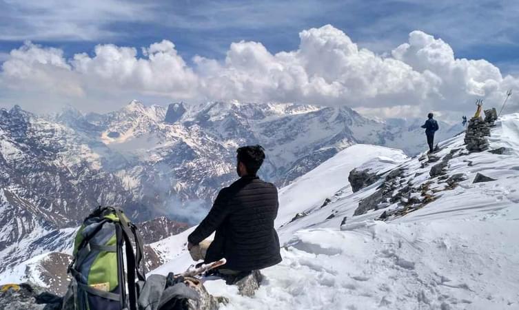
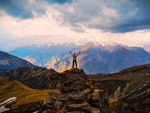
About the Kuari Pass Trek:
A top winter trekking destination in India, the Kuari Pass Trek is tucked away in the gorgeous Garhwal region of the Himalayas. This trail, also known as the Lord Curzon trail, is situated at an elevation of 12,516 feet and offers both historical value and breathtaking natural scenery.
You can experience the vibrant local traditions of Uttarakhand as you travel through villages of Tugasi, Guling, and Khullara with the Kuari Pass trek package. The Pangarchulla, Chaukhamba, Neelkanth, Dronagiri, Hathi Ghoda, and Nilgiri mountain ranges are among the breathtaking sights that can be seen from the trail.
The spectacular vista of the Nanda Devi Massif, which provides an amazing backdrop for stargazing, is the trek's high point. With an easy to moderate difficulty level, the Kuari Pass trip is suitable for both novice and seasoned hikers.
You may come across the paw prints of snow leopards and Himalayan bears throughout your walk, offering a unique look into the local wildlife. The span of November-March is the best time for Kuari Pass trek because of the perfect weather that makes for an unforgettable experience.
Departure Dates (2024)
November: 3, 9, 11, 16, 17, 23, 24, 30
December: 1, 7, 8, 10, 13, 14, 15, 18, 19, 21, 22, 23, 24, 25, 26, 27, 28, 29, 30, 31
January: 4, 5, 6, 11, 12
Kuari Pass Trek Quick Facts:
- Duration:6D/5N
- Kuari Pass Trek Distance: 33 km
- Kuari Pass Altitude: 12,516 ft
- Difficulty Level: Easy To Moderate
- Kuari PassTemperature: Day: 13°C to 18°C and Night: -3°C to 4°C
- Best time for Kuari Pass Trek: March to mid-June & mid-September to early November
- Railway Station: Haridwar is the nearest railway station
- Airport: Jolly Grant Airport, Dehradun
- ATM: The last ATM is available in Joshimath
- Start-End Point: Haridwar


.jpg?w=753&h=450&dpr)
- 7D/6N
- 7D/6N
About Har Ki Dun Trek:
If you love summer treks to expansive valleys surrounded by lofty peaks, the Har Ki Dun trek trails can definitely mesmerise you. This is a 7-day-long trek that you can easily undertake with the help of Thrillophilia’s expert trek leaders.
Being an easy-moderate level trek, Har Ki Dun receives well-deserved importance in the trekking community worldwide. The name “Har Ki Dun” refers to the “Valley of Lord Mahadev”. Its trails take you through dense forests of pine and deodar trees, along the banks of rapidly flowing Tons and Supin rivers, and across several undulating landscapes.
This trek journey spans around 43 kilometres (both ways) and touches the highest altitude of 12000 feet. You can plan for Har Ki Dun trekking during the summer or autumn season to get the best of this journey.
One of the main reasons for choosing to undertake this exciting adventure with Thrillophilia lies in our on-ground support. With well-arranged camps, proper food, and immediate rescue facilities, you can find comfort even in the nooks of the mighty Himalayas.
So, buckle up and book your slots now. Get ready to pack your rucksack and set out to the Valley of Gods, Har Ki Dun!
Har Ki Doon Trek Quick facts:
Duration: 7D/6N
Maximum altitude: 11,675 ft
Har Ki Dun Trek Difficulty Level: Easy to Moderate
Har Ki Dun Trek Distance: 47 KM
Temperature: 10℃ to 15℃ during the day and 2℃ to -5℃ during the night
Best Time to do Har ki Dun Trek: April to Mid-June and October to Mid-November
ATM: Purola has the last ATM before your trek begins
Start/End Point of the trek: Sankri Village
Best of
.jpg?gravity=center&width=90&height=90&crop=fill&quality=auto&fetch_format=auto&flags=strip_profile&format=jpg&sign_url=true)


- 6D/5N
- Kathgodam
- 6D/5N
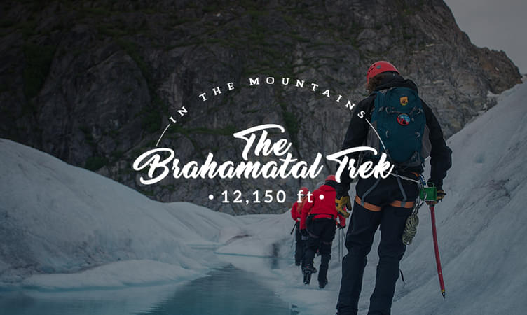
About the Brahmatal Trek:
Known as one of the most enchanting treks, the Brahmatal trek is a great winter trek for the nature lovers and adventure seekers. You will start this amazing trek from Kathgodam and make your way through some of the beauty of the region. Upon your arrival in Kathgodam early morning, you will be picked from the railway station or bus stand. You will be traveling for 9 hours to reach Lohajung which is 225 KM away from Kathgodam. By late afternoon, you will reach Lohajung where you will be staying at night in a guest house.
On second day of your Brahmatal trekking tour, you will be trekking from Lohajung to Bekaltal. En route, let your eyes enjoy some awe-inspiring views of Nandaghunti Peak. Trek through the forests of oaks and firs. Conclude the 4-5 hours long trek after you reach Bekaltal. The total distance you cover would be 8 km. On your third day, you will trek from Bekaltal to Brahmatal which is another of most beautiful rail for you. The trails go through a forest and when you reach Telindi top, behold the enchanting views of the mighty Himalayas.
On fourth day of your Brahmatal trekking tour, you will be covering from Khabekhal to Bhramtaal to Daldum. You will be treading along the tricky pathways which go through Chota Jhandidar and Bada Jhandidar. This trail is encircled by a mountain ridge with valleys on both sides. Catch the glimpses of magnificent Himalayan Ranges. Mt. Trishul is very close along with the views of Nandhaghunti. On fifth day of your Brahmatal trekking tour, you will be trekking from Brahmatal to Lohajung and trek through the same route. Then on your last and sixth day, you will take the trail from Lohajung to Kathgodam. The Brahmatal Trekking package is the perfect adventure that you have been long waiting for.
Brahmatal Trek Weather :
- Winters (December-February): This is considered to be the best season for Brahmatal trek. During these cold winter months, daytime temperatures of Brahmatal trek range between 0°C to 2°C. In the night, the temperatures fall to around -5°C to -10°C. The temperature inside the tent is better but can still be freezing at around 10°C.
Meals during Brahmatal Trek:
Breakfast, lunch and dinner (vegetarian) are included in the package
Stay during Brahmatal Trek:
How to reach?
Kathgodham has a railway station which is well-connected from all metropolitian cities and nearest airport is Dehradun - Jolly Grant.
Best of


- 4D/3N
- Manali
- 4D/3N
About the Activity:
- Start by arriving in Manali and get oriented about the place and the trip
- Stay in a camp here and start a trek to Lamadugh the next day
- The next day will be dedicated to a visit to the famous Jogini waterfalls and a dip in the hot water springs of Vashisth
- You will be ending you trip in Old Manali as you check out of the camp arranged for you
- 5D/4N
- 5D/4N
Activity Duration: 5 Days 4 Nights
Start Point: Haridwar
About Auli Trek Uttarakhand:
Situated above Joshimath, Auli is huddled in the Himalayan mountains of Uttarakhand and is a popular spot for tourists. The landscape is laced with coniferous and oak forests, lending in a distinct appeal.
The Auli winter trek lets you relish the striking drive through the twisting roads of Devprayag, enjoy the cable car ride here, and witness the beautiful meadows of Gorson and Auli. You also get to walk through the dense rhododendron and oak forest besides enjoying a hearty interaction with the locals and observing their uncomplicated lifestyle.
Note:- The temperature varies from 12 to 17°C, 0 to 5°C, and -5 to 0°C. Please keep in mind that this information is not exact and does not account for sudden changes.
About Chanderkhani Pass Trek -
Chanderkhani Pass is a window to some of the largest Himalayan homes which chaperone your journey. Witness the grandeur Bara Bangal range in the west while the Pir Panjal ranges fall in the north and Parvati towering high in the east. It welcomes you with lively meadows unfurling against the canvas of majestic peaks.
The Chanderkhani pass trek requires walking through trees like blue pine and deodar, walnut, golden oak, and wild cherry. The trek offers a wide view of the Kullu region and the cloud touching peaks. The trek embarks from Naggar and after crossing the Chanderkhani Pass at 12030 ft, the trailheads to the Malana village.
Quick Facts About Chanderkhani Pass Trek -
- Duration: 4N/5D
- Maximum altitude: 12,030 ft
- Trekking difficulty of Chanderkhani pass trek: Easy to moderate
- Approx. Chanderkhani pass trek route Distance: 26 KM
- Temperature: 5°C to 15°C; and Night: 3°C to 10°C
- Best time to visit Chanderkhani pass trek: March to October
- ATM: Naggar is the last point where you will get ATM
- Start/Endpoint: From Naggar to Jari

- 10D/9N
- 10D/9N
About GoechaLa Pass Trek:
GoechaLa trek is nestled at a height of 16,207 ft, with a closer look at the third-highest peak-Mt. Kanchenjunga. It is a dream and desire for hundreds of adventure lovers. Bounded by the mesmerizing flora and fauna, which are so vibrant and colourful to cheer up one's mood.
The GoechaLa pass trek is a bundle of big summits, making it an absolute adventure to embark on. The trail link with the famous Kanchenjunga National Park, where one can witness the true nature, enough to revitalize your senses. To watch the mountains clearly, April and May are the ideal months. Since the sky is completely clear during this time and the sunset-sunrise views can be captured.
Departure Dates (2024)
March-23,24,30,31
April-1,6,7,13,14,20,21,27,28
May-4,5,6,11,12,18,19,24,25,26.
June-1,2,8,9,15,16,22,23,29,30
GoechaLa Pass Trek Quick Facts:
GoechaLa Trek duration: 10D/9N
Maximum Altitude: 16207 ft
Difficulty Level: Difficult
GoechaLa Trek Distance: 90 Km
Temperature Range: April - June: 15 to 22 Degrees (Days); -1 to 7 Degrees (Nights), September – Nov: 10 to 15 Degrees (Days); -5 to 5 Degrees (Nights)
GoechaLa Trek Best Time: April end - May And September - November
Railway Station: New Jalpaiguri (NJP) is the nearest railway station, which is 150 km away from Yuksom
Airport: Bagdogra Airport which is 155 km from Yuksom
ATM: Yuksom is the last point where you can find the ATM.
Starting and Ending point: Yuksom

- 6D/5N
- 6D/5N
About the Sandakphu Trek:
The Sandakphu Trek is tucked away in the Darjeeling district of West Bengal and provides breathtaking panoramas of the highest peaks on Earth. It's rated moderate to challenging, so both beginners and seasoned hikers can enjoy it. The scenery is adorned by snow-capped peaks from Tibet, Bhutan, and Nepal. Being a part of Singalila National Park, you'll see a diverse range of animals and plants.
From Phalut, you may take in breathtaking views of the Everest range, which includes Makalu and Lhotse. Kanchenjunga, the highest peak in the "Sleeping Buddha" range, is a majestic and calming sight. The views of the sunrise and sunset from Aahl are quite amazing, particularly when the brilliant hues of the Everest cluster and Sleeping Buddha are reflected.
In the midst of the rhododendron and bamboo forests, you might spot exotic animals like the Himalayan black bear. With inviting hospitality and mouthwatering food included in Sandakphu trek package, it is the Indo-Nepali culture that enhances the trip. You can choose between Churpi and Dalle Khursani, two of the most popular authentic dishes.
Discover the turns of the Old Silk Road while taking in the warmth of the people. The area is dotted with magnolias and rhododendrons, which add to its picturesque appeal. Immerse yourself in local culture, marvel at breathtaking landscapes, and experience genuine hospitality on the Sandakphu Trek.
Departure Dates (2024)
March-6,8,9,10,16,17,23,24,26,30,31
April-6,7,8,12,13,14,20,21,27,28,29,30
May-4,5,11,12,18,19,21,25,26.
June-1,2,8,9,15,16,22,23,29,30
Quick Facts:
- Duration: 6D/5N
- Altitude: 11,930 ft
- Sandakphu Trek Difficulty Level: Moderate
- Sandakphu Trek Distance: 52 km
- Temperature: Day: 8°C to 15°C and Night: -5°C to 5°C
- Best Time to do Sandakphu Trek: March to May, October to January
- Nearest Railway Station: NJP
- Nearest Airport: Bagdogra
- ATM: You can withdraw money at New Jalpaiguri Railway Station (NJP).
- Starting Point: Manebhanjan/Chitrey
- Ending Point: Srikhola
- 9D/8N
- Pokhara
- 9D/8N
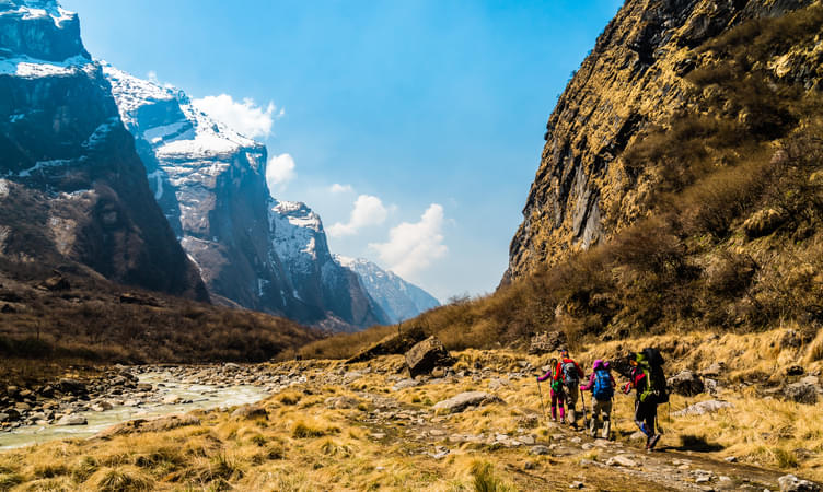
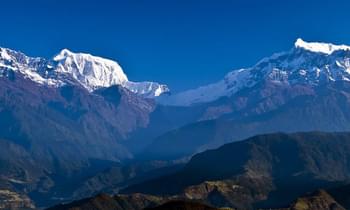
About the Annapurna:
The host to not one, not two but six massive peaks of the Himalayas – The Annapurna Massif lies in the northern region of Nepal and Annapurna Base Camp trek is a stunning opportunity to relish the giant. While the peaks themselves stretch over 55km, the Annapurna base camp trek brings you within breath-taking distance of the 7,000m high ranges after a trek of few days from Pokhara. Few mountains can boast of the raw beauty that the base camp of Annapurna possesses! It brings you through oak, pine, rhododendron and merrily dancing rice fields to a silvery carpet of snow and capricious slopes of lush valleys. Annapurna range satiates your thirst for adventure with the unending peaks of the mountains right from Pokhara and before the start of the trek itself, you will be able to gain the picturesque beauty of all the mountain peaks. When you reach Ghandruk, the distinct views of Machapuchare, Annapurna South, and other peaks will be possibly seen.
Machapuchare, an important peak in the range is also known as the fish-tailed mountain and protected highly and tourists arrive here in plenty for its exquisite beauty. Natives believe that it is an abode of Lord Shiva. From the base camp of Machapuchare, one can capture the views of Annapurna 1, Annapurna South and Hiunchuli. Moreover, the Annapurna Base Camp is considered to hold a small cluster of lodges that offer the mystical sights of the Annapurna Glacier situated on the opposite side alongside the towering glaciers called Gangapurna, Gandharvachuli, and Machapuchare.
On Annapurna Base Camp trek, you have a wide range of landscapes to be covered and the tricky, long trails that go through the variety of forests filled with rhododendron, fern and bamboo trees. After Sinuwa, while you enter Annapurna Sanctuary, nature becomes dense with seamless forests and greenery. There, oak trees become dominant. The forests coming your way until you reach the Machapuchare Base Camp will have tall grass and tall trees along with some flowering ones as well to make your trails filled with happy smiles.
About the Annapurna Base Camp Trek:
The trail that progresses towards the Annapurna Base Camp is bedecked with scenery and sights of every kind imaginable. Steady and gradual climbs through its dense forests and fertile terrace fields bring us to be amazed by the majestic and upright peaks of the Annapurna Mountains. Nayapul, Ghandruk, Sinuwa, Deurali and the base camp are the spots you will stay overnight during the trek.
Traversing the scenic vistas, over course of nine days you will be engaging yourselves trekking through carpeted ridges and ravines to arrive at Machapuchare Base Camp (3700m) and finally towards the destination of this epic journey, Annapurna Base Camp, and then back to Pokhara.
Annapurna Base Camp Trek Highlights:
- Trek to Annapurna Base Camp is classified as a classic tea house trekking expedition since you will be staying in lodges that can accommodate around 25 people and are run by locals.
- This trek is a great opportunity to interact with the local people and know the Buddhist culture prevailing in the villages and taste the local dishes.
- Since the trekking happens around a vast area of Annapurna Conservation Area, you will be able to spot much rare flora and fauna as it is home to 1226 species of plants, 102 mammals, 474 birds, 22 amphibians and so on.
- This is a trek attempted by hundreds of foreigners as well as natives and when it is October, the views become outstanding and the roads will be filled with so many people from all over the world. Experience diversities gets unified by this amazing trek.
Annapurna Base Camp Trek Weather Conditions:
Most routes leading to the base camp have little danger by the snow cover but you must be cautious in the spring. At the lower elevations, spring brings joy with multiple flowers but at the top, it will be filled with snow. It is a great time to do trekking during the months of the spring season. Also, since it is located at a great height, weather conditions are really fluctuating but autumn season experience quite a steady weather. Hence it is considered to be the most suitable time to do trekking.
At Pokhara, the day temperature will be between 15°C to20°C in October. Night temperatures will be 0 to 5°C. It will fall to 0°C at Machapuchare Basecamp and Annapurna Base camp. Snow cover will not be there to hinder you in October but if you choose April, then you will likely witness snow near to Machapuchare Base Camp and near ABC.
Annapurna Base Camp Trek Difficulty:
Annapurna Base Camp Trek has a moderate difficulty as it is located at an elevation of 4,130m above sea level with a total trek distance of 115 KM. Which makes up to 10-20 KM per day but it is still very much attainable. If you have never done a high altitude trek then you must prepare beforehand by watching your diet, exercise. If you have done trekking but not as high as this one then you should work on your determination because it would be more difficult than other treks. And if you are a regular trekker then this should not be as challenging for you as it could be.
Annapurna Base Camp Weather:
Spring: Starting from March to May, spring season has a slightly warmer temperature ranging from 17 °C to 20 °C. But it is still the best time to trek after Autumn as the forests come to life with blooming flowers and green trees. The air is filled with the fragrance of the flowers and the clear sky gives an uninterrupted view of mountains.
Summer: Starting from June to August, the summer season is also known as the rainy season with daily temperature from 18 °C to 25 °C. It is also known as ‘off-season’ as the rain leads to landslides in the lower region and avalanches in the higher reason making it very less preferable season. Though you can still trek in the season if you would have prepared accordingly. Having muddy and slippery routes with unclear sky you will find lesser crowd.
Autumn: September to November is the best season to plan a trek. The temperature starts from 15 °C to 17 °C with rain or snowfall. As the sky will be clear, sunrise and sunsets could be seen perfectly. Though you will find the trail very crowded but the trek is worth doing.
Winter: Starting from December and lasting till February, winter days have temperature from 9 °C to 12 °C, whereas the temperature at night could fall down till -15 °C to -20 °C with foggy morning and unclear sky. Although lower regions are dry but upper regions are covered with a thick layer of snow which requires crampons to hike upon and winter clothes are a must.
Quick Facts About Annapurna Base Camp Trek:
Annapurna Base Camp Trek Duration: 9D/8N
Annapurna Base Camp Temperature: Day: 15°C to 20 °C and Night: 0°C to 5°C
Annapurna Base Camp Altitude: 13,550 ft
Meal Types: Veg Meals
Annapurna Base Camp Trek Difficulty Level: Moderate-Difficult
Starting and Ending Point: The trek starts and ends at Pokhara.
ATM: Pokhara
About Stok Kangri Trek:
The ascents make Stok Kangri an enduring challenge. The Stok Kangri peak provides you an entire view of the Zanskar and the Indus Valley. This entire region looks amazing because of the deserted surroundings and the trails with plenty of ridges. Through the entire trek, you will experience many magnificent views starting from Leh where you get the perfect combination of natural aesthetics with cultural beauty till the whole path to the Stok Village, full of natural majesty and dark green trees. The route will take you through glaciers and steep slopes until you reach the summit ridge. You will be trekking on an average of 7-13 hours each day for fulfilling the dream trek to Stok Kangri peak. This out-of-the-ordinary trek to Stok Kangri will be one of the greatest moments to cherish, in your life.
Quick Facts About Stok Kangri Trek:
Stok Kangri Trek Duration: 9D/8N
Stok Kangri Trek height 20180 Ft.
Trek Grade: Difficult
Mt Stok Kangri Trek Ladakh Trekking distance: 40 km
Temperatures: Day- 18° C to 10° C & Night 6° C to -5° C
Best Time to do Mt Stok Kangri Trek Ladakh: July to Mid September
Airport: Kushok Bakula Rimpochee Airport, Leh
ATM: ATMs are available at Leh
Start & End Point: Leh
- 7D/6N
- 7D/6N
About Pangarchulla Peak Trek:
Adorning the Lord Curzon circuit- one of Garhwal Himalaya’s most fabled trails, Pangarchulla Peak Trek. The peak is usually covered with snow and rugged mountain terrains. The one dominant characteristic of your winter adventure to the Pangarchulla Peak will be the treat of snow.
The paves are swaddled with alluring lush greenery, dense jungles, and pristine snow-capped landscapes around. A close-up look of the Garhwal region can be discovered through this trek with the sunshine falling on its summit. Travelers choose to head out on this Trek just to behold the remarkable sights of Nanda Devi, Mana, Hathi, Lampak, and Dronagiri.
Departure Dates (2024)
November: 3, 9, 11, 16, 17, 23, 24, 30
December: 1, 7, 8, 10, 13, 14, 15, 18, 19, 21, 22, 23, 24, 25, 26, 27, 28, 29, 30, 31
January: 4, 5, 6, 11, 12
Pangarchulla Peak Trek Quick Facts:
Duration: 7D/6N
Maximum Altitude: 15,069 ft.
Pangarchulla Peak Trek Difficulty Level: Moderate to Difficult
Trekking distance: 38 km
Temperature: Day 18°C to 12°C & Night -3°C to -6°C
Pangarchulla Peak Trek Best Time: April, May, October, November
Start point/Endpoint: Joshimath
ATM: Joshimath
Nearest Railway Station: Haridwar
Nearest Airport: Jolly Grant Airport, Dehradun
- 4D/3N
- 4D/3N
About the Dayara Bugyal:
Discover the charming beauty of Himalayan meadows and valleys as you go for the iconic Dayara Bugyal trek in Uttarakhand with Thrillophilia. Our trek itineraries are designed to include the best experiences within the stipulated time to ensure you don’t miss anything. From providing experienced trek leaders and pickup and drop services to ensuring top-notch safety and comfort on the trek, we do it all. Book your Dayara Bugyal trek package with us for a wholesome all-inclusive trekking adventure through the Uttarakhand Himalayas with your family and friends.
Dayara Bugyal is famous for having one of the highest rolling meadows in India.
It is situated at a height of over 11,000 feet. The lush alpine meadow is surrounded by giant Himalayan peaks of Gangotri Peak, Bandarpoonch, Kala Nag, Srikanth Peak, and Shrikhand Mahadev. These peaks, along with dense oak and maple forests and charming valleys, create a picture-perfect scenery that is simply unmatched. If that isn’t enough, the trails are lined with pristine streams, alpine lakes, lush grasslands, and remote villages offering a glimpse into Himalayan beauty.
Ranked among the easy-to-moderate treks in the Uttarakhand Himalayas, the Dayara Bugyal trek can be covered in four days. Its short duration makes it popular as a long weekend trek that is ideal for beginners as well as experienced trekkers. The base camp of the journey is at Raithal, a village that can be easily reached by the state capital Dehradun. So, pack your trekking essentials and come along in any season to the charming Dayara Bugyal with Thrillophilia.
Departure Dates of Dayara Bugyal Trek (2024)
March 4, 8, 9,10, 11, 16, 19, 24, 25, 28, 29
April 6, 7, 13, 14, 20, 21, 27, 28
May 10, 4, 5, 11, 12, 18, 19, 25, 26
Quick Facts:
- Temperature:- 4 degrees (minimum), 25 degrees (maximum); days are relatively warmer
- Dayara Bugyal Trek Distance: 29 km
- Maximum Altitude: 12,000 ft
- Difficulty Level of Dayara Bugyal Trek: Easy To Moderate
- Railway Station: Haridwar is the nearest railway station
- Airport: Jolly Grant Airport, Dehradun
- Base Camp: Barsu
- ATM: Uttarkashi and Bhatwari on the way to Barsu have the last ATM point before your trek begins.

- 11D/10N
- 11D/10N
About the Nanda Devi East Base Camp:
Experience the breathtaking beauty of the Himalayas with the Nanda Devi East Base Camp Trekking experience. Trek through the picturesque locations of Bogudiar, Railkot, and Ghangharia, and stay overnight in cozy tents. Explore the base camp at Pachu Glacier for a day and then continue the exciting trek to Martoli, Rargari, and Munsiyari, staying at each location. The hike leads to the eastern face of the country's second-highest peak, Nanda Devi. The base camp offers panoramic views of the surrounding mountains. Book the Nanda Devi East Base Camp Trek and embark on this unforgettable adventure.
Quick Facts about Nanda Devi East Base Camp Trek:
- Nanda Devi East Base Camp Trek Duration: 11D/10N
- Maximum Altitude: 13,123 ft
- Nanda Devi Trek Difficulty Level: Moderate
- Nanda Devi Trek Distance: 110 km
- Temperature: Day 12°C to 20°C and Night: -4°C to 10°C
- Best time to go for Nanda Devi Trek: Mid March to Mid June & Mid September to Mid October
- Nanda Devi Base Camp trek Start Point/End Point: Kathgodam
- ATM: Kathgodam
- Railway Station: Kathgodam is the nearest railway station
- Airport: Jolly Grant Airport, Dehradun

.jpg?w=350&h=210&dpr)