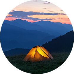
![H6y9ejh8jx2d1hycjiv4c2sl84jo [downloader.la] 65bb3adc74bd6](https://media1.thrillophilia.com/filestore/h6y9ejh8jx2d1hycjiv4c2sl84jo_[Downloader.la]-65bb3adc74bd6.jpg?w=753&h=450&dpr)
About the Triund Trek:
Embark on a captivating 2-day adventure from McLeodganj with our Triund Trek and Camping. Journey through picturesque landscapes, dense pine forests, and winding trails to reach the awe-inspiring Triund Top. Ideal for beginners and nature enthusiasts, this trek seamlessly blends excitement and serenity.
At Triund Top, revel in a night of camping beneath the stars amidst Himalayan tranquility. The experience offers a perfect harmony of thrill and peaceful retreat, allowing you to soak in breathtaking views and immersive mountain vibes. Discover the beauty of Triund in just 2 days—a journey etched with memories of nature's grandeur and unforgettable moments under the vast, starlit sky.
Quick Facts:
- Triund Trek Quick Facts:
- Start/End Point of the Trek: McLeodganj
- Duration: 2D/1N
- Triund Trek Distance: 14 Kms
- Triund Trek Height: 9350 feet
- ATM: Last ATM is in McLeod Ganj
- Mobile Network: BSNL/Vodafone works the best in these areas
- Trekking Gradient: Easy To Moderate

- 12D/11N
- 12D/11N
About Everest Base Camp Trek:
The Everest Base Camp Trek is an amazing adventure in the Himalayas. Since it is the highest mountain in the world, many people dream of getting close to it. This trek takes you through Nepal's beautiful Bagmati Zone. You'll see four of the six tallest mountains: Cho Oyu, Mt. Makalu, Mt. Lhotse, and Mt. Everest.
During the trek, you will stay in small villages called teahouses. These are some of the highest villages in the world. You will learn about the local Sherpa people, their culture, and their life in the mountains. One special place on Mt. Everest Base Camp Trek is Kala Patthar, which is 5,500 metres high and gives you a great view of Mt. Everest.
Your journey starts in Kathmandu, where you take a short flight to Lukla. The trail leads to Namche Bazaar, a big village where you stay for a day to get used to the high altitude. From there, you continue to places like Pheriche and Dingboche, and finally to Everest Base Camp.
So, what are you waiting for? Book your Everest Base Camp trek packages with Thrillophilia today and get ready for a 13-day adventure that will last a lifetime.
Available Group Departures:
➔ March: 2, 7, 8, 9, 14, 15, 23, 27, 29, 30, 31
➔ April: 1, 4, 5, 7, 9, 12, 13, 14, 15, 21, 22, 26, 29
➔ May: 1, 4, 5, 9, 12, 13, 14, 18, 20, 21, 25, 30

- 6D/5N
- 6D/5N
About the Kuari Pass Trek:
A top winter trekking destination in India, the Kuari Pass Trek is tucked away in the gorgeous Garhwal region of the Himalayas. This trail, also known as the Lord Curzon trail, is situated at an elevation of 12,516 feet and offers both historical value and breathtaking natural scenery.
You can experience the vibrant local traditions of Uttarakhand as you travel through villages of Tugasi, Guling, and Khullara with the Kuari Pass trek package. The Pangarchulla, Chaukhamba, Neelkanth, Dronagiri, Hathi Ghoda, and Nilgiri mountain ranges are among the breathtaking sights that can be seen from the trail.
The spectacular vista of the Nanda Devi Massif, which provides an amazing backdrop for stargazing, is the trek's high point. With an easy to moderate difficulty level, the Kuari Pass trip is suitable for both novice and seasoned hikers.
You may come across the paw prints of snow leopards and Himalayan bears throughout your walk, offering a unique look into the local wildlife. The span of November-March is the best time for Kuari Pass trek because of the perfect weather that makes for an unforgettable experience.
Departure Dates (2024)
November: 3, 9, 11, 16, 17, 23, 24, 30
December: 1, 7, 8, 10, 13, 14, 15, 18, 19, 21, 22, 23, 24, 25, 26, 27, 28, 29, 30, 31
January: 4, 5, 6, 11, 12
Kuari Pass Trek Quick Facts:
- Duration:6D/5N
- Kuari Pass Trek Distance: 33 km
- Kuari Pass Altitude: 12,516 ft
- Difficulty Level: Easy To Moderate
- Kuari PassTemperature: Day: 13°C to 18°C and Night: -3°C to 4°C
- Best time for Kuari Pass Trek: March to mid-June & mid-September to early November
- Railway Station: Haridwar is the nearest railway station
- Airport: Jolly Grant Airport, Dehradun
- ATM: The last ATM is available in Joshimath
- Start-End Point: Haridwar

About the Kedarkantha Trekking:
Kedarkantha Trek is a renowned winter trek in Uttarakhand, India, known for its stunning snow-covered landscapes and panoramic views of the Himalayas. The trek starts from Sankri village and takes around 5 days to complete, covering approximately 20 kilometres. The trail passes through dense pine forests, meadows, and quaint villages, offering a unique experience for trekkers. With a maximum altitude of around 12,500 feet, it provides a moderate level of challenge, making it suitable for both beginners and experienced trekkers.
Trekkers witness breathtaking snowy panoramas, making it a dream trek for those seeking an unforgettable winter experience. Thrillophilia’s Kedar Kantha trek packages are often chosen for their inclusions, accessibility, beautiful trails and experienced guides.
Kedarkantha Trekking Quick Facts:
Start/ End Point of the Trek: Sankri village
Duration: 5D/4N
Kedarkantha Trek Distance: 20 km
Kedarkantha Trek Height: 12,500 ft
Kedarkantha Difficulty Level: Easy To Moderate
Kedarkantha Trek Temperature: Day (8°C to 15°C) and Night: (-5°C to 3°C)
Best Time to do Kedarkantha Trekking: November to April
Railway Station: Dehradun is the nearest railway station
Airport: Jolly Grant Airport, Dehradun

- 6D/5N
- 6D/5N
About the Sandakphu Trek:
The Sandakphu Trek is tucked away in the Darjeeling district of West Bengal and provides breathtaking panoramas of the highest peaks on Earth. It's rated moderate to challenging, so both beginners and seasoned hikers can enjoy it. The scenery is adorned by snow-capped peaks from Tibet, Bhutan, and Nepal. Being a part of Singalila National Park, you'll see a diverse range of animals and plants.
From Phalut, you may take in breathtaking views of the Everest range, which includes Makalu and Lhotse. Kanchenjunga, the highest peak in the "Sleeping Buddha" range, is a majestic and calming sight. The views of the sunrise and sunset from Aahl are quite amazing, particularly when the brilliant hues of the Everest cluster and Sleeping Buddha are reflected.
In the midst of the rhododendron and bamboo forests, you might spot exotic animals like the Himalayan black bear. With inviting hospitality and mouthwatering food included in Sandakphu trek package, it is the Indo-Nepali culture that enhances the trip. You can choose between Churpi and Dalle Khursani, two of the most popular authentic dishes.
Discover the turns of the Old Silk Road while taking in the warmth of the people. The area is dotted with magnolias and rhododendrons, which add to its picturesque appeal. Immerse yourself in local culture, marvel at breathtaking landscapes, and experience genuine hospitality on the Sandakphu Trek.
Departure Dates (2024)
March-6,8,9,10,16,17,23,24,26,30,31
April-6,7,8,12,13,14,20,21,27,28,29,30
May-4,5,11,12,18,19,21,25,26.
June-1,2,8,9,15,16,22,23,29,30
Quick Facts:
- Duration: 6D/5N
- Altitude: 11,930 ft
- Sandakphu Trek Difficulty Level: Moderate
- Sandakphu Trek Distance: 52 km
- Temperature: Day: 8°C to 15°C and Night: -5°C to 5°C
- Best Time to do Sandakphu Trek: March to May, October to January
- Nearest Railway Station: NJP
- Nearest Airport: Bagdogra
- ATM: You can withdraw money at New Jalpaiguri Railway Station (NJP).
- Starting Point: Manebhanjan/Chitrey
- Ending Point: Srikhola
.jpeg?w=753&h=450&dpr)
About The Brahmatal Lake Trek:
Another jewel of the Himalayas which is untouched by trekkers around the world is the Brahmatal trek, which is devoted to Lord Brahma. It is beautifully positioned amidst the Himalayas and covered with blankets of snow. The trail allows you to see the centuries-old forest of Oak and Rhododendron. Walking in meadows besides Brahamatal Ridge you can see many sites of Roopkund Trek. A glance at the Garhwal Mountains in the distance on a clear day will totally melt your heart.
Brahmatal Trek Quick Facts:
- Duration:6D/5N
- Brahmatal Trek Distance: 22km
- Brahmatal Trek Height: 12,150 ft
- Bhramatal Trek Difficulty Level: Moderate
- Temperature: Day: (8°C to 15°C) and Night: (0°C to -7°C)
- Best Time for Brahmatal Trek: December - March
- Nearest Railway Station: Dehradun is the nearest railway station
- Nearest Airport: Jolly Grant Airport, Dehradun
- Nearest ATM: Dewal has the last ATM point before your trek begins. It's advisable to withdraw money in Dehradun itself.
- Start/End Point: Dehradun

- 4D/3N
- 4D/3N
About the Dayara Bugyal:
Discover the charming beauty of Himalayan meadows and valleys as you go for the iconic Dayara Bugyal trek in Uttarakhand with Thrillophilia. Our trek itineraries are designed to include the best experiences within the stipulated time to ensure you don’t miss anything. From providing experienced trek leaders and pickup and drop services to ensuring top-notch safety and comfort on the trek, we do it all. Book your Dayara Bugyal trek package with us for a wholesome all-inclusive trekking adventure through the Uttarakhand Himalayas with your family and friends.
Dayara Bugyal is famous for having one of the highest rolling meadows in India.
It is situated at a height of over 11,000 feet. The lush alpine meadow is surrounded by giant Himalayan peaks of Gangotri Peak, Bandarpoonch, Kala Nag, Srikanth Peak, and Shrikhand Mahadev. These peaks, along with dense oak and maple forests and charming valleys, create a picture-perfect scenery that is simply unmatched. If that isn’t enough, the trails are lined with pristine streams, alpine lakes, lush grasslands, and remote villages offering a glimpse into Himalayan beauty.
Ranked among the easy-to-moderate treks in the Uttarakhand Himalayas, the Dayara Bugyal trek can be covered in four days. Its short duration makes it popular as a long weekend trek that is ideal for beginners as well as experienced trekkers. The base camp of the journey is at Raithal, a village that can be easily reached by the state capital Dehradun. So, pack your trekking essentials and come along in any season to the charming Dayara Bugyal with Thrillophilia.
Departure Dates of Dayara Bugyal Trek (2024)
March 4, 8, 9,10, 11, 16, 19, 24, 25, 28, 29
April 6, 7, 13, 14, 20, 21, 27, 28
May 10, 4, 5, 11, 12, 18, 19, 25, 26
Quick Facts:
- Temperature:- 4 degrees (minimum), 25 degrees (maximum); days are relatively warmer
- Dayara Bugyal Trek Distance: 29 km
- Maximum Altitude: 12,000 ft
- Difficulty Level of Dayara Bugyal Trek: Easy To Moderate
- Railway Station: Haridwar is the nearest railway station
- Airport: Jolly Grant Airport, Dehradun
- Base Camp: Barsu
- ATM: Uttarkashi and Bhatwari on the way to Barsu have the last ATM point before your trek begins.

About the Kheerganga Trekking:
Kheerganga trek is the most recommended one among all the treks in Parvati valley and takes you through some amazing scenery. It needs neither too much time nor any prior trekking experience which makes it perfect for any beginner trekker or a backpacker.
While strolling through the magnificent landscape of Himachal Pradesh, you will be treated to majestic sights of nature. On the trail, pass a few wooden bridges and some slippery sections.
During this part of the Kheerganga trek from Kasol, your eyes also feast on many picturesque waterfalls, remember to take pictures of every single one of these.

- 9D/8N
- 9D/8N
About the Annapurna Base Camp Trek:
The Annapurna Base Camp is perched on a cloud-piercing height of 13,550 feet in the northern region of Nepal. Starting from Banthanti, Annapurna Base Camp offers a stunning opportunity to relish the breathtaking heights of giant Himalayan ranges. The mountain ranges included in this tour bring you through oak, pine, rhododendron, and lush green rice fields engraved with a diamond-like carpet of snow amidst majestic slopes of misty valleys.
Since the Annapurna Base Camp Trek happens around a vast area of Annapurna Conservation Area,. You'll be walking across the Modi River and discovering some of the massive peaks at 7000–8000 m.
Annapurna Base Camp Trek Nepal Quick Facts:
- Annapurna Base Camp Trek Duration: 9D/8N
- Maximum Altitude: 13,550 ft
- Annapurna Base Camp Trek Difficulty Level: Moderate-Difficult
- Approx. trekking distance: 67 Kms
- Temperature: Day: 15°C to 20 °C and Night: 0°C to 5°C
- Best Time To Trek Annapurna Base Camp: Feb to May, Oct to Dec.
- ATM: Pokhara
- Start Point/End Point: Pokhara.

- 9D/8N
- 9D/8N
About Chadar Frozen River Trek :
The Chadar Trek, also known as the Zanskar River Chadar Trek, is a thrilling winter adventure over the frozen Zanskar River in Ladakh, India. This spectacular journey takes trekkers through breathtaking landscapes of icy cliffs and snow-covered mountains. Starting near the village of Chilling, the trek unfolds the mystery of the Himalayas as adventurers navigate the frozen river, experiencing the unique challenges and beauty of the region. With temperatures dropping significantly, the trek requires careful preparation and endurance but rewards participants with an unforgettable experience amidst the untouched wilderness of the Zanskar region.
Departure Dates:
➔ Jan '25: 5th, 7th, 8th, 10th, 12th, 16th, 18th, 20th, 25th.
➔ Feb '25: 1st & 2nd
Chadar Trek Quick Facts:
- Chadar River Trek Duration: 9D/8N
- Chadar Trek Distance: 62 km
- Maximum Altitude: 11,123ft
- Difficulty Level: Difficult
- Chadar Trek Temperature: -5 to -15 degrees (during the day) and -15 to -25 degrees (during the night)
- Chadar Trek Best Time: Early January-Early February.
- Start and End Point of the Trek: Guest House in Leh.
- Nearest Airport: Leh airport. (Kushok Bakula Rimpochee Airport)
- Last ATM: Leh Market and Airport.
How to Reach Leh :
By Air: The most convenient way to reach Leh is by taking a direct flight to Kushok Bakula Rimpochee Airport from New Delhi. This journey can take around 1 hour and 15 minutes and is offered by various airlines including SpiceJet, Air India, and IndiGo.
By Road: Delhi is approximately 930 kilometres and it takes around 24 hours to reach depending on the road conditions. You can take an HRTC bus from Delhi to Leh via Manali which takes approximately 30 hours to reach. Similarly, you can opt for a road trip to Leh from Delhi via NH 3 which can take around 25 hours depending on the route and halts.

- 9D/8N
- 9D/8N
About Chadar Frozen River Trek:
Trekking, for some, is an escape from the ordinary and for others, it is an adventure to conquer. To walk on the path carved out in the midst of naked mountains with the clear blue skies over your head, to breathe its complexities, to sense the soothing touch of the chilly breeze on your face, and to witness the incredible frozen waterfall is an experience one cannot put into words. One such experience is the glorious and equally fascinating, Chadar Trek.
Departure Dates:
➔ Jan '25: 5th, 7th, 8th, 10th, 12th, 16th, 18th, 20th, 25th.
➔ Feb '25: 1st & 2nd
Why choose this package over other Chadar-Trek packages:
➔ Smaller batch-size for better assistance
➔ Stay in Deluxe Hotels for the first three days
➔ Get a chance to Visit an Ice-Hockey Match on day 1(Depending on the matchday/match calendar)
➔ Ice-Skating on day 2 (Additional charges to be paid for the gears)
➔ Visit & climb to Ice Stupa on day 2 (Siang/Sankar gompa village with transportation from the hotel and crampons and ropes 500-700 meter height)
➔ Trekking stick - To walk with support on the trail
➔ Ladakhi Meal on last day Dinner
➔ Cultural program (4-5 performances with traditional outfits)
➔ We believe that roughing it out necessarily doesn’t mean sleeping in smelly sleeping bags, compromising on safety by using low-quality equipment, and having unappetizing meals. We focus on your safety, basic comforts, and the environment while camping.
➔ Handpicked Supporting Staff of multiple guides/helpers for the group. This will ensure high safety, accurate information, and personal attention which is necessary for this trek. We will be putting you in the hands of qualified & professional trek leaders, guides, and support staff with multiple years of experience.
The Chadar Trek is unique because it takes place on the surface of a frozen river. Other treks in India go through hills and mountains, through passes and caves, through ancient forts and valleys. This trek meanders along the Zanskar River. Walking over ice sheets and frozen rivers bordered by towering rusty hills seems very much like a scene straight out of a luxury travel magazine. During the winter months, the captivating Zanskar River turns into a frozen river as if wearing a ‘chadar’ of ice and the waterfall turns into a "frozen waterfall".
The sheer beauty of this trek has its twists and turns, the trail takes you through steep canyons, and understanding the ice pattern will take time but the overwhelming feeling of conquering this trek will be worth every second. Fortunately for us, Chadar Trek is no dream; it is as real as it gets and very much within your reach.
Chadar Trek Quick Facts:
➔ Chadar River Trek Duration: 9D/8N
➔ Chadar Trek Distance: 62 km
➔ Maximum Altitude: 11,123ft
➔ Difficulty Level: Difficult
➔ Chadar Trek Temperature: -5 to -15 degrees (during the day) and -15 to -25 degrees (during the night)
➔ Chadar Trek Best Time: Early January - Early February.
➔ Start and End Point of the Trek: Leh Airport
➔ Nearest Airport: Leh airport (Kushok Bakula Rimpochee Airport)
➔ Last ATM: Leh Market and Airport.
➔ Group Size: 15 Trekkers
➔ Staff Size: Cook x 2, Porters x 17, Guide x 2, Helper x 4

- 10D/9N
- 10D/9N
About GoechaLa Pass Trek:
GoechaLa trek is nestled at a height of 16,207 ft, with a closer look at the third-highest peak-Mt. Kanchenjunga. It is a dream and desire for hundreds of adventure lovers. Bounded by the mesmerizing flora and fauna, which are so vibrant and colourful to cheer up one's mood.
The GoechaLa pass trek is a bundle of big summits, making it an absolute adventure to embark on. The trail link with the famous Kanchenjunga National Park, where one can witness the true nature, enough to revitalize your senses. To watch the mountains clearly, April and May are the ideal months. Since the sky is completely clear during this time and the sunset-sunrise views can be captured.
Departure Dates (2024)
March-23,24,30,31
April-1,6,7,13,14,20,21,27,28
May-4,5,6,11,12,18,19,24,25,26.
June-1,2,8,9,15,16,22,23,29,30
GoechaLa Pass Trek Quick Facts:
GoechaLa Trek duration: 10D/9N
Maximum Altitude: 16207 ft
Difficulty Level: Difficult
GoechaLa Trek Distance: 90 Km
Temperature Range: April - June: 15 to 22 Degrees (Days); -1 to 7 Degrees (Nights), September – Nov: 10 to 15 Degrees (Days); -5 to 5 Degrees (Nights)
GoechaLa Trek Best Time: April end - May And September - November
Railway Station: New Jalpaiguri (NJP) is the nearest railway station, which is 150 km away from Yuksom
Airport: Bagdogra Airport which is 155 km from Yuksom
ATM: Yuksom is the last point where you can find the ATM.
Starting and Ending point: Yuksom

About the trek:
Head out for a fascinating trek expedition to Chandrashila, the summit of Tungnath, which is prominently known as a famous tourist attraction for high-altitude trek lovers. It is located at a height of about 4,000 meters above sea level. Spot the spellbinding glimpses of Nandadevi, Trisul, Kedar Peak, Bandarpunch, and Chaukhamba peaks, the views of which are going to be your rewards for the hike. Discover the laid-back side of the Himalayas while trekking through the lush jungles and snow-capped mountains. Make your way through the forests with snowy paths and discover rich flora and fauna until you reach the destination at an altitude of 13,000 feet. On arriving at Chopta - a picturesque and unexplored destination, famous as 'Mini Switzerland of Uttarakhand', you are surely going to reconnect with nature and soothe your senses completely. Later, proceed towards Chandrashila - the 'Moon Rock' summit of the Tungnath.
Quick Info:
- Start Time - End Time from Delhi: 11:00 PM (Day 0) - Between 5:00 AM - 6:00 AM (Day 4)
- Start Time - End Time from Rishikesh: 6:00 AM (Day 1)-Between 6:00 PM - 7:00 PM (Day 3)
- Pickup Point/ Drop point from Delhi: near Akshardham Metro Station
- Pickup Point/ Drop point from Rishikesh: Natraj Chowk/ Rishikesh ISBT
- Temperature: 32°C to 15°C
- Trek Distance:18km
- Maximum altitude: 4,000 meters above sea level
- Electricity: Electricity will be available at Chopta campsite and Sari village.
- ATM: Rishikesh is the last point where you will find an ATM

- 7D/6N
- 7D/6N
About Pangarchulla Peak Trek:
Adorning the Lord Curzon circuit- one of Garhwal Himalaya’s most fabled trails, Pangarchulla Peak Trek. The peak is usually covered with snow and rugged mountain terrains. The one dominant characteristic of your winter adventure to the Pangarchulla Peak will be the treat of snow.
The paves are swaddled with alluring lush greenery, dense jungles, and pristine snow-capped landscapes around. A close-up look of the Garhwal region can be discovered through this trek with the sunshine falling on its summit. Travelers choose to head out on this Trek just to behold the remarkable sights of Nanda Devi, Mana, Hathi, Lampak, and Dronagiri.
Departure Dates (2024)
November: 3, 9, 11, 16, 17, 23, 24, 30
December: 1, 7, 8, 10, 13, 14, 15, 18, 19, 21, 22, 23, 24, 25, 26, 27, 28, 29, 30, 31
January: 4, 5, 6, 11, 12
Pangarchulla Peak Trek Quick Facts:
Duration: 7D/6N
Maximum Altitude: 15,069 ft.
Pangarchulla Peak Trek Difficulty Level: Moderate to Difficult
Trekking distance: 38 km
Temperature: Day 18°C to 12°C & Night -3°C to -6°C
Pangarchulla Peak Trek Best Time: April, May, October, November
Start point/Endpoint: Joshimath
ATM: Joshimath
Nearest Railway Station: Haridwar
Nearest Airport: Jolly Grant Airport, Dehradun
.jpg?w=753&h=450&dpr)
- 7D/6N
- 7D/6N
About Har Ki Dun Trek:
If you love summer treks to expansive valleys surrounded by lofty peaks, the Har Ki Dun trek trails can definitely mesmerise you. This is a 7-day-long trek that you can easily undertake with the help of Thrillophilia’s expert trek leaders.
Being an easy-moderate level trek, Har Ki Dun receives well-deserved importance in the trekking community worldwide. The name “Har Ki Dun” refers to the “Valley of Lord Mahadev”. Its trails take you through dense forests of pine and deodar trees, along the banks of rapidly flowing Tons and Supin rivers, and across several undulating landscapes.
This trek journey spans around 43 kilometres (both ways) and touches the highest altitude of 12000 feet. You can plan for Har Ki Dun trekking during the summer or autumn season to get the best of this journey.
One of the main reasons for choosing to undertake this exciting adventure with Thrillophilia lies in our on-ground support. With well-arranged camps, proper food, and immediate rescue facilities, you can find comfort even in the nooks of the mighty Himalayas.
So, buckle up and book your slots now. Get ready to pack your rucksack and set out to the Valley of Gods, Har Ki Dun!
Har Ki Doon Trek Quick facts:
Duration: 7D/6N
Maximum altitude: 11,675 ft
Har Ki Dun Trek Difficulty Level: Easy to Moderate
Har Ki Dun Trek Distance: 47 KM
Temperature: 10℃ to 15℃ during the day and 2℃ to -5℃ during the night
Best Time to do Har ki Dun Trek: April to Mid-June and October to Mid-November
ATM: Purola has the last ATM before your trek begins
Start/End Point of the trek: Sankri Village

- 7D/6N
- 7D/6N
About Kashmir Great Lakes Trek:
The Kashmir Great Lakes trek is a life-changing journey through the most scenic trail of the country. This trek takes you through the turquoise lakes, alpine meadows and lush valleys of Kashmir. Thrillophilia’s Kashmir Great Lakes trek packages allow you to embark on this trek and come with every travel necessity starting from meals, accommodations, transfers, and guides.
We work with a wide network of trusted tour operators who make the journey secure. The guides are local residents and often end up taking you through detours to hidden spots, offering the best views.
Kashmir Great Lakes’ best time is between July to September with pleasant weather and meadows in full bloom. The trek spanning 7 days and 6 nights, leads you through five different valleys of the region and six alpine lakes. You cover a distance of 75 km in a duration of 6 days starting from Sonmarg and ending at Narang Village.
On the first day of the Kashmir Great Lakes trek, you’ll journey to Nichnai followed by the second day of your trek, when you’ll reach the twin lakes of Vishansar and Krishansar. The next day involves crossing the challenging Gadsar Pass. As you continue your trek, you’ll pass through the beautiful Satsar Lakes, a series of seven interconnected lakes. The final stretch of the journey takes you to the Gangbal and Nundkol Lakes and concludes with a descent to Naranag.
So, book your packages from Thrillophilia to leave all your worries behind and embark on this once in a lifetime experience.
Kashmir Great Lakes Trek Quick Facts:
Duration: 7D/6N
Great Lakes of Kashmir Trek Distance: 72km
Kashmir Great Lakes Trek Altitude: 13,800ft
Difficulty Level: Moderate
Kashmir Great Lakes Trek Temperature: 17°C-20°C (Max. During Day Time) to 3°C-4°C ( Min. During Night Time)
Best Time to do Kashmir Great Lake Treks: July to September
Railway Station: Jammu is the nearest railway station
Airport: Srinagar Airport
Start Point: Srinagar
End Point: Srinagar
.jpg?w=753&h=450&dpr)
- 5D/4N
- 5D/4N
About Hampta Pass Trekking
Hampta Pass trek is one of the most picturesque adventure in the Indian Himalayas that takes you through the lush green valleys of Kullu to the rocky, barren landscapes of Lahaul and Spiti.Thrillophilia’s Hampta Pass trek packages offer you to embark on a journey that gives you an essence of the true beauty of mountains.
Our all inclusive packages include all the travel arrangements starting from accommodation in hygienic campsites, transportation to and from the trek’s base camp and healthy meals. Thrillophilia operates the treks through a vast network of trusted tour operators who know bits and pieces of the journey, in depth. The highly experienced trek leaders guide you throughout the journey and often take you to offbeat places to soak in the best views.
The Hampta Pass trek route begins from the quaint village of Jobra from where you hike towards your campsite in Chika. The next day, start ascending towards Balu ka Ghera which is nestled amidst the alpine meadows and surrounded by the gigantic peaks all around. You will be rewarded with beautiful views of the snow-covered peaks and witness the terrain changing from meadows to boulders. You will then commence the final leg of your journey to reach your destination- the Hampta Pass, situated at an altitude of 14,000 ft. Spend some peaceful time there in laps of the Himalayas.
After exploring the remote village of Hampta, proceed to descend towards Chatruwhich is one of the main highlights of the trek. It is the junction point of the roads to Spiti Valley, Rohtang Pass and Hampta Pass.
So what are you waiting for ? Pack your rucksacks, tie up your trekking shoes and get ready for a life-changing journey through the deep gorges, lush valleys and rocky trails of upper Himachal.
Quick facts about Hampta Pass Trekking:
Start Point/End Point: Manali Base Camp
Duration: 4 Nights & 5 Days
Hampta Pass Trek Height: 14,100ft
Hampta Pass Trek Difficulty Level: Moderate
Trekking Distance: 35kms
Best time to do Hampta Pass Trek: Mid June - September

- 6D/5N
- 6D/5N
About Valley of Flowers Trek:
Valley of Flowers "Foolon ki Ghati" is one of those beautiful trekking expeditions that can be enjoyed during the monsoon season. It is flawlessly nestled in the West Himalayan region of Uttarakhand and lies at a lofty height of 3600 m above sea level. With an opportunity to spot the very rare blue Primula, the Valley Of Flowers trek is one of the best-known treks in the world.
The Valley of Flowers is also believed to be the place from where Hanuman brought the magical herb to resuscitate Lakshman in the Hindu epic Ramayan. Just as you set your foot into the valley, the intoxicating mix of fragrances emitted from the flowers makes you feel in a paradise. The hidden lake at the height of 14,400 ft, creates a hidden coop for numerous species of wildflowers like the saxifrages, sedums, lilies, poppy, calendulas, daisies, geranium, zinnia, and petunia.

- 7D/6N
- 7D/6N
About the Tarsar Marsar Trek:
Kashmir the “paradise on earth” and universally proclaimed as the home to the most spectacular treks in the Himalayas. Tarsar Marsar Trek takes the cake among all of them. This breathtaking trek is literally located in the clouds, at an altitude of 13,201 feet. The trail of Tarsar Marsar crosses forests, meadows, rivers and snow-clad mountains of Kashmir, promising spellbinding views. The highlight of the trek is watching three charming alpine lakes, Tarsar, Marsar, and Sundarsar, on your way.
As you trek through these pristine lakes, you will be amazed by the lush green meadows of Kashmir. Embraced by the thick avenues of splendid Chinar tree forest and the spellbinding Lidder river, which is also known as a glacier river flowing through the Kolahoi Glacier. Throughout the whole day during the stay, you will be stunned by variable shades of snow-fed lake changing with the angle of the sun.
Tarsar Marsar Trek Quick Facts:
Duration: 7D/6N
Maximum Altitude: 13,201 ft
Tarsar Marsar Trekking Difficulty level: Moderate
Tarsar Marsar Trek Distance: 47kms
Temperature Range: During the day: 17°C - 20°C and During the night 3°C - to -4°C
Best Time for Tarsar Marsar Trek: July - September
Railway station: Jammu is the nearest station [ 260kms ]
Airport: Srinagar
Basecamp: Aru (112 km drive from Srinagar approx 4 hours)
Atm: Pahalgam [ But do not rely on the last ATM as it runs out of cash frequently. Withdraw cash at Srinagar or even before that.]
Start point / End Point: ARU

- 2D/1N
- Manali
- 2D/1N
Camp Location: Manali
About Lamadugh:
Manali is gifted with a lot of amazing places and one of them happens to be this unique high altitude alpine meadow near Old Manali. Popular as one of the must-visit and most visited places, Lamadugh is famous for offering experiences and views that you may have never witnessed before.
About Lamadugh Trek:
This day trek to the meadow of Lamadugh starts with your arrival at the meeting point in the Old Manali. You will then start the trek and climb through thick forests of Pine and Deodar to reach your destination. The trek offers majestic views of the many high mountains of the Himalayas that surround the valley like Indrasan, Deo Tibba and the peaks of Bara Shigri glacier.
To enter Lamadugh, you will have to walk on the ridge, the place will open up to this green heaven of a meadow dotted by just one hut and with a variety of flowers. Spend some time here and have your packed lunch, before climbing back down to reach Manali base camp and enjoy overnight camping over there. The next day morning, after having breakfast bring the experience to an end. To make the experience more convenient and helpful, you will have the facility of trek guide, cook, and helpers on the trek.
Lamadugh Trek Quick Facts:
Maximum Altitude: 9,900 ft
Difficulty Level: Easy To Moderate
Electricity: There will be electricity facility available at Manali base camp.
ATM: Manali is the last point where you will get ATM.
Trek Gradient: Moderately Challenging
Landmarks Covered: Manu Temple, Deodar & Pine forests
How to reach?
You have to report at Old Manali which is the starting point of the trek and it is around 2 km from Mall Road of Manali. Many local means of transport and private cabs are available from Mall Road to reach Old Manali.

About the trek:
Unwind in the tranquil environment of Kasol and Kheerganga, which are some of the most rejuvenating tourist destinations in Himachal Pradesh. The Kasol trip with a trek to Kheerganga and Tosh valley embarks from the capital city Delhi and takes you through Bhuntar, Rudra Nag, and Barshini. While on the trek, you can pay a visit to the pilgrim center - Manikaran, and also indulge in the phenomenal beauty of the mesmerizing Parvati valley and the snow-capped Himalayas.
Departure Dates (2024)
March-4,7,8,910,15,16,17,21,22,23,24,27,29,30
April-5,6,15,29
May-2,10,19,21
June-9,16,17,26,27,30
Start Point: New Delhi
End Point: New Delhi
Start Time/End Time of Trip: 06:00 PM to 7:00 PM (Day 1) and around 8:00 AM (Day 6)
Inclusions:
- Stay: Dome tents on sharing basis
- Meals: Breakfast and dinner
- Transportation: Delhi to Kasol and Kasol to Delhi in a semi sleeper AC bus.
- Highly Experienced Guide
- Activities: Trekking & Camping
.jpeg?w=753&h=450&dpr)
- 4D/3N
- 4D/3N
About the Bhrigu Lake Trek:
Bhrigu Lake is a high-altitude glacial lake, perched at a height of 14,100 ft, thus catering to a perfect place for some mind-blowing adventure and thrills. Bhrigu Lake Trek in Manali is one of the most captivating short treks in the Himalayas and it greets you to witness high altitude alpine lake, the verdant meadows, and everything your heart has yearned for.
The mesmerizing lake has its own majestic beauty as it changes its colors with each passing season. In late summer, it changes its color to emerald green, and in summer it turns its beauty to
blue which is a fascinating sight for the eyes to behold.
This 4-day Bhrigu Lake trek takes you through unparalleled breathtaking views of Seven Sister Peaks, Deo Tibba, Indrasan, Hanuman Tibba, the outstretched Pir Panjal ranges which will soothe your senses and make you content with unbounded natural beauty.
Bhrigu Trek Quick Facts:
- Bhrigu LakeTrek Distance: 26 km
- Bhrigu LakeTrek Height:14,100 ft
- Trekking Gradient: Steep ascent throughout the trail
- Bhrigu Lake Trek Difficulty Level: Easy To Moderate
- Start Point/End Point of Trip: Old Manali
- Start Time/End Time: The trek starts at 10:00 AM (Day 1) and ends around 2:00 PM (Day 4).

- 5D/4N
- 5D/4N
With mesmerizing summit views of Kedar, Chaukhamba, and the Himalayas, the Chandrashila trek, at an altitude of 12,083 ft. is one of the most suitable treks for beginners. A visit to the holy Tugnath temple, famous for being the highest Shiva temple in the world offers you a vantage point in the trek.
The journey to the trek takes you through Rishikesh, Sari, and Chopta, and the way is surrounded by vivacious patches of pine, oaks, and rhododendron. When here you can also indulge in bird-watching activities and lakeside picnics. Do not miss watching, the golden-breasted eagles that are a mesmerizing sight from the summit.

About The Triund Trek:
Start on an unforgettable journey with Thrillophilia's Triund Trek package to experience a mesmerising adventure. The trek takes you through the dense forests of Oak and Rhododendron, leading you to the awe-inspiring views of the Dhauladhar range. This carefully curated trek leads you through natural trials, providing stunning views of the Kangra Valley.
As the day unfolds, prepare to be captivated by the stunning sunset that adorns the sky in vibrant hues of orange and pink. With Thrillophilia, immerse yourself in the tranquillity of the Himalayas, enjoying an ideal getaway with peace and adventure. Join us on this journey to discover the serene beauty and exhilarating challenges of the Triund Trek Dharamshala, for an experience etched in your memory forever..
Triund Trek Quick Facts:
Start/ End Point of the Trek: Bhagsu Naag taxi stand
Duration: 2D/1N
Triund Trek Distance: 14 Kms
Triund Trek Height: 9350 feet
ATM: Last ATM is in McLeod Ganj
Mobile Network: BSNL/Vodafone works the best in these areas
Trekking Gradient: Easy To Moderate
Triund Trek Best Time: March till December

- 4D/3N
- 4D/3N
About the trek:
Perched at a towering height of 14,245 ft above sea level, the spectacular Indrahar Pass lies at the border between breathtaking Kangra and Chamba districts. Though a short one, this trek is considered to be a bit challenging as the trekking trail consists of numerous sharp ascents and steep climbs. This is one of the most fascinating treks that Himachal has to offer. Owing to the magnificent view of the might Dhauladhar, the lush green valleys, and the exotic flora and fauna will truly leave you awestruck. The path passes by the placid crystal blue waters of Lake Mankiani and Kareri. Hike through the steep passing mostly through the lush green landscapes of the Dhauladhar Range, this challenging yet tempting trek takes about 4 days to complete.
Start Point/End Point: Mcleodganj - Bhagsu Nag Taxi Stand.
Inclusions:
- Stay: Domed tents on sharing basis cleaned & sanitized on daily basis
- Meals: Breakfast and Lunch or Dinner
- Activities: Trekking & Camping
- Highly experienced trek guide

About the Kareri Lake trek:
Located at an elevation of about 2,950 meters in the Kangra district of Himachal Pradesh, Kareri Lake is a freshwater lake rugged amidst mountains with greenery all around. Situated in the majestic Dhauladhar range, this glacial Kareri lake trek will take you through a journey of the most scenic views as it is home to lush pasturelands, exotic perennial flowers, and dense conifers. Kareri trek is also a favorite among the shutterbugs and nature lovers who can spend some time close to nature while clicking their best shots.
Kareri Lake Trek Quick facts:
Start Point: Kareri Village
End Point: Kareri village
Kareri Lake Trek Height: 9,650 ft.
Temperature: 8°C to 20°C
Kareri Lake Trek Distance: 26 KM (to and fro)

About The Bijli Mahadev Trek:
Bijli Mahadev is one of the sacred temples of the Indian state of Himachal Pradesh. It is located at an altitude of about 2,460m in the Kullu Valley. Explore the nature trails of a city and experience secrets in its kitty in the beautiful city of Manali. Enjoy the company of tall trees and beautiful landscapes with the Bijli Mahadev trek. Report at Kinja village in Kullu. You will meet your guide there and start the trek towards the Bijli Mahadev temple.
Activity Location: Kashawri, Kullu
Start Point/End Point: Kinja village, Himachal Pradesh
Start Time: 10:00 AM
End Time: 02:00 PM
Bijli Mahadev Trek Package Inclusions:
- Guide
- Activity- Trekking

About The Prashar Lake Trek:
Prashar Lake Trek in Kullu is a beautiful journey with nature and culture. This trek takes you to a stunning Prashar Lake. It is situated at an altitude of 8,960 feet (2,730 m). It also rewards you with stunning views of the mountains like Dhauladhar, Pir Pranjal, and Kinnaur ranges.
The trek path goes through green fields, forests of pine and oak, and quaint villages. The Prashar Lake has crystal-clear waters and has a floating island. The island moves in different seasons, which is really cool to see.
During the trek, you’ll also visit the Prashar Rishi Temple. It dates back to the 13th century and you can marvel at its pagoda-style architecture.
This trek is not too difficult and it is perfect for both beginners and seasoned trekkers. The trek is 16 kilometres long and takes around 8 hours to complete. Prashar Lake Trek also offers camping opportunities near the lake for a truly immersive experience.
Start Point/End Point: Panarsa
Start Time: 7:30 AM On Day 1
End Time: 3:30 PM Day 2
Prashar Lake Trek Package Inclusions:
- Stay: Dome/Alpine tents on a sharing basis
- Meals: Breakfast, Lunch, and Dinner
- Highly experienced guide
- Activities: Trekking & Camping

- 6D/5N
- 6D/5N
About the Brahmatal Lake Trek:
Another jewel of the Himalayas that is untouched by trekkers around the world is the Brahmatal Trek, which is devoted to Lord Brahma. It is beautifully positioned amidst the Himalayas and covered with blankets of snow. The trail allows you to see the centuries-old forest of oak and rhododendron. Walking in meadows besides Brahamatal Ridge, you can see many sites of the Roopkund Trek. A glance at the Garhwal Mountains in the distance on a clear day will totally melt your heart.
Brahmatal Trek Quick Facts:
- Duration:6D/5N
- Brahmatal Trek Distance: 22km
- Brahmatal Trek Height: 12,150 ft
- Bhramatal Trek Difficulty Level: Moderate
- Temperature: Day: (8°C to 15°C) and Night: (0°C to -7°C)
- Best Time for Brahmatal Trek: December - March
- Nearest Railway Station: Dehradun is the nearest railway station
- Nearest Airport: Jolly Grant Airport, Dehradun
- Nearest ATM: Dewal has the last ATM point before your trek begins. It's advisable to withdraw money in Dehradun itself.
- Start/End Point: Dehradun

About the Yuksom Dzongri Trek:
The Yuksom Dzongri trek will take you to the heart of the beautiful Sikkim landscape. One will be tasked to make their way through the rugged, challenging and fascinating trails. Offering you a glimpse of some of the magnificent peaks like Kabru (7,353m), Ratong (6,678m), Kanchenjunga (8,534m), Koktang (6,147m), Pandim (6,691m) and Narsingh (5,825m). Along with your way to the Dzongri peak, you can also visit several other attractions as well.
This includes some of the popular and stunning waterfalls within the region, sunset point like Tiger Hill in Darjeeling which will cap off a wonderful trek. The trek will lead you to some of the majestic sights of the mountains and the distant valleys. This trek is considered as a moderate trek. The temperature here might go beyond the freezing point at any time of the year. This exotic trek takes you through the thick pristine forest of Sikkim Himalayas takes you to the highest point of at Dzongri Top around 15000 ft from where one can imbibe the splendour of Kanchenjunga National Park. You will complete this trek in a period of eleven days.
Come across the famous and beautiful Khecheopalri Lake. It is believed that the birds here do not allow any leaves to fall on the lake. This trek shares the similar trek course to Chaurikhang the HMI Basecamp and Goechala Trek and starts at Yuksom. Listen to the chirping of the birds and spend some time staring at the small lakes while you head out on this trek. Head out for this amazing trek and also get a chance to explore the beautiful northeast. An augmentation of the Dzongri Trek, the Yuksom-Dzongri Trek brings the crude trekking adventure at its best beyond and past the glades where the trekkers can come close to nature.