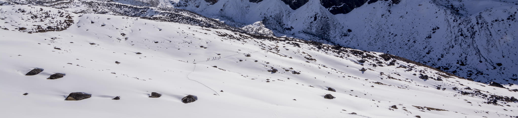
- 4D/3N
- 4D/3N
About the trek:
Perched at a towering height of 14,245 ft above sea level, the spectacular Indrahar Pass lies at the border between breathtaking Kangra and Chamba districts. Though a short one, this trek is considered to be a bit challenging as the trekking trail consists of numerous sharp ascents and steep climbs. This is one of the most fascinating treks that Himachal has to offer. Owing to the magnificent view of the might Dhauladhar, the lush green valleys, and the exotic flora and fauna will truly leave you awestruck. The path passes by the placid crystal blue waters of Lake Mankiani and Kareri. Hike through the steep passing mostly through the lush green landscapes of the Dhauladhar Range, this challenging yet tempting trek takes about 4 days to complete.
Start Point/End Point: Mcleodganj - Bhagsu Nag Taxi Stand.
Inclusions:
- Stay: Domed tents on sharing basis cleaned & sanitized on daily basis
- Meals: Breakfast and Lunch or Dinner
- Activities: Trekking & Camping
- Highly experienced trek guide

- 6D/5N
- 6D/5N
About Valley of Flowers Trek:
Valley of Flowers "Foolon ki Ghati" is one of those beautiful trekking expeditions that can be enjoyed during the monsoon season. It is flawlessly nestled in the West Himalayan region of Uttarakhand and lies at a lofty height of 3600 m above sea level. With an opportunity to spot the very rare blue Primula, the Valley Of Flowers trek is one of the best-known treks in the world.
The Valley of Flowers is also believed to be the place from where Hanuman brought the magical herb to resuscitate Lakshman in the Hindu epic Ramayan. Just as you set your foot into the valley, the intoxicating mix of fragrances emitted from the flowers makes you feel in a paradise. The hidden lake at the height of 14,400 ft, creates a hidden coop for numerous species of wildflowers like the saxifrages, sedums, lilies, poppy, calendulas, daisies, geranium, zinnia, and petunia.

- 10D/9N
- 10D/9N
About Pin Parvati Pass Trek:
The trail is wrapped in a lush green forest and in mighty green valleys. An alternate passage to the Spiti Valley in Himachal Pradesh, the Pin Parvati Pass trek is one of the most enthralling and challenging trekking trails in India.
Mantalai, known for its age-old Lord Shiva temple and the charming lake, is the jovial host during the trek to Pin Parvati camp. Manali, with plenty of trekking options, comes up with the best in its kit, which is the Pin Parvati Trek, leading the trekker up to 17457 feet in height. This trek will take you on a journey to heaven and prevent you from returning to your chaotic city life.
Quick Facts About the Pin Parvati Pass Trek:
- Duration: 10D/9N
- Maximum Altitude: 17,457 ft
- Pin Parvati valley trek difficulty level: Difficult
- Pin Parvati trek distance: 110 km
- Temperature: Day: 16°C to 20°C and Night: 0°C to 4°C
- Pin Parvati trek best time: July to September.
- ATM: Manali has the last ATM point before your trek begins.
- Start Point of the Pin Parvati Valley Trek: Barshani, near Kasol
- End Point of the Pin Parvati Valley Trek: Kaza.
How to Reach Barshani:
- By Air: To reach Pin Parvati Trek by air, you need to fly to Kullu-Manali Airport. Once you’re at the airport, you can take a taxi or bus to reach Manali. The distance from the airport is 50 kilometres and will take around 1 hour 20 minutes to reach. Once in Manali, you can arrange a private vehicle or local transport to reach the starting point of the trek which is Barshaini. It will take 3 hours to reach Manali.
- By Train: If coming by train, arrive at Joginder Nagar Railway Station in Himachal. From there, you can take a taxi to Bhuntar which will cover a distance of 96 kilometres in 3 hours. Once at Bhuntar, you can take a taxi or bus to reach Manali. From Manali, you can reach via bus to Barshaini Village, the starting point of the Pin Parvati Trek itinerary, which will take 3 hours to reach.
- By Road: You can reach Pin Parvati Trek by road from Delhi or Chandigarh. The most convenient way to reach Manali is via NH44. From Delhi, Manali is 505 kilometres and will take around 10 hours to reach. From Chandigarh, Manali is 272 kilometres and will take 6 hours to reach. Once at Manali, drive to Bhuntar village near Manikaran.

- 2D/1N
- Mcleodganj
- 2D/1N
Start/End Point: Bhagsu Nag Taxi Stand
Start/End Time: 09:000 AM (Day1) & 12:00 PM (Day2)
Camp Location: Leta/Mana village Village (2.5 km before Triund)
About Triund:
- Triund is the easiest Himalayan trek. With breathtaking views of the Kangra valley and the snow covered Dhauladhar ranges, it is also very picturesque.
- Triund is the ideal destination for those seeking a hassle-free taste of trekking in the Himalayas. The trek can easily be done over a weekend.
- The trail to Triund is short but steep. The steep climb is well-compensated by refreshing walks amongst rhododendron and oak trees. There are also various songbirds in the forests along the trail which make it a birdwatcher’s delight.
About the Triund Trek:
- Get a chance to witness the many small hamlets and stream through the trek to Triund.
- Feast your eyes at the majestic view of the Dhauladhar ranges on one side and Kangra valley on the other
- Enjoy camping at a high summit and the clear night sky under the billions of stars.
- Also, enjoy a small bonfire with your friends and the other trekkers in Alpine tents on double/triple sharing basis.
- Trek through some of the most beautiful forests of alpine and fir, Rhododendron and Oak.
- Get a chance to witness the rare flora and fauna of this region as you continue your Triund trek.
- Also, taste the local cuisine of this region while you head out for the trek to Triund.
Quick Facts:
Maximum Altitude: 9,432 ft
Difficulty Level: Easy
Electricity: Electricity is available at the campsite
ATM: Mcleodganj is the last point where you will find an ATM
Trekking Gradient: Steep throughout the trail
How to reach the campsite?
You have to report at Bhagsu Nag Taxi Stand which is the starting point of the trek and it is around 3 km from Mcleodganj. Many local transports and private cabs are available from Mcleodganj to reach Bhagsu Nag.
Note: If the snow at the top of base camp is beyond the operator's control, the camping for the day will be organized in Dharamkot instead.

About the trek:
Laka Glacier lies gracefully in the laps of Kangra Valley and is enveloped in the mighty Dhauladhar ranges making it a mesmerising trek to indulge in. It gains popularity as a beginner-friendly trek for the terrain is easy to moderate and as it is easily accessible from McLeodganj and Dharamshala it becomes an ideal choice for trekkers. Laka Glacier trek would offer you an adventurous experience and as you reach the top, the panoramic views of snow-covered mountain ranges would be a glorifying scenery to witness.
Start point/Endpoint: Bhagsu Nag Taxi Stand, McLeodganj
Start Time: 10:00 AM (Day 1)
End Time: 2:00 PM (Day 3)
Inclusions:
- Stay: Dome tents on sharing basis
- Meals: Breakfast, Lunch & Dinner
- Highly Experienced Guide
- Activities: Trekking & Camping

- 3D/2N
- 3D/2N
About the trek:
Beas Kund is a thousand-year-old alpine lake that sits royally amidst the mountains of Himachal Pradesh at an altitude of 3,810 meters. This taintless beauty is the origin of the Beas River, which is believed to be the water body where Sage Vyas used to take baths while he meditated and wrote the Hindu epic, Mahabharata. Beas Kund is the famous trek of Manali with lush green grasslands below the summits of the three biggest mountains around Manali and hidden in these grasslands is the emerald lake. The contrasting sight of this serene water body nestled in between jagged mountain peaks of the Pir Panjal range adds to the beauty of the lake. Your camping experience will be worth remembering with the picturesque view of the sparkling rivers and verdant mountains.
Start Time/End Time of Trek: The trek starts at 10:00 AM (Day 1) and ends around 2:00 PM on (Day 3)
Start Point/End Point of Trek: Solang Valley
Inclusions:
- Stay: Dome tents on a shared basis
- Meals: Breakfast and Lunch or Dinner
- Highly experienced guide
- Activities: Trekking & Camping

- 5D/4N
- 5D/4N
About the trek:
Kheerganga is one of the unique Himalayan treks in which you are rewarded with natural hot water springs on reaching the summit at almost 10,000 feet. This trek takes you deep into the Parvati Valley by walking alongside the babbling Beas River, ascending through pine and oak forests and traversing the verdant gorge. On the way to the top, you will come across many beautiful waterfalls and a Shiva temple. The snowy Himalayan peaks will accompany you throughout the day.
The one-of-a-kind experience of relaxing in the vistas of snow-capped peaks will remain with you forever as memories. Be it a memorable walk along the sparkling Parvati river or savoring Israeli food at colorful cafes, everything here would be a little more unique.
Departure Dates (2024)
March-4,7,8,910,15,16,17,21,22,23,24,27,29,30
April-5,6,15,29
May-2,10,19,21
June-9,16,17,26,27,30
Quick facts:
- Start/End Point: New Delhi/Kasol (As per variant selected)
- Start Time/End Time of Trip: 09:00 AM (Day 1) and around 12:00 PM (Day 2)
- Maximum altitude: 9600 ft.
- Temperature range: Day: 8°C to 15°C; and Night: 0°C to 3°C
- Approximate trekking distance:14 KM
- ATM: Last ATM is in Kasol
- Mobile Network: BSNL works the best in these areas
- Trekking gradient: Easy to moderate.

- 5D/4N
- 5D/4N
About the Nagtibba Trek:
The Nag Tibba trek is an exciting and accessible trek located in the Indian state of Uttarakhand. It takes you into the Garhwal Himalayas to offer you a chance to explore the snowy landscapes and enjoy stunning views of the surrounding peaks.
Your journey begins in the small village of Pantwari near Mussoorie. It begins at an altitude of 4,650 feet and ascends to the Nag Tibba summit at 9,900 feet above sea level.
One of the main attractions on the trek is the Nag Tibba Temple, which is dedicated to the serpent god Nag Devta. The summit of Nag Tibba provides breathtaking views of many Himalayan peaks, including Bandarpoonch, Swargarohini, and the Gangotri group.
Even the snowy landscapes and dense forests make for excellent photography opportunities. Camping in the snow under a clear sky is another highlight of the Nag Tibba trek package.
The peaceful environment and the adventure of a summit climb make this trek perfect for a weekend getaway. It offers an easy introduction to the world of trekking for beginners. So, enjoy the beauty of the Dhauladhar, Pir Panjal and Nag Tibba ranges through this trek with Thrillophilia today!
Nag Tibba Trek Package Inclusions:
- Stay: Dome tents on sharing basis
- Meals: Breakfast,Lunch and Dinner
- Transportation: As per the variant selected
- Activities: Trekking & Camping
.jpeg?w=753&h=450&dpr)
- 4D/3N
- 4D/3N
About the Bhrigu Lake Trek:
Bhrigu Lake is a high-altitude glacial lake, perched at a height of 14,100 ft, thus catering to a perfect place for some mind-blowing adventure and thrills. Bhrigu Lake Trek in Manali is one of the most captivating short treks in the Himalayas and it greets you to witness high altitude alpine lake, the verdant meadows, and everything your heart has yearned for.
The mesmerizing lake has its own majestic beauty as it changes its colors with each passing season. In late summer, it changes its color to emerald green, and in summer it turns its beauty to
blue which is a fascinating sight for the eyes to behold.
This 4-day Bhrigu Lake trek takes you through unparalleled breathtaking views of Seven Sister Peaks, Deo Tibba, Indrasan, Hanuman Tibba, the outstretched Pir Panjal ranges which will soothe your senses and make you content with unbounded natural beauty.
Bhrigu Trek Quick Facts:
- Bhrigu LakeTrek Distance: 26 km
- Bhrigu LakeTrek Height:14,100 ft
- Trekking Gradient: Steep ascent throughout the trail
- Bhrigu Lake Trek Difficulty Level: Easy To Moderate
- Start Point/End Point of Trip: Old Manali
- Start Time/End Time: The trek starts at 10:00 AM (Day 1) and ends around 2:00 PM (Day 4).

- 6D/5N
- 6D/5N
About the Sandakphu Trek:
The Sandakphu Trek is tucked away in the Darjeeling district of West Bengal and provides breathtaking panoramas of the highest peaks on Earth. It's rated moderate to challenging, so both beginners and seasoned hikers can enjoy it. The scenery is adorned by snow-capped peaks from Tibet, Bhutan, and Nepal. Being a part of Singalila National Park, you'll see a diverse range of animals and plants.
From Phalut, you may take in breathtaking views of the Everest range, which includes Makalu and Lhotse. Kanchenjunga, the highest peak in the "Sleeping Buddha" range, is a majestic and calming sight. The views of the sunrise and sunset from Aahl are quite amazing, particularly when the brilliant hues of the Everest cluster and Sleeping Buddha are reflected.
In the midst of the rhododendron and bamboo forests, you might spot exotic animals like the Himalayan black bear. With inviting hospitality and mouthwatering food included in Sandakphu trek package, it is the Indo-Nepali culture that enhances the trip. You can choose between Churpi and Dalle Khursani, two of the most popular authentic dishes.
Discover the turns of the Old Silk Road while taking in the warmth of the people. The area is dotted with magnolias and rhododendrons, which add to its picturesque appeal. Immerse yourself in local culture, marvel at breathtaking landscapes, and experience genuine hospitality on the Sandakphu Trek.
Departure Dates (2024)
March-6,8,9,10,16,17,23,24,26,30,31
April-6,7,8,12,13,14,20,21,27,28,29,30
May-4,5,11,12,18,19,21,25,26.
June-1,2,8,9,15,16,22,23,29,30
Quick Facts:
- Duration: 6D/5N
- Altitude: 11,930 ft
- Sandakphu Trek Difficulty Level: Moderate
- Sandakphu Trek Distance: 52 km
- Temperature: Day: 8°C to 15°C and Night: -5°C to 5°C
- Best Time to do Sandakphu Trek: March to May, October to January
- Nearest Railway Station: NJP
- Nearest Airport: Bagdogra
- ATM: You can withdraw money at New Jalpaiguri Railway Station (NJP).
- Starting Point: Manebhanjan/Chitrey
- Ending Point: Srikhola

About the trek:
Head out for a fascinating trek expedition to Chandrashila, the summit of Tungnath, which is prominently known as a famous tourist attraction for high-altitude trek lovers. It is located at a height of about 4,000 meters above sea level. Spot the spellbinding glimpses of Nandadevi, Trisul, Kedar Peak, Bandarpunch, and Chaukhamba peaks, the views of which are going to be your rewards for the hike. Discover the laid-back side of the Himalayas while trekking through the lush jungles and snow-capped mountains. Make your way through the forests with snowy paths and discover rich flora and fauna until you reach the destination at an altitude of 13,000 feet. On arriving at Chopta - a picturesque and unexplored destination, famous as 'Mini Switzerland of Uttarakhand', you are surely going to reconnect with nature and soothe your senses completely. Later, proceed towards Chandrashila - the 'Moon Rock' summit of the Tungnath.
Quick Info:
- Start Time - End Time from Delhi: 11:00 PM (Day 0) - Between 5:00 AM - 6:00 AM (Day 4)
- Start Time - End Time from Rishikesh: 6:00 AM (Day 1)-Between 6:00 PM - 7:00 PM (Day 3)
- Pickup Point/ Drop point from Delhi: near Akshardham Metro Station
- Pickup Point/ Drop point from Rishikesh: Natraj Chowk/ Rishikesh ISBT
- Temperature: 32°C to 15°C
- Trek Distance:18km
- Maximum altitude: 4,000 meters above sea level
- Electricity: Electricity will be available at Chopta campsite and Sari village.
- ATM: Rishikesh is the last point where you will find an ATM

- 10D/9N
- 10D/9N
About GoechaLa Pass Trek:
GoechaLa trek is nestled at a height of 16,207 ft, with a closer look at the third-highest peak-Mt. Kanchenjunga. It is a dream and desire for hundreds of adventure lovers. Bounded by the mesmerizing flora and fauna, which are so vibrant and colourful to cheer up one's mood.
The GoechaLa pass trek is a bundle of big summits, making it an absolute adventure to embark on. The trail link with the famous Kanchenjunga National Park, where one can witness the true nature, enough to revitalize your senses. To watch the mountains clearly, April and May are the ideal months. Since the sky is completely clear during this time and the sunset-sunrise views can be captured.
Departure Dates (2024)
March-23,24,30,31
April-1,6,7,13,14,20,21,27,28
May-4,5,6,11,12,18,19,24,25,26.
June-1,2,8,9,15,16,22,23,29,30
GoechaLa Pass Trek Quick Facts:
GoechaLa Trek duration: 10D/9N
Maximum Altitude: 16207 ft
Difficulty Level: Difficult
GoechaLa Trek Distance: 90 Km
Temperature Range: April - June: 15 to 22 Degrees (Days); -1 to 7 Degrees (Nights), September – Nov: 10 to 15 Degrees (Days); -5 to 5 Degrees (Nights)
GoechaLa Trek Best Time: April end - May And September - November
Railway Station: New Jalpaiguri (NJP) is the nearest railway station, which is 150 km away from Yuksom
Airport: Bagdogra Airport which is 155 km from Yuksom
ATM: Yuksom is the last point where you can find the ATM.
Starting and Ending point: Yuksom
.jpg?w=753&h=450&dpr)
- 5D/4N
- 5D/4N
About Hampta Pass Trekking
Hampta Pass trek is one of the most picturesque adventure in the Indian Himalayas that takes you through the lush green valleys of Kullu to the rocky, barren landscapes of Lahaul and Spiti.Thrillophilia’s Hampta Pass trek packages offer you to embark on a journey that gives you an essence of the true beauty of mountains.
Our all inclusive packages include all the travel arrangements starting from accommodation in hygienic campsites, transportation to and from the trek’s base camp and healthy meals. Thrillophilia operates the treks through a vast network of trusted tour operators who know bits and pieces of the journey, in depth. The highly experienced trek leaders guide you throughout the journey and often take you to offbeat places to soak in the best views.
The Hampta Pass trek route begins from the quaint village of Jobra from where you hike towards your campsite in Chika. The next day, start ascending towards Balu ka Ghera which is nestled amidst the alpine meadows and surrounded by the gigantic peaks all around. You will be rewarded with beautiful views of the snow-covered peaks and witness the terrain changing from meadows to boulders. You will then commence the final leg of your journey to reach your destination- the Hampta Pass, situated at an altitude of 14,000 ft. Spend some peaceful time there in laps of the Himalayas.
After exploring the remote village of Hampta, proceed to descend towards Chatruwhich is one of the main highlights of the trek. It is the junction point of the roads to Spiti Valley, Rohtang Pass and Hampta Pass.
So what are you waiting for ? Pack your rucksacks, tie up your trekking shoes and get ready for a life-changing journey through the deep gorges, lush valleys and rocky trails of upper Himachal.
Quick facts about Hampta Pass Trekking:
Start Point/End Point: Manali Base Camp
Duration: 4 Nights & 5 Days
Hampta Pass Trek Height: 14,100ft
Hampta Pass Trek Difficulty Level: Moderate
Trekking Distance: 35kms
Best time to do Hampta Pass Trek: Mid June - September
.jpg?w=753&h=450&dpr)
- 7D/6N
- 7D/6N
About Har Ki Dun Trek:
If you love summer treks to expansive valleys surrounded by lofty peaks, the Har Ki Dun trek trails can definitely mesmerise you. This is a 7-day-long trek that you can easily undertake with the help of Thrillophilia’s expert trek leaders.
Being an easy-moderate level trek, Har Ki Dun receives well-deserved importance in the trekking community worldwide. The name “Har Ki Dun” refers to the “Valley of Lord Mahadev”. Its trails take you through dense forests of pine and deodar trees, along the banks of rapidly flowing Tons and Supin rivers, and across several undulating landscapes.
This trek journey spans around 43 kilometres (both ways) and touches the highest altitude of 12000 feet. You can plan for Har Ki Dun trekking during the summer or autumn season to get the best of this journey.
One of the main reasons for choosing to undertake this exciting adventure with Thrillophilia lies in our on-ground support. With well-arranged camps, proper food, and immediate rescue facilities, you can find comfort even in the nooks of the mighty Himalayas.
So, buckle up and book your slots now. Get ready to pack your rucksack and set out to the Valley of Gods, Har Ki Dun!
Har Ki Doon Trek Quick facts:
Duration: 7D/6N
Maximum altitude: 11,675 ft
Har Ki Dun Trek Difficulty Level: Easy to Moderate
Har Ki Dun Trek Distance: 47 KM
Temperature: 10℃ to 15℃ during the day and 2℃ to -5℃ during the night
Best Time to do Har ki Dun Trek: April to Mid-June and October to Mid-November
ATM: Purola has the last ATM before your trek begins
Start/End Point of the trek: Sankri Village

- 12D/11N
- Kathmandu
- 12D/11N
• Cost with stay in Kathmandu and airport transfers: INR 42,500 per person
• Cost with stay in Kathmandu, airport transfers and all meals: INR 58,500 per person

- 6D/5N
- Dehradun
- 6D/5N
Departure Dates:
December: 5,6,12,13,14,15,16,17,18,19,20,21,22,23,24,25,26,27,28,29,30,31,
January: 1,2,3,4,5,9,10,16,17,23,24,30,31
February: 6,7,13,14,20,21,27,28
Kedarkantha Trek Highlights:
About the Kedarkantha Trek:
For those of you who are looking for some thrilling adventure then Kedarkantha trek is perfectly made for you. Decorated with a beguiling magnificence of falling snow and bordered with pine trees, The Kedarkantha Peak is a standout amongst the most looked for after snow trekking destinations in India. You will start this trek from Dehradun which is another beautiful destination. The drive to Kedarkantha takes you through Mussoorie, and some of the scenic beauty of the region till you reaches Sankri.
During your trek, you will come across some of the majestic sights of the snow-capped Himalayas, the verdant greenery, lush landscapes, a myriad collection of flora and frozen ponds. As you continue your trek you will also see remote towns where ladies and children are busy taking, bundles of wooden logs, wooden sticks and dry leaves to use them for cooking and set up bonfires at night. Kedarkantha trekking package gives you that perfect trekking experience that you have been long waiting for.
About the Kedarkantha:
In the celestial like the state of Uttarakhand, lies the snowy delight of Kedarkantha trek which is another beautiful trek. Close to the famous Har ki dun valley, this place is lesser visited. Steeped in unsurpassed beauty, over here you find charming villages, vast stretches of meadows, snow paths and magnificent views of the great Himalayas. The people of the region are said to be friendly and follow a unique culture and practice. Uttarakhand, permeating nature’s glory offers a dramatic landscape dotted with lovely lakes, tranquil rivers, mountains and rising Himalayan peaks. This is one trek which should not be missed by the adventure seekers who loves to take some challenges. This trek is an ideal destination for the nature lovers to bask in the prettiness of intact nature and enjoy wonderful and heavenly moments with exhilarating experiences.
Best time to visit Kedarkantha Trek:
The best time to visit the Kedarkantha trek is in the months of December to April. The entire region is covered with sparkling white snow and the base of alpine trees is half-submerged with it. If the snowy mountains attract you then this the best time for you to witness the true beauty of nature. The months of June to September are the monsoon months and one must avoid trekking at this time. The trekking route remains open in the summertime but the beauty in the winter months is truly paradisiacal that makes it the best time to visit Kedarkantha.
Quick Facts About Kedarkantha Trek:
Temperature: Day: 8°C to 15°C and Night: -5°C to 3°C
Kedarkantha Trek Distance: 20 km
Maximum Altitude: 12,500 ft
Kedarkantha Trek Difficulty Level: Easy To Moderate
Railway Station: Dehradun is the nearest railway station
Airport: Jolly Grant Airport, Dehradun
Base Camp: Sankri (10 hrs drive from Dehradun)
ATM: Purola has the last ATM point before your trek begins.
Meals during Kedar Kantha Trek:
Everyday Snacks, breakfast, lunch and dinner (vegetarian) are included in the package
Stay during Kedar Kantha Trek:
Tent or Guesthouse stay on triple/quad sharing basis
Standard tents/Hotels/Guest House with attached washroom in Sankri
Alpine tents in Juda – ka - Talab
Alpine tents in Base of Kedarkantha
There are two different variants available with this package as given below:
Variant 1: Kedarkantha Trek Ex Sankri- Rs. 6000/- per person
Variant 2: Kedarkantha Trek Ex Dehradun- Rs. 8000/- per person
How to reach?
Haridwar has a railway station which is well-connected from all metropolitan cities and nearest airport is Dehradun - Jolly Grant.

- 6D/5N
- 6D/5N
About the Kuari Pass Trek:
A top winter trekking destination in India, the Kuari Pass Trek is tucked away in the gorgeous Garhwal region of the Himalayas. This trail, also known as the Lord Curzon trail, is situated at an elevation of 12,516 feet and offers both historical value and breathtaking natural scenery.
You can experience the vibrant local traditions of Uttarakhand as you travel through villages of Tugasi, Guling, and Khullara with the Kuari Pass trek package. The Pangarchulla, Chaukhamba, Neelkanth, Dronagiri, Hathi Ghoda, and Nilgiri mountain ranges are among the breathtaking sights that can be seen from the trail.
The spectacular vista of the Nanda Devi Massif, which provides an amazing backdrop for stargazing, is the trek's high point. With an easy to moderate difficulty level, the Kuari Pass trip is suitable for both novice and seasoned hikers.
You may come across the paw prints of snow leopards and Himalayan bears throughout your walk, offering a unique look into the local wildlife. The span of November-March is the best time for Kuari Pass trek because of the perfect weather that makes for an unforgettable experience.
Departure Dates (2024)
November: 3, 9, 11, 16, 17, 23, 24, 30
December: 1, 7, 8, 10, 13, 14, 15, 18, 19, 21, 22, 23, 24, 25, 26, 27, 28, 29, 30, 31
January: 4, 5, 6, 11, 12
Kuari Pass Trek Quick Facts:
- Duration:6D/5N
- Kuari Pass Trek Distance: 33 km
- Kuari Pass Altitude: 12,516 ft
- Difficulty Level: Easy To Moderate
- Kuari PassTemperature: Day: 13°C to 18°C and Night: -3°C to 4°C
- Best time for Kuari Pass Trek: March to mid-June & mid-September to early November
- Railway Station: Haridwar is the nearest railway station
- Airport: Jolly Grant Airport, Dehradun
- ATM: The last ATM is available in Joshimath
- Start-End Point: Haridwar

- 9D/8N
- Pokhara
- 9D/8N
About the Annapurna:
The host to not one, not two but six massive peaks of the Himalayas – The Annapurna Massif lies in the northern region of Nepal and Annapurna Base Camp trek is a stunning opportunity to relish the giant. While the peaks themselves stretch over 55km, the Annapurna base camp trek brings you within breath-taking distance of the 7,000m high ranges after a trek of few days from Pokhara. Few mountains can boast of the raw beauty that the base camp of Annapurna possesses! It brings you through oak, pine, rhododendron and merrily dancing rice fields to a silvery carpet of snow and capricious slopes of lush valleys. Annapurna range satiates your thirst for adventure with the unending peaks of the mountains right from Pokhara and before the start of the trek itself, you will be able to gain the picturesque beauty of all the mountain peaks. When you reach Ghandruk, the distinct views of Machapuchare, Annapurna South, and other peaks will be possibly seen.
Machapuchare, an important peak in the range is also known as the fish-tailed mountain and protected highly and tourists arrive here in plenty for its exquisite beauty. Natives believe that it is an abode of Lord Shiva. From the base camp of Machapuchare, one can capture the views of Annapurna 1, Annapurna South and Hiunchuli. Moreover, the Annapurna Base Camp is considered to hold a small cluster of lodges that offer the mystical sights of the Annapurna Glacier situated on the opposite side alongside the towering glaciers called Gangapurna, Gandharvachuli, and Machapuchare.
On Annapurna Base Camp trek, you have a wide range of landscapes to be covered and the tricky, long trails that go through the variety of forests filled with rhododendron, fern and bamboo trees. After Sinuwa, while you enter Annapurna Sanctuary, nature becomes dense with seamless forests and greenery. There, oak trees become dominant. The forests coming your way until you reach the Machapuchare Base Camp will have tall grass and tall trees along with some flowering ones as well to make your trails filled with happy smiles.
About the Annapurna Base Camp Trek:
The trail that progresses towards the Annapurna Base Camp is bedecked with scenery and sights of every kind imaginable. Steady and gradual climbs through its dense forests and fertile terrace fields bring us to be amazed by the majestic and upright peaks of the Annapurna Mountains. Nayapul, Ghandruk, Sinuwa, Deurali and the base camp are the spots you will stay overnight during the trek.
Traversing the scenic vistas, over course of nine days you will be engaging yourselves trekking through carpeted ridges and ravines to arrive at Machapuchare Base Camp (3700m) and finally towards the destination of this epic journey, Annapurna Base Camp, and then back to Pokhara.
Annapurna Base Camp Trek Highlights:
- Trek to Annapurna Base Camp is classified as a classic tea house trekking expedition since you will be staying in lodges that can accommodate around 25 people and are run by locals.
- This trek is a great opportunity to interact with the local people and know the Buddhist culture prevailing in the villages and taste the local dishes.
- Since the trekking happens around a vast area of Annapurna Conservation Area, you will be able to spot much rare flora and fauna as it is home to 1226 species of plants, 102 mammals, 474 birds, 22 amphibians and so on.
- This is a trek attempted by hundreds of foreigners as well as natives and when it is October, the views become outstanding and the roads will be filled with so many people from all over the world. Experience diversities gets unified by this amazing trek.
Annapurna Base Camp Trek Weather Conditions:
Most routes leading to the base camp have little danger by the snow cover but you must be cautious in the spring. At the lower elevations, spring brings joy with multiple flowers but at the top, it will be filled with snow. It is a great time to do trekking during the months of the spring season. Also, since it is located at a great height, weather conditions are really fluctuating but autumn season experience quite a steady weather. Hence it is considered to be the most suitable time to do trekking.
At Pokhara, the day temperature will be between 15°C to20°C in October. Night temperatures will be 0 to 5°C. It will fall to 0°C at Machapuchare Basecamp and Annapurna Base camp. Snow cover will not be there to hinder you in October but if you choose April, then you will likely witness snow near to Machapuchare Base Camp and near ABC.
Annapurna Base Camp Trek Difficulty:
Annapurna Base Camp Trek has a moderate difficulty as it is located at an elevation of 4,130m above sea level with a total trek distance of 115 KM. Which makes up to 10-20 KM per day but it is still very much attainable. If you have never done a high altitude trek then you must prepare beforehand by watching your diet, exercise. If you have done trekking but not as high as this one then you should work on your determination because it would be more difficult than other treks. And if you are a regular trekker then this should not be as challenging for you as it could be.
Annapurna Base Camp Weather:
Spring: Starting from March to May, spring season has a slightly warmer temperature ranging from 17 °C to 20 °C. But it is still the best time to trek after Autumn as the forests come to life with blooming flowers and green trees. The air is filled with the fragrance of the flowers and the clear sky gives an uninterrupted view of mountains.
Summer: Starting from June to August, the summer season is also known as the rainy season with daily temperature from 18 °C to 25 °C. It is also known as ‘off-season’ as the rain leads to landslides in the lower region and avalanches in the higher reason making it very less preferable season. Though you can still trek in the season if you would have prepared accordingly. Having muddy and slippery routes with unclear sky you will find lesser crowd.
Autumn: September to November is the best season to plan a trek. The temperature starts from 15 °C to 17 °C with rain or snowfall. As the sky will be clear, sunrise and sunsets could be seen perfectly. Though you will find the trail very crowded but the trek is worth doing.
Winter: Starting from December and lasting till February, winter days have temperature from 9 °C to 12 °C, whereas the temperature at night could fall down till -15 °C to -20 °C with foggy morning and unclear sky. Although lower regions are dry but upper regions are covered with a thick layer of snow which requires crampons to hike upon and winter clothes are a must.
Quick Facts About Annapurna Base Camp Trek:
Annapurna Base Camp Trek Duration: 9D/8N
Annapurna Base Camp Temperature: Day: 15°C to 20 °C and Night: 0°C to 5°C
Annapurna Base Camp Altitude: 13,550 ft
Meal Types: Veg Meals
Annapurna Base Camp Trek Difficulty Level: Moderate-Difficult
Starting and Ending Point: The trek starts and ends at Pokhara.
ATM: Pokhara
- 2D/1N
- Mandi
- 2D/1N
Starting & Ending Point: Panarsa
About Prashar Lake:
With views fit for a king, the trail, leading to the lake region i.e. from the city of Mandi to the little village of Apple village Jawalapur, become private and exclusive to every group that visits. The setting of the campsite in Prashar Lake location is yet another pleasant surprise because of its closeness to the water and its harmony with nature.
Prashar Lake trek (2,730m), which happily takes people to the lake which is completely frozen in the winter and a dazzling beauty otherwise, is considered to be an important trek in Himachal Pradesh. It has in day: 13°C to 18°C , in Night: 0°C to 7°C and maximum altitude 8,956 ft.
The picture-perfect blue water lake is surrounded by the majestic Dhauladhar Ranges in Kullu Valley and it is always kept as a secret in the Mandi district of Himachal Pradesh.
About the Prashar Lake Trek Package:
Tour will be started from Panaras through driving you will reach Apple village Jawalapur and from where your trek will start for Prashar Lake. You will have camp stay at beautiful lake site for one night and in morning again you will trek till Apple village Jawalapur from there you will drive by to Panarsa. During this trek, you will be going through the charming trails crossing the forests and several small streams. All meals for the Prashar Lake trek is included in the package.
Apart from trekking you will have sightseeing, bonfire at camp and as per weather yoga meditation as well. As you climb the trails up, you will come to meet the local people and it is the best chance to know the indigenous culture closely. Also, once you finish the trek to Prashar Lake, you will have a satisfied heart filled with plenty of beautiful views of Dhauladhar, Pir Panjal, and Kinnaur mountain ranges.
There is a surprisingly beautiful attraction near the lake that is the local temple of Prashar Rishi which has a lot of significant architectural brilliance carved on the walls. If you're in the mood for some outdoor adventure and want these memories to be etched forever, then make Prashar Lake trekking the trek of your choice!
About Camping:
For a decent stay, you can opt for alpine tents with common washroom facilities. All tent offers amenities like mattresses, pillows and clean linen. In the evening enjoy the musical night with a bonfire.
Quick Facts About Prashar Lake Trek:
Trekking distance: 24 km
Maximum altitude: 2730 m
Prashar Lake Trek Difficulty level: Easy To Moderate
ATM: Mandi is the last point where you will get an ATM
Meals during your Prashar Lake Trek:
Breakfast, lunch and dinner (vegetarian and non-vegetarian) are included in the package
Stay during your Prashar Lake Trek:
Transit Room on the day of arrival in Panarsa for freshen-up
Clock Room to leave any extra stuff at Panarsa
Stay at Prashar Lake (Camping)
Double/ triple/ Quad sharing Basis in camps
How to reach :
Nearest railway station is Shimla and nearest airport is Bhuntar Airport, Kullu from there one can reach by bus and private vehicle. One can also take a direct bus from Delhi to Panarsa.
Note: The group package is available on weekends. Private trek can be arranged for more than one adult.

- 3D/2N
- Mcleodganj
- 3D/2N
Nestled at an elevation of around 9,626 feet above the sea level, the pristine Kareri Lake is a beautiful shallow freshwater lake, which can be reached by hiking the even serene 26 kilometers long Kareri Lake Trek. Kareri Lake gets its water supply from the thick snow melting down the Dhauladhar mountains and eventually outflows as a breathtaking stream. This spectacular destination in the majestic Dhauladhar range is home to lush pasturelands, exotic perennial flowers, and dense conifers. Other major attractions in this place that Kareri Lake Trekking will reward you with include an ancient Lord Shiva temple and the gaddi kothis.
About the Kareri Lake Trek:
For those of you who are planning to conquer the Himalayan Mountains, then trek to Kareri lake is a great option for you. located at an elevation of about 2,950 meters in the Kangra district of Himachal Pradesh. This glacial Kareri lake trek will take you through a journey of the most scenic views. Trek through the lush green forest filled with chir and chilgoza pines as you continue your trek.
The endpoint is feasible to take the private cabs to reach Mcleodganj. This trek is also a favorite among the shutterbugs and the nature lovers who can spend some time close to nature while clicking their best shots.
Quick Facts About Kareri Lake Trek:
Maximum Altitude: 9,650 Ft.
Temperature: 8°C to 20°C
Start Time: 09:00 AM
Kareri Lake Trek Difficulty Level:- Easy To Moderate
Approx Trekking Km:- 26 Kms (To & FRO)
Stay during Kareri Lake Trek Himachal:
Stay in Alpine/ Dome tents on double/triple/quad sharing basis.
Meals during Kareri Lake Trek Himachal:
Lunch from day 1 till the breakfast of day 3 (All the meals are included, veg meals will be provided)
How to Reach:
The nearest airport is Gaggal Airport at Dharamshala about 20 km away. The Main Square is the epicenter of McLeodganj Town which is surrounded by most of the Hotels, the start point can easily be reached through convenient public and private transportation from here.
Note:
This Kareri Lake trek can be availed on every Weekend. Open even for Solo travelers as well. Send the inquiry for more available dates.

The Patalsu Peak Trekking Adventure takes you on a thrilling journey to the summit at 13,800 ft., offering breathtaking views of the Dhauladhar ranges and Kullu Valley. This 11-hour trek, starting from Solang Valley in Manali, promises diverse terrains, including dense forests, meadows, and rocky snow-covered paths, making it a truly exhilarating experience.
Accompanied by an experienced local guide, you’ll also learn about the mountain’s fascinating history and wildlife. With a light lunch included and seamless planning through Thrillophilia, this adventure is perfect for nature enthusiasts and thrill-seekers alike.

- 6D/5N
- Kathgodam
- 6D/5N
About the Brahmatal Trek:
Known as one of the most enchanting treks, the Brahmatal trek is a great winter trek for the nature lovers and adventure seekers. You will start this amazing trek from Kathgodam and make your way through some of the beauty of the region. Upon your arrival in Kathgodam early morning, you will be picked from the railway station or bus stand. You will be traveling for 9 hours to reach Lohajung which is 225 KM away from Kathgodam. By late afternoon, you will reach Lohajung where you will be staying at night in a guest house.
On second day of your Brahmatal trekking tour, you will be trekking from Lohajung to Bekaltal. En route, let your eyes enjoy some awe-inspiring views of Nandaghunti Peak. Trek through the forests of oaks and firs. Conclude the 4-5 hours long trek after you reach Bekaltal. The total distance you cover would be 8 km. On your third day, you will trek from Bekaltal to Brahmatal which is another of most beautiful rail for you. The trails go through a forest and when you reach Telindi top, behold the enchanting views of the mighty Himalayas.
On fourth day of your Brahmatal trekking tour, you will be covering from Khabekhal to Bhramtaal to Daldum. You will be treading along the tricky pathways which go through Chota Jhandidar and Bada Jhandidar. This trail is encircled by a mountain ridge with valleys on both sides. Catch the glimpses of magnificent Himalayan Ranges. Mt. Trishul is very close along with the views of Nandhaghunti. On fifth day of your Brahmatal trekking tour, you will be trekking from Brahmatal to Lohajung and trek through the same route. Then on your last and sixth day, you will take the trail from Lohajung to Kathgodam. The Brahmatal Trekking package is the perfect adventure that you have been long waiting for.
Brahmatal Trek Weather :
- Winters (December-February): This is considered to be the best season for Brahmatal trek. During these cold winter months, daytime temperatures of Brahmatal trek range between 0°C to 2°C. In the night, the temperatures fall to around -5°C to -10°C. The temperature inside the tent is better but can still be freezing at around 10°C.
Meals during Brahmatal Trek:
Breakfast, lunch and dinner (vegetarian) are included in the package
Stay during Brahmatal Trek:
How to reach?
Kathgodham has a railway station which is well-connected from all metropolitian cities and nearest airport is Dehradun - Jolly Grant.

About the Kanchenjunga Base Camp:
Nestled in the beautiful state of Sikkim, India, Kanchenjunga is a mighty peak in the Himalayas that stands at an impressive elevation of about 8586 meters. Spanning across the boundaries of Nepal, Tibet, and India, Kanchenjunga is divided into three major sections - Main, Central, and South. Covering an area of around 7,000 meters, Kanchenjunga is known for its vastness and unique landscape. The trek to Kanchenjunga Base Camp takes you through pristine landscapes, dense forests, charming tribal villages, and glistening lakes. Escape from the hustle and bustle of city life and immerse yourself in the mesmerizing beauty of snow-capped mountains & scenic landscapes. Many Sikkim tour packages include guided explorations of this enchanting region, making it easier for travelers to experience the magic of the Himalayas.

- 4D/3N
- Haridwar
- 4D/3N
For inquiry please call @ 7412020072
About the Chopta Tungnath Trek:
Tungnath trek is short and easy in the Chopta Tungnath trek which runs parallel to the sky-scraping Himalayan Treks. Tunganath is the highest temple of Garwal. During this hiking, one can enjoy a clear view of majestic peaks of Panchchuli, Nanda Devi, Nilkanth and Kedarnath. Chopta gives a picturesque view of the Himalayas. In the early spring, the Rhododendron forest glows red as the flowers bloom.
Your journey for the Chopta Tungnath trekking will start from Haridwar, in Haridwar will visit the famous Mandakini Valley, the river and lake. Then we will visit Chopta, which is surrounded by dense forests. From Chopta, we will start for Tungnath and Chandrashilla Top (Our last destination).
About the Destination:
Tungnath is always the starting point of the Chanadrashila summit trek which possesses a captivating beauty with the help of many deodar and rhododendron forests. Chopta has a myriad collection of pictorial sights to bewitch the visitors which is marvelously engulfed by huge vegetation in spring and summer. During winter it would be appealing to all eyes since the thick cover of snow will be an amusing part of the region.
The summit of the Chandrashilla peak provides a breathtaking 360-degree view. Views, which go far beyond the simple view of mountains.
Quick Facts About Chopta Tungnath Trek:
Temperature: Day: 8°C to 15°C and Night: -5°C to 3°C
Maximum Altitude: 11,154 ft
Chopta to Tungnath Trek Distance: 5 Km
Chopta Tungnath Trek Difficulty Level: Easy To Moderate
Railway Station: Haridwar is the nearest railway station
Airport: Jolly Grant Airport, Dehradun
Base Camp: Sari Village (6 hrs drive from Haridwar)
ATM: Last ATM is in Ukhimath, around 13 km before Sari.

- 8D/7N
- 8D/7N
About the Roopkund Trek-
The Roopkund trek is an invigorating expedition from the high altitude region of Loharjung, in the Chamoli district of Uttarakhand at 16499 ft. The trail for the trek that leads to the frozen Roopkund Lake also overlaps with the religious pilgrimage of Nanda Devi thus making this experience of trekking in Uttarakhand, an overall mix of culture and adventure. Going by legends, the ‘Mystery Lake’ is immersed and circled by hundreds of skeletons which is the major attraction of this trek.
At the top of the mysterious lake of Roopkund, witness, and marvel at the stunning views of Roopkund Glacier, Trishul, Nandaghungti, and Choukhamba peaks. Roopkund trail cuts through dense thickets and surpasses through the varied landscape of gushing waters and streams as well as charming lakes and vast expanse of lush grasslands.
Quick Facts:
Duration: 8D/7N
Maximum Altitude: 16,499 ft.
Trek Grade: Moderate to Difficult
Total Trek Distance: 53 km
Temperature: May – June: day 15°C to 20° C and night 7°C to -2°C Sept-Oct: Day- 15°C to 10°C and night 5°C to -5°C
Best Time To Travel: May- June & September- October
Nearest Railway Station: Kathgodam Railway Station
Base Camp: Lohajung Base Camp
ATM: Last ATM is in Kathgodam
Start point/Endpoint: Kathgodam

About Chanderkhani Pass Trek -
Chanderkhani Pass is a window to some of the largest Himalayan homes which chaperone your journey. Witness the grandeur Bara Bangal range in the west while the Pir Panjal ranges fall in the north and Parvati towering high in the east. It welcomes you with lively meadows unfurling against the canvas of majestic peaks.
The Chanderkhani pass trek requires walking through trees like blue pine and deodar, walnut, golden oak, and wild cherry. The trek offers a wide view of the Kullu region and the cloud touching peaks. The trek embarks from Naggar and after crossing the Chanderkhani Pass at 12030 ft, the trailheads to the Malana village.
Quick Facts About Chanderkhani Pass Trek -
- Duration: 4N/5D
- Maximum altitude: 12,030 ft
- Trekking difficulty of Chanderkhani pass trek: Easy to moderate
- Approx. Chanderkhani pass trek route Distance: 26 KM
- Temperature: 5°C to 15°C; and Night: 3°C to 10°C
- Best time to visit Chanderkhani pass trek: March to October
- ATM: Naggar is the last point where you will get ATM
- Start/Endpoint: From Naggar to Jari