.jpeg?w=753&h=450&dpr)
- 4D/3N
- 4D/3N
About the Bhrigu Lake Trek:
Bhrigu Lake is a high-altitude glacial lake, perched at a height of 14,100 ft, thus catering to a perfect place for some mind-blowing adventure and thrills. Bhrigu Lake Trek in Manali is one of the most captivating short treks in the Himalayas and it greets you to witness high altitude alpine lake, the verdant meadows, and everything your heart has yearned for.
The mesmerizing lake has its own majestic beauty as it changes its colors with each passing season. In late summer, it changes its color to emerald green, and in summer it turns its beauty to
blue which is a fascinating sight for the eyes to behold.
This 4-day Bhrigu Lake trek takes you through unparalleled breathtaking views of Seven Sister Peaks, Deo Tibba, Indrasan, Hanuman Tibba, the outstretched Pir Panjal ranges which will soothe your senses and make you content with unbounded natural beauty.
Bhrigu Trek Quick Facts:
- Bhrigu LakeTrek Distance: 26 km
- Bhrigu LakeTrek Height:14,100 ft
- Trekking Gradient: Steep ascent throughout the trail
- Bhrigu Lake Trek Difficulty Level: Easy To Moderate
- Start Point/End Point of Trip: Old Manali
- Start Time/End Time: The trek starts at 10:00 AM (Day 1) and ends around 2:00 PM (Day 4).

- 2D/1N
- Mcleodganj
- 2D/1N
Start/End Point: Bhagsu Nag Taxi Stand
Start/End Time: 09:000 AM (Day1) & 12:00 PM (Day2)
Camp Location: Leta/Mana village Village (2.5 km before Triund)
About Triund:
- Triund is the easiest Himalayan trek. With breathtaking views of the Kangra valley and the snow covered Dhauladhar ranges, it is also very picturesque.
- Triund is the ideal destination for those seeking a hassle-free taste of trekking in the Himalayas. The trek can easily be done over a weekend.
- The trail to Triund is short but steep. The steep climb is well-compensated by refreshing walks amongst rhododendron and oak trees. There are also various songbirds in the forests along the trail which make it a birdwatcher’s delight.
About the Triund Trek:
- Get a chance to witness the many small hamlets and stream through the trek to Triund.
- Feast your eyes at the majestic view of the Dhauladhar ranges on one side and Kangra valley on the other
- Enjoy camping at a high summit and the clear night sky under the billions of stars.
- Also, enjoy a small bonfire with your friends and the other trekkers in Alpine tents on double/triple sharing basis.
- Trek through some of the most beautiful forests of alpine and fir, Rhododendron and Oak.
- Get a chance to witness the rare flora and fauna of this region as you continue your Triund trek.
- Also, taste the local cuisine of this region while you head out for the trek to Triund.
Quick Facts:
Maximum Altitude: 9,432 ft
Difficulty Level: Easy
Electricity: Electricity is available at the campsite
ATM: Mcleodganj is the last point where you will find an ATM
Trekking Gradient: Steep throughout the trail
How to reach the campsite?
You have to report at Bhagsu Nag Taxi Stand which is the starting point of the trek and it is around 3 km from Mcleodganj. Many local transports and private cabs are available from Mcleodganj to reach Bhagsu Nag.
Note: If the snow at the top of base camp is beyond the operator's control, the camping for the day will be organized in Dharamkot instead.

- 2D/1N
- Kasol
- 2D/1N
Camp Location: Kheerganga, Barshaini, Himachal Pradesh
Start Point/End Point: The trek starts from Barshaini and ends at Barshaini only.
Start Time/End Time: The trek start at 10:00 AM on day 1 and ends between 11:30 AM to 12:30 PM on day 2.
About the Destination:
Perched at an elevation of around 3,050 meters above sea level, Kheerganga can be reached by hiking the 24 kilometers long picture-perfect Kheerganga Trek. Nestled at one end of the majestic Parvati Valley, this ever-charming destination treats the trekkers’ eyes with its verdant greenery and panoramic skies.
The sacred destination of Kheerganga is home to a holy bathing tank, an age-old shrine of Lord Shiva, and a beautiful hot water spring. Getting to take a bath in the hot water when everything around is shrouded with snow is a dream for all trekkers and Kheerganga Trekking actually rewards the tired trekkers by granting this wish!
About the Kheerganga Trek:
Kheerganga Trek is one of the most well-known trekking destinations in Himachal Pradesh and is located deep in the Parvati Valley. For this guided trek, you have to meet us in the beautiful hill station Barshaini which is the starting point of this trek. Along your way to Kheerganga Trek, you will explore Rudra Nag village. The scenic hamlets mark a space for the perfect stops and are ideal to delve into the local culture of Himachal Pradesh.
You can enjoy the local food and cafes on the way. After a while, you will reach the Rudra Nag temple. As you cross the waterfall, the path gets a little steeper and then you will start spotting the blue and yellow huts which indicates the final milestone of the trek i.e Kheerganga top. Upon reaching Kheerganga, you can head straight for the Parvati Kund, or the natural hot water springs, which become all the more attractive in the winters. After reaching the top, you can relax into the alloted camps and enjoy the music session to be organized at the campsite is the cherry on the top.
Quick Facts About Kheerganga Trek:
Kheerganga Trek Distance: 24 km
Maximum Altitude:9,700 ft
Kheerganga Trek Difficulty Level: Easy To Moderate
Electricity: Electricity will be available in Kheerganga campsite.
ATM: Kasol is the last point where you will get ATM.
Trekking Gradient: Steep ascent throughout the trail
This Kheerganga Trek offers two options of stay as mentioned below:
Variant 1
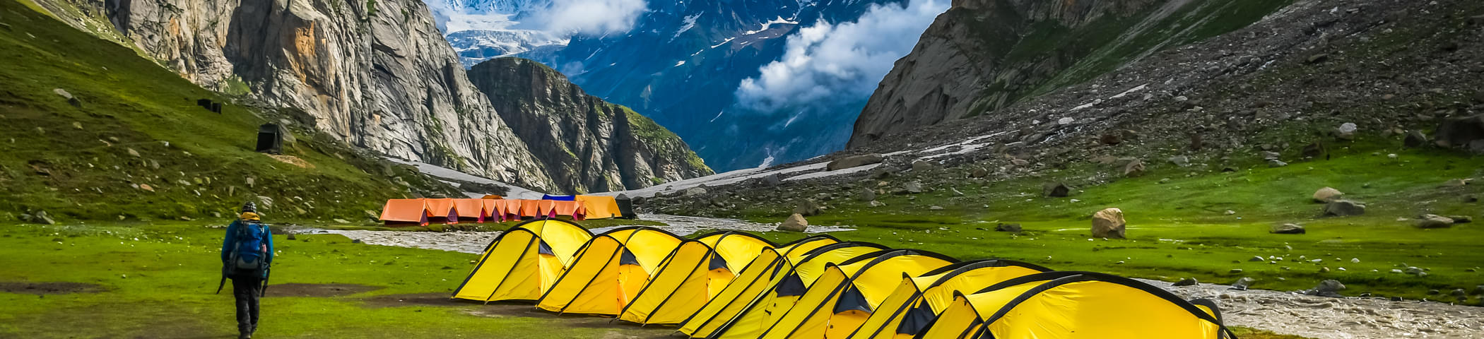
Alpine Tent stay - with common washroom
How to reach the campsite?
You have to report at Barshaini which is the starting point of the trek and it is around 22 km from Kasol. Many local transports and private cabs are available from Kasol to reach Barshaini.

- 2D/1N
- Kasol
- 2D/1N
Starting time of the trek: 10:00 AM on day 1
End time of the trek: 11:30 AM to 12:30 PM on day 2
Camping Location: Tosh Village, Himachal Pradesh
Indulge your visual senses as you take on the Tosh valley trek, a trail that will take you across the periphery of the mighty Himalayas. A village at the end of the Parvati Valley in Himachal Pradesh, Tosh is situated at a height of 7,874ft and leads to the beautiful Pin Parvati Pass. The Tosh River here is an offshoot of the Parvati River, which suckles into the main river at Pulga. An amazing point to note here is that the valley of Tosh is actually home to a tributary of the river Parvati, which also goes by the name River Tosh. This means that as soon as you arrive at a point after the trek to Tosh, where a smaller river stream is feeding its waters into the grand Parvati Valley, you have arrived at the beginning point of Tosh Valley.
Quick Facts:
Temperature Range: The average temperature here ranges between 2°C and 7°C and dips below the freezing point in winters.
Tosh Valley Trekking distance: 6 km
Tosh Trek Difficulty Level: Easy
Starting and Ending Point: Barshaini, Kullu
Best time to visit Tosh Valley: April to October would be the best time, though pleasant weather can be seen throughout the year. November to February would be a good time to see snow and experience freezing cold.
How to reach the campsite?
You have to report at Barshaini which is the starting point of the trek and it is around 22 km from Kasol. Many local transports and private cabs are available from Kasol to reach Barshaini.

- 8D/7N
- Shimla
- 8D/7N
About the Bhaba Pass Trek:
The Bhabha Pass trekking package for 8 days starts at Kafnu after you reach there from Shimla. Kafnu is a tiny hamlet in the Bhabha Valley, Kinnaur. The beginning of the Bhaba Pass trek will showcase apple orchards, meadows and an abundant natural beauty on the way to Mulling, a specific point you will camp at during the trek. From Mulling to the next stop that is Kara, you will go through some of the adventurous moments like river crossing and nature walk. Brace yourself to get bewitched by the stunning sights of vibrant peaks lying on the border of Kinnaur and Spiti.
Kara to Phustirang will let you witness the mighty Hansbeshan Peak located at a height of about 5840 meters and then comes the destination Bhabha Pass at 4850 meters filled with steep paths and heavy snow. At the top, you will be rewarded with the unending views of many mountain passes and the famous Pin Parvati Pass. Baldar, Mudh, and then Kaza are the destinations to cover in the last stretch of the Bhaba Pass trek.
On the last leg, you will be going to visit the famous Chandra Tal Lake and Kunzum La Pass which will definitely add more glamour to your exciting trek. From Chandratal, your trek goes to Manali where the trip comes to a conclusion.
About the Bhaba Pass:
For those of you seeking divine beauty and thrilling experiences in your Himachal trekking Packages, the Bhaba Pass trek is an ideal option. The trail opens up to the ethereal charms of Himachal Pradesh. Proud peaks and stunning river valleys of the region appear as if it was made for adventure. Along with an alpine adrenaline, the state also appeals with a rich Himachali culture and Buddhist monasteries.
With Bhaba Pass trekking, lap up the blend of dewy meadows and stark landscapes of the Spiti Valley. Get an opportunity to interact with some gaddi shepherds. Make way through apple orchards and winsome wooded area to complete the Bhabha Pass trek, where you can soak in the sights of Parvati Pin Pass. At Chandratal Lake, savour the enchanting sights of turquoise waters ringed by high mountains. Other delights include crossing natural bridges over rivers, feasting your eyes on purple mountains and enjoying a trail through a carpet full of alpine flowers.
A lot of trekkers get confused with Pin Parvati Trek and Pin Bhabha Pass Trek and wonder which one is better than the other. But these two are different as well as equally difficult trek. Bhabha Pass has so much beauty like Pin Parvati has. The maximum altitude a trekker of Bhabha Pass will achieve is 16000 feet. Bhabha Pass trek becomes somewhat similar to the trekking in Kashmir with rough desert like regions encircled by the towering mountains on all sides. But this Bhaba Pass trek also shows vast open grassland where you can camp at, beautiful forests and thrilling landscapes at some points.
Quick Facts:
Temperature: Day: 13°C to 18°C and Night: 0°C to 7°C
Maximum Altitude: 16,105 ft
Difficulty Level: Difficult
ATM: Rampur has the last ATM point before your trek begins.