


.jpg?w=305&h=230&dpr)


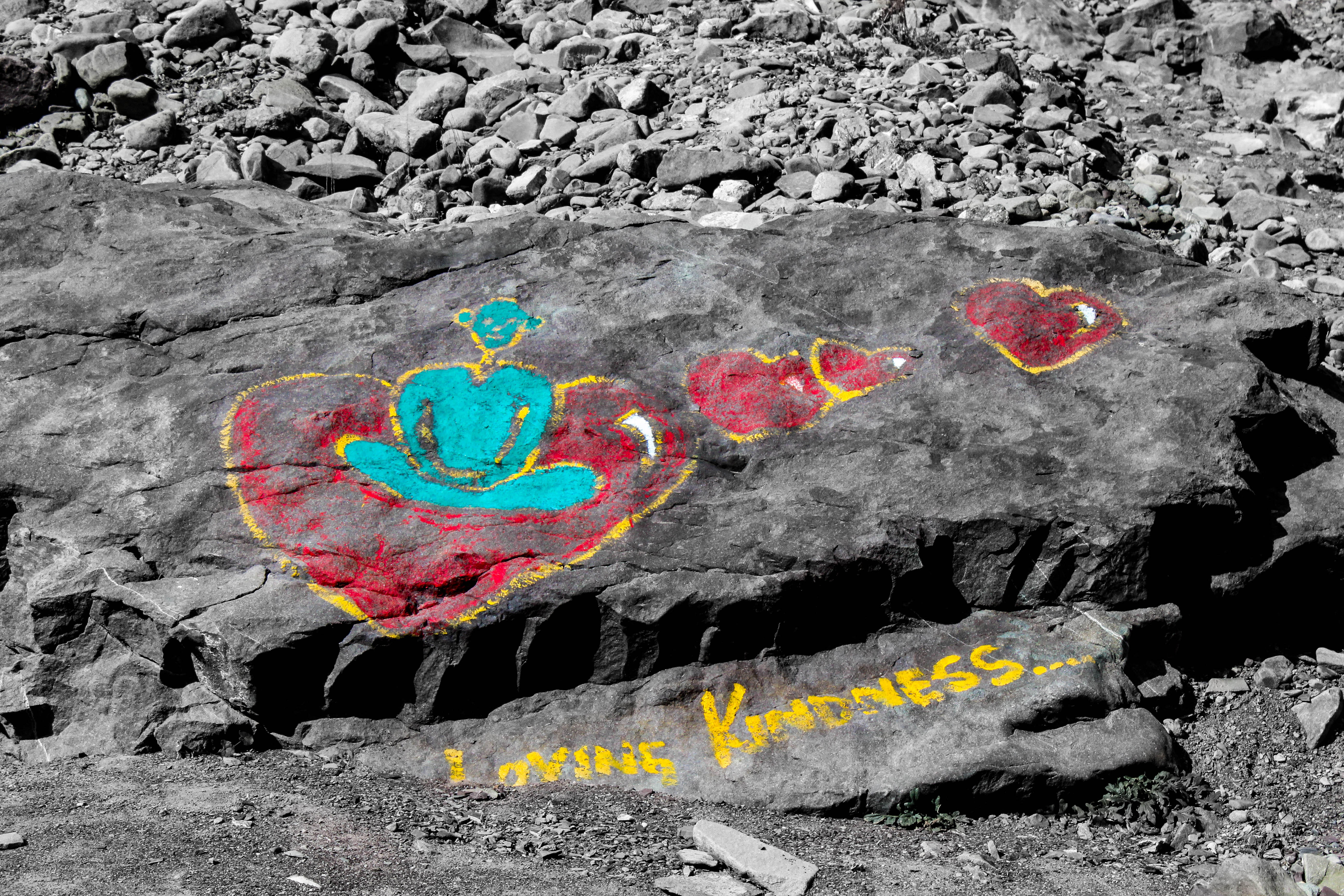
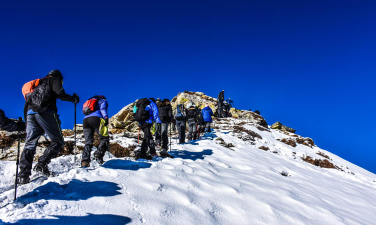
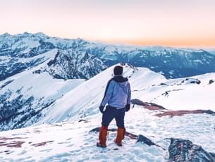
Chadar Trek
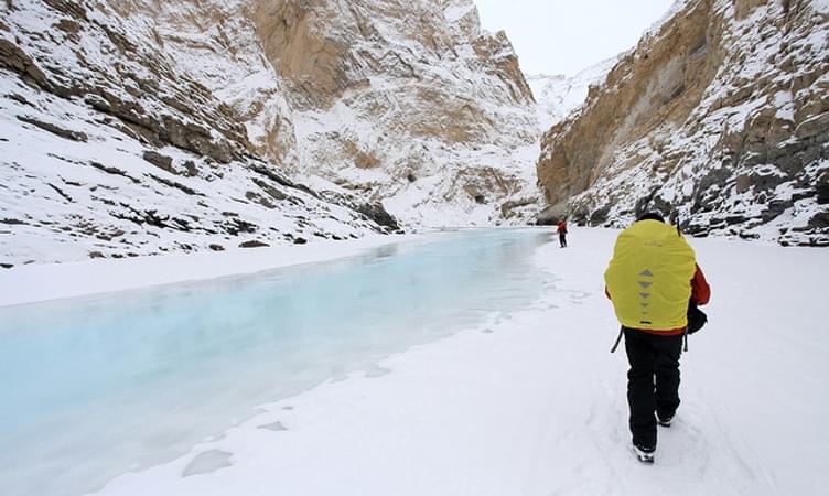
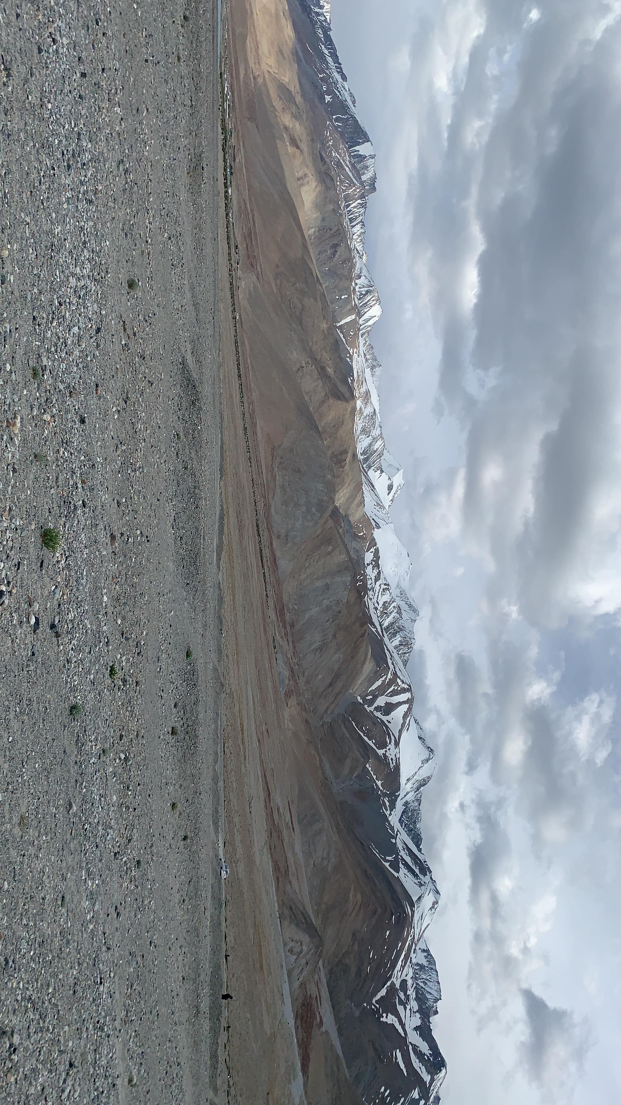
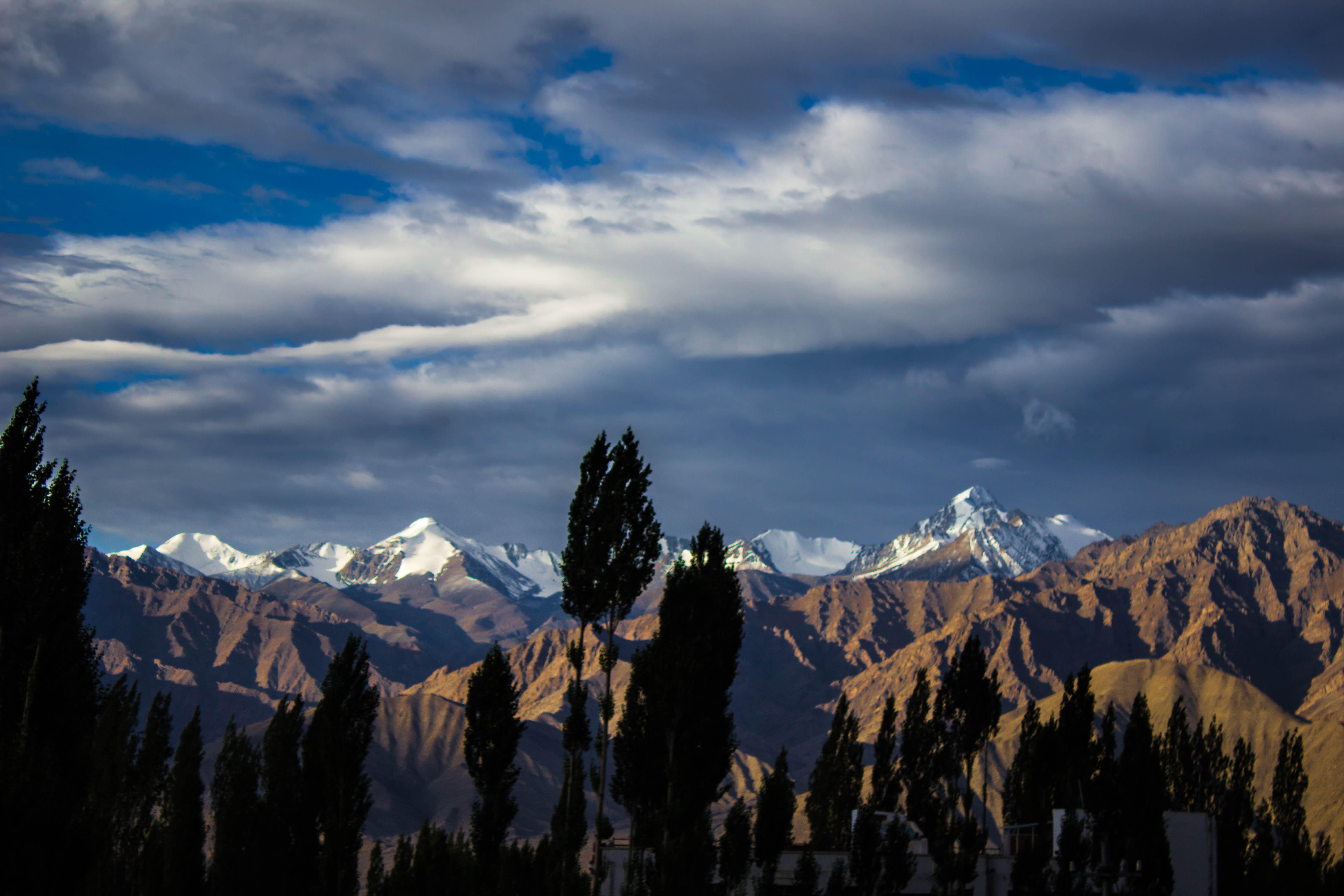
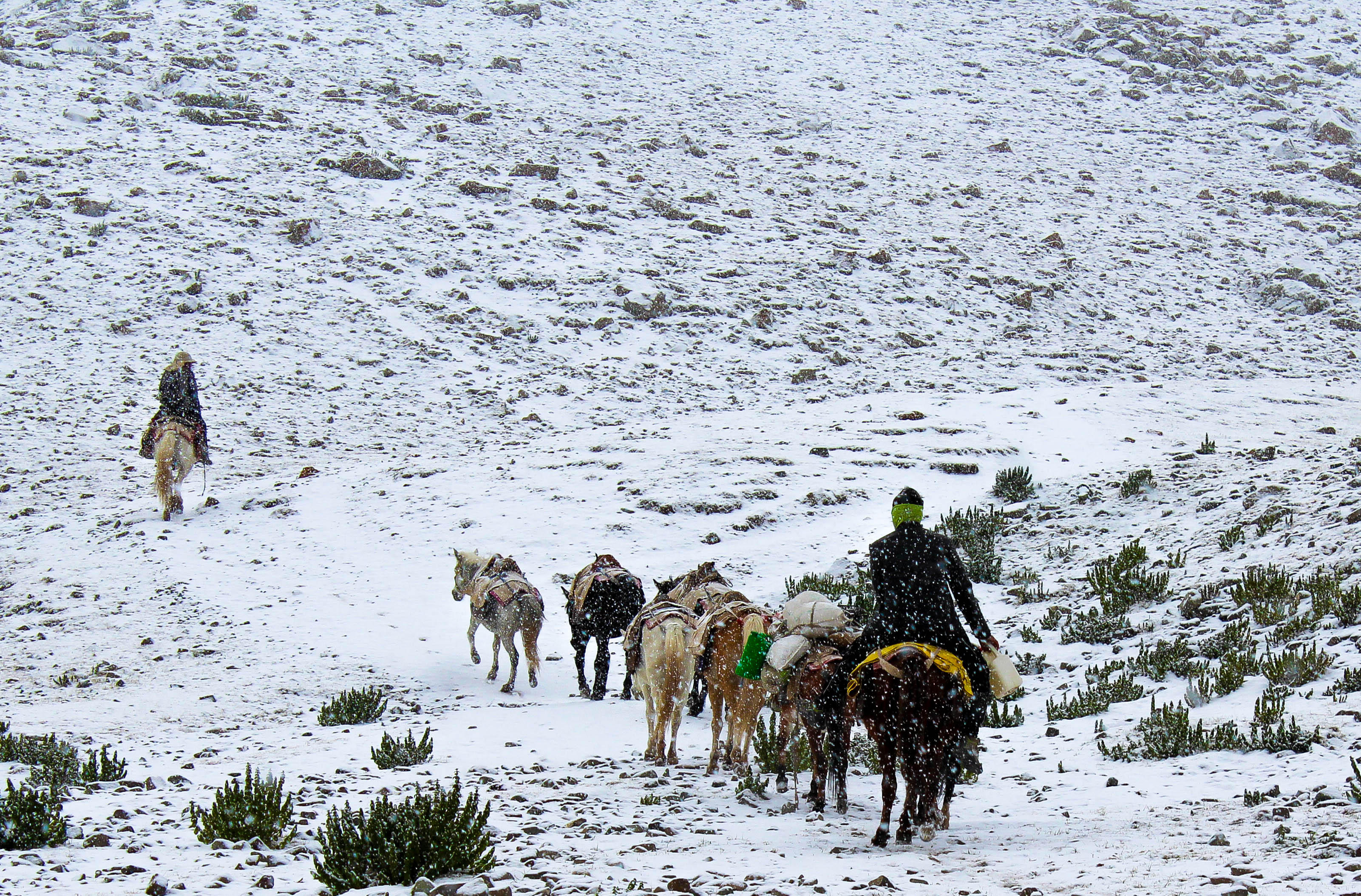
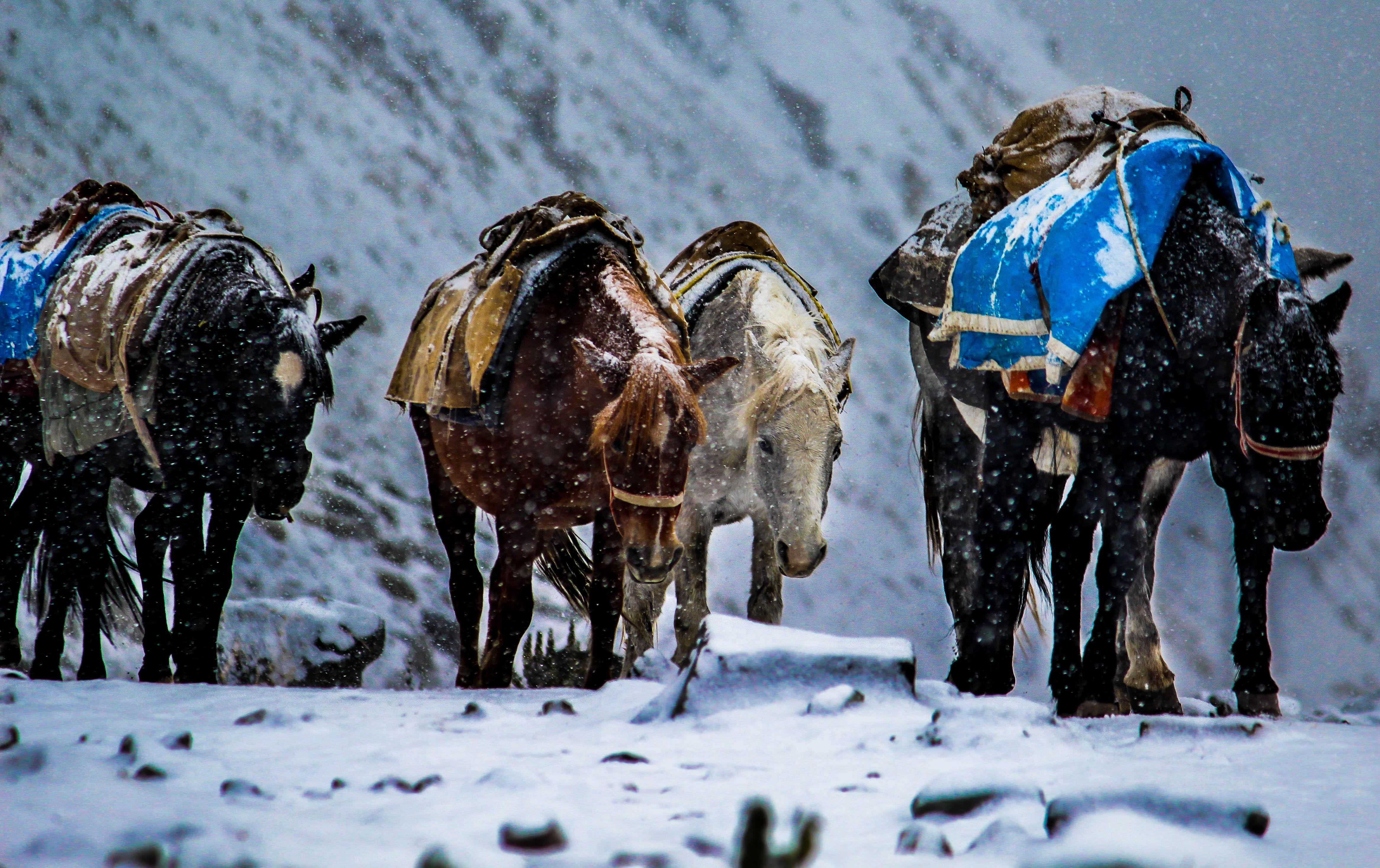
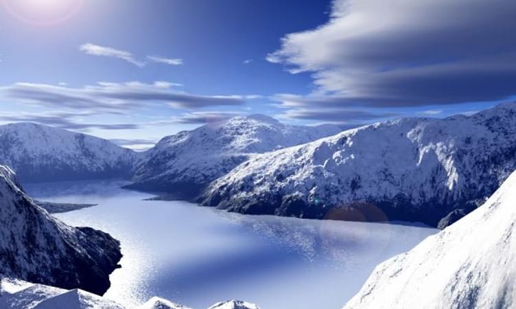
The beautiful Ladakh district is one of the most popular tourist destinations in the country. With snowy mountain peaks and picturesque landscape, Ladakh attracts innumerable tourists from all over the country and world. It is also a popular trekking destination. During the winter season, from November to March, the mountain passes get blocked due to snowfall. This cuts off access to several villages in the region.
One of the few ways to reach these snowbound villages is by trekking over frozen rivers. The Chadar trek, Leh is one such experience. Trekking along the Zanskar River, which offers a frozen path, takes you through such villages. This route has served as a trade and transportation route for several years now. Today, it is a popular trekking destination and attracts trekking enthusiasts from all over the world.
The Zanskar River is big and fast-flowing during the summers and lies frozen, all its energies harnessed, during the winters. The Chadar trek is definitely exciting but perilous too, the temperatures remain 15 to 20 degrees during the daytime and between 25 to 30 degrees at night. The trek will require you to walk on a sheet of ice, hence the name ‘Chadar’. On your way, you will be able to enjoy breathtaking views of glistening ice peaks and sparkling icicles.
During the trek, you will have to be very careful. You may have to walk on very thin strips of ice, bounded by canyon walls on one side and swift-flowing icy water on the other side. One mistake and you may be washed below the ice. So it is very important that you take care of yourself.
The trek usually lasts for a week and you will have to sleep in nearby caves during the night hours. The Chadar trek is unique and adventurous. It is perfect for those who love a little peril with their adventure. The beautiful snow-covered landscape of Ladakh and the chilly and slippery chadar of snow beneath your feet as your trek over the frozen Zanskar River will be an experience that you will never forget in your life.
Best Season: January - February
Difficulty Level: Difficult
Max. Elevation: 3390 m
Know More: A Complete Guide to Chadar Trek

About the Kanchenjunga Base Camp:
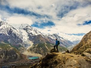
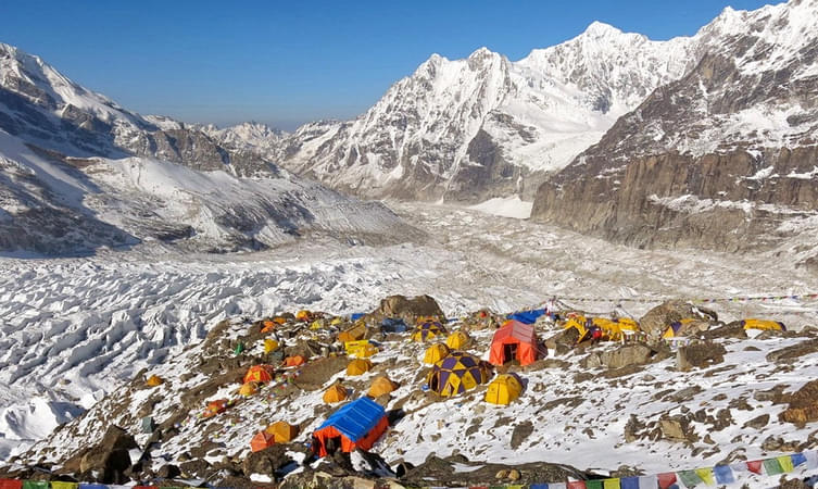
Nestled in the beautiful state of Sikkim, India, Kanchenjunga is a mighty peak in the Himalayas that stands at an impressive elevation of about 8586 meters. Spanning across the boundaries of Nepal, Tibet, and India, Kanchenjunga is divided into three major sections - Main, Central, and South. Covering an area of around 7,000 meters, Kanchenjunga is known for its vastness and unique landscape. The trek to Kanchenjunga Base Camp takes you through pristine landscapes, dense forests, charming tribal villages, and glistening lakes. Escape from the hustle and bustle of city life and immerse yourself in the mesmerizing beauty of snow-capped mountains & scenic landscapes. Many Sikkim tour packages include guided explorations of this enchanting region, making it easier for travelers to experience the magic of the Himalayas.
- 6D/5N
- Dehradun
- 6D/5N
Departure Dates:
December: 5,6,12,13,14,15,16,17,18,19,20,21,22,23,24,25,26,27,28,29,30,31,
January: 1,2,3,4,5,9,10,16,17,23,24,30,31
February: 6,7,13,14,20,21,27,28
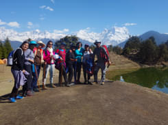
Kedarkantha Trek Highlights:
About the Kedarkantha Trek:
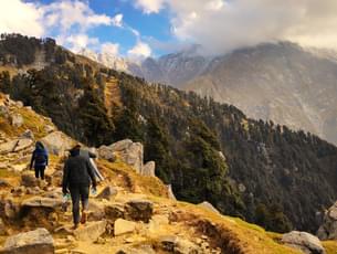
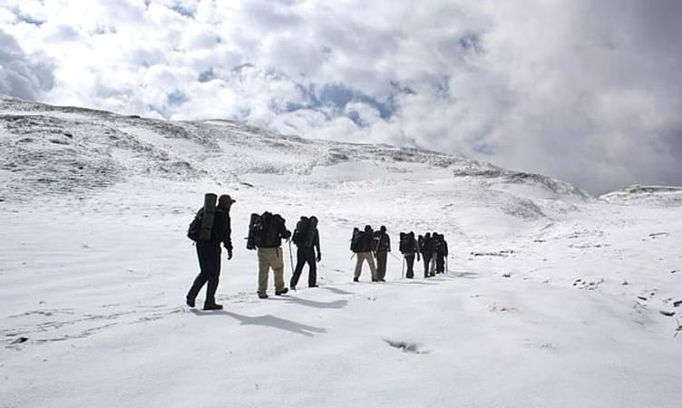
For those of you who are looking for some thrilling adventure then Kedarkantha trek is perfectly made for you. Decorated with a beguiling magnificence of falling snow and bordered with pine trees, The Kedarkantha Peak is a standout amongst the most looked for after snow trekking destinations in India. You will start this trek from Dehradun which is another beautiful destination. The drive to Kedarkantha takes you through Mussoorie, and some of the scenic beauty of the region till you reaches Sankri.
During your trek, you will come across some of the majestic sights of the snow-capped Himalayas, the verdant greenery, lush landscapes, a myriad collection of flora and frozen ponds. As you continue your trek you will also see remote towns where ladies and children are busy taking, bundles of wooden logs, wooden sticks and dry leaves to use them for cooking and set up bonfires at night. Kedarkantha trekking package gives you that perfect trekking experience that you have been long waiting for.
About the Kedarkantha:
In the celestial like the state of Uttarakhand, lies the snowy delight of Kedarkantha trek which is another beautiful trek. Close to the famous Har ki dun valley, this place is lesser visited. Steeped in unsurpassed beauty, over here you find charming villages, vast stretches of meadows, snow paths and magnificent views of the great Himalayas. The people of the region are said to be friendly and follow a unique culture and practice. Uttarakhand, permeating nature’s glory offers a dramatic landscape dotted with lovely lakes, tranquil rivers, mountains and rising Himalayan peaks. This is one trek which should not be missed by the adventure seekers who loves to take some challenges. This trek is an ideal destination for the nature lovers to bask in the prettiness of intact nature and enjoy wonderful and heavenly moments with exhilarating experiences.
Best time to visit Kedarkantha Trek:
The best time to visit the Kedarkantha trek is in the months of December to April. The entire region is covered with sparkling white snow and the base of alpine trees is half-submerged with it. If the snowy mountains attract you then this the best time for you to witness the true beauty of nature. The months of June to September are the monsoon months and one must avoid trekking at this time. The trekking route remains open in the summertime but the beauty in the winter months is truly paradisiacal that makes it the best time to visit Kedarkantha.
Quick Facts About Kedarkantha Trek:
Temperature: Day: 8°C to 15°C and Night: -5°C to 3°C
Kedarkantha Trek Distance: 20 km
Maximum Altitude: 12,500 ft
Kedarkantha Trek Difficulty Level: Easy To Moderate
Railway Station: Dehradun is the nearest railway station
Airport: Jolly Grant Airport, Dehradun
Base Camp: Sankri (10 hrs drive from Dehradun)
ATM: Purola has the last ATM point before your trek begins.
Meals during Kedar Kantha Trek:
Everyday Snacks, breakfast, lunch and dinner (vegetarian) are included in the package
Stay during Kedar Kantha Trek:
Tent or Guesthouse stay on triple/quad sharing basis
Standard tents/Hotels/Guest House with attached washroom in Sankri
Alpine tents in Juda – ka - Talab
Alpine tents in Base of Kedarkantha
There are two different variants available with this package as given below:
Variant 1: Kedarkantha Trek Ex Sankri- Rs. 6000/- per person
Variant 2: Kedarkantha Trek Ex Dehradun- Rs. 8000/- per person
How to reach?
Haridwar has a railway station which is well-connected from all metropolitan cities and nearest airport is Dehradun - Jolly Grant.
Best of


- 6D/5N
- 6D/5N
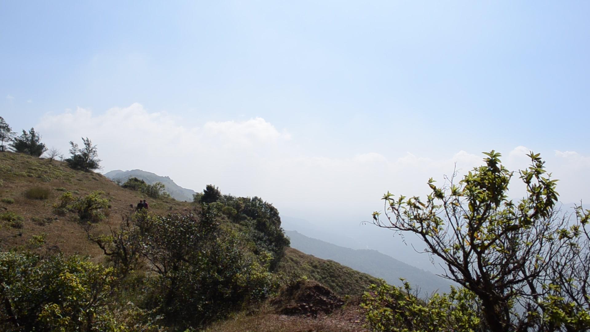
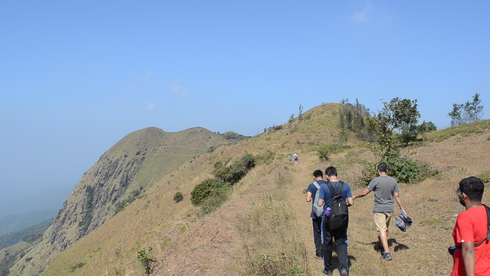
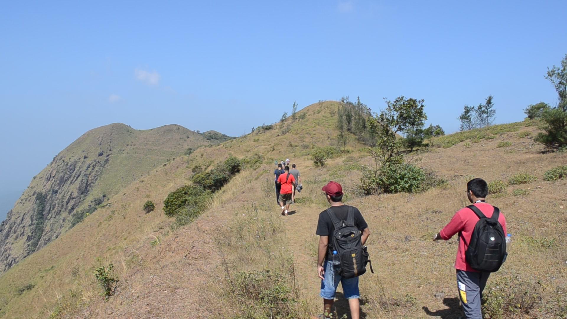
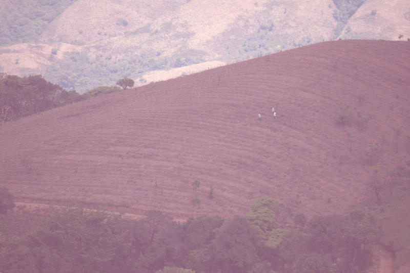
About the Sandakphu Trek:
The Sandakphu Trek is tucked away in the Darjeeling district of West Bengal and provides breathtaking panoramas of the highest peaks on Earth. It's rated moderate to challenging, so both beginners and seasoned hikers can enjoy it. The scenery is adorned by snow-capped peaks from Tibet, Bhutan, and Nepal. Being a part of Singalila National Park, you'll see a diverse range of animals and plants.
From Phalut, you may take in breathtaking views of the Everest range, which includes Makalu and Lhotse. Kanchenjunga, the highest peak in the "Sleeping Buddha" range, is a majestic and calming sight. The views of the sunrise and sunset from Aahl are quite amazing, particularly when the brilliant hues of the Everest cluster and Sleeping Buddha are reflected.
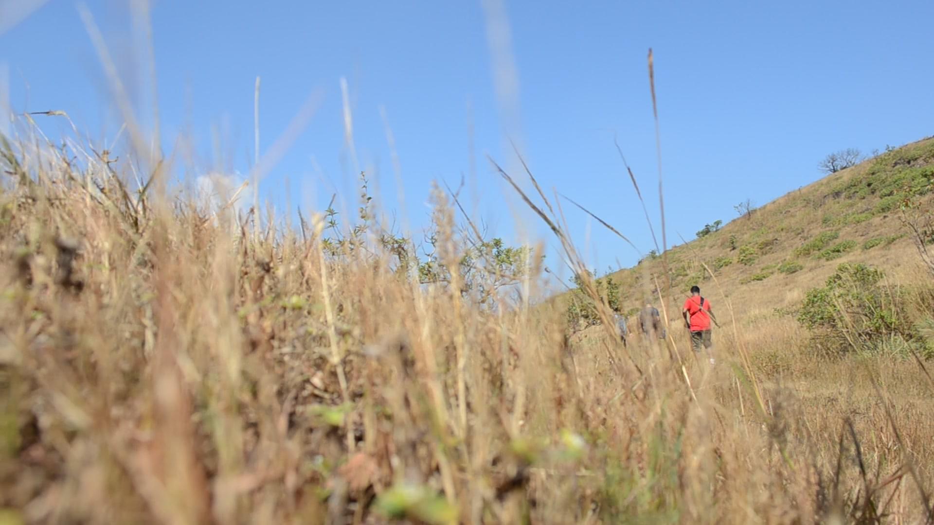
In the midst of the rhododendron and bamboo forests, you might spot exotic animals like the Himalayan black bear. With inviting hospitality and mouthwatering food included in Sandakphu trek package, it is the Indo-Nepali culture that enhances the trip. You can choose between Churpi and Dalle Khursani, two of the most popular authentic dishes.
Discover the turns of the Old Silk Road while taking in the warmth of the people. The area is dotted with magnolias and rhododendrons, which add to its picturesque appeal. Immerse yourself in local culture, marvel at breathtaking landscapes, and experience genuine hospitality on the Sandakphu Trek.
Departure Dates (2024)
March-6,8,9,10,16,17,23,24,26,30,31
April-6,7,8,12,13,14,20,21,27,28,29,30
May-4,5,11,12,18,19,21,25,26.
June-1,2,8,9,15,16,22,23,29,30
Quick Facts:
- Duration: 6D/5N
- Altitude: 11,930 ft
- Sandakphu Trek Difficulty Level: Moderate
- Sandakphu Trek Distance: 52 km
- Temperature: Day: 8°C to 15°C and Night: -5°C to 5°C
- Best Time to do Sandakphu Trek: March to May, October to January
- Nearest Railway Station: NJP
- Nearest Airport: Bagdogra
- ATM: You can withdraw money at New Jalpaiguri Railway Station (NJP).
- Starting Point: Manebhanjan/Chitrey
- Ending Point: Srikhola
.jpg?w=753&h=450&dpr)
- 5D/4N
- 5D/4N
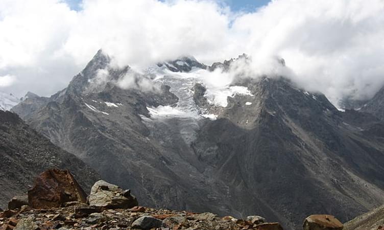
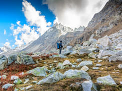
About Hampta Pass Trekking
Hampta Pass trek is one of the most picturesque adventure in the Indian Himalayas that takes you through the lush green valleys of Kullu to the rocky, barren landscapes of Lahaul and Spiti.Thrillophilia’s Hampta Pass trek packages offer you to embark on a journey that gives you an essence of the true beauty of mountains.
Our all inclusive packages include all the travel arrangements starting from accommodation in hygienic campsites, transportation to and from the trek’s base camp and healthy meals. Thrillophilia operates the treks through a vast network of trusted tour operators who know bits and pieces of the journey, in depth. The highly experienced trek leaders guide you throughout the journey and often take you to offbeat places to soak in the best views.
The Hampta Pass trek route begins from the quaint village of Jobra from where you hike towards your campsite in Chika. The next day, start ascending towards Balu ka Ghera which is nestled amidst the alpine meadows and surrounded by the gigantic peaks all around. You will be rewarded with beautiful views of the snow-covered peaks and witness the terrain changing from meadows to boulders. You will then commence the final leg of your journey to reach your destination- the Hampta Pass, situated at an altitude of 14,000 ft. Spend some peaceful time there in laps of the Himalayas.
After exploring the remote village of Hampta, proceed to descend towards Chatruwhich is one of the main highlights of the trek. It is the junction point of the roads to Spiti Valley, Rohtang Pass and Hampta Pass.
So what are you waiting for ? Pack your rucksacks, tie up your trekking shoes and get ready for a life-changing journey through the deep gorges, lush valleys and rocky trails of upper Himachal.
Quick facts about Hampta Pass Trekking:
Start Point/End Point: Manali Base Camp
Duration: 4 Nights & 5 Days
Hampta Pass Trek Height: 14,100ft
Hampta Pass Trek Difficulty Level: Moderate
Trekking Distance: 35kms
Best time to do Hampta Pass Trek: Mid June - September
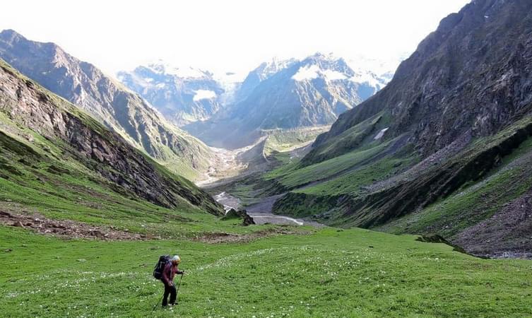
Valley of Flowers Trek
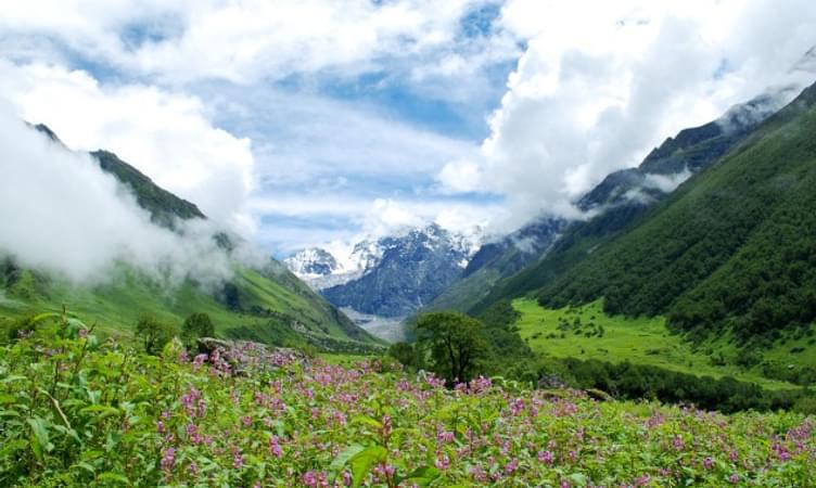
Just as the name suggests, the place is heaven on earth. It may be difficult to believe, but the Valley of Flowers seems too surreal to believe. The Valley of Flowers is in full bloom in the months from June to October and appears as a carpet of myriad colours.
The Valley of Flowers is the second core zone of the Nanda Devi Biosphere Reserve and has been now declared as a World Heritage Site. The entire landscape springs into full bloom right after the monsoon rains. The Valley of Flowers attracts a number of tourists, botanists, florists, and trekkers all throughout the year.
The Valley of Flowers is open to the public only during the summers. It is an excellent place for trekking and can be reached on foot by trekking 17 km from the nearest town of Joshimath in Garhwal. You will have to trek about 14 km from Govindghat, which is situated near Rishikesh, to reach Ghangaria. Ghangaria is the last settlement on your way to the Valley of Flowers. You reach the gorge over the River Pushpavati where the valley starts. There are fixed timings for entry into the valley and camping is prohibited there. You will have to return to Ghangaria the same day.
The beautiful valley is situated at an elevation of 3650 m and is delightful to look at. The best time to visit the Valley of Flowers is mid-July to mid-August. The trek to the Valley of Flowers is very easy and can be undertaken by people who have limited or no experience of trekking.
The Valley of Flowers has a very pleasant climate during the daytime with the temperatures hovering between 15 to 20 degrees. However, it gets pretty cold during the night time and you may want to dress in layers to protect yourself from the cold. The treks are always led by professional guide trekkers who have completed the basic and advanced mountaineering course and are certified in first-aid.
Best Season: May - October
Difficulty Level: Medium
Max. Elevation: 4329 m
Also Check: Guide to Valley of Flowers Trek

Best of


.jpg?gravity=center&width=90&height=90&crop=fill&quality=auto&fetch_format=auto&flags=strip_profile&format=jpg&sign_url=true)


- 3D/2N
- 3D/2N
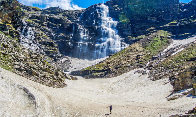
About the trek:
Beas Kund is a thousand-year-old alpine lake that sits royally amidst the mountains of Himachal Pradesh at an altitude of 3,810 meters. This taintless beauty is the origin of the Beas River, which is believed to be the water body where Sage Vyas used to take baths while he meditated and wrote the Hindu epic, Mahabharata. Beas Kund is the famous trek of Manali with lush green grasslands below the summits of the three biggest mountains around Manali and hidden in these grasslands is the emerald lake. The contrasting sight of this serene water body nestled in between jagged mountain peaks of the Pir Panjal range adds to the beauty of the lake. Your camping experience will be worth remembering with the picturesque view of the sparkling rivers and verdant mountains.
Start Time/End Time of Trek: The trek starts at 10:00 AM (Day 1) and ends around 2:00 PM on (Day 3)
Start Point/End Point of Trek: Solang Valley
Inclusions:
- Stay: Dome tents on a shared basis
- Meals: Breakfast and Lunch or Dinner
- Highly experienced guide
- Activities: Trekking & Camping

- 5D/4N
- 5D/4N
About the Nagtibba Trek:
The Nag Tibba trek is an exciting and accessible trek located in the Indian state of Uttarakhand. It takes you into the Garhwal Himalayas to offer you a chance to explore the snowy landscapes and enjoy stunning views of the surrounding peaks.
Your journey begins in the small village of Pantwari near Mussoorie. It begins at an altitude of 4,650 feet and ascends to the Nag Tibba summit at 9,900 feet above sea level.
One of the main attractions on the trek is the Nag Tibba Temple, which is dedicated to the serpent god Nag Devta. The summit of Nag Tibba provides breathtaking views of many Himalayan peaks, including Bandarpoonch, Swargarohini, and the Gangotri group.
Even the snowy landscapes and dense forests make for excellent photography opportunities. Camping in the snow under a clear sky is another highlight of the Nag Tibba trek package.
The peaceful environment and the adventure of a summit climb make this trek perfect for a weekend getaway. It offers an easy introduction to the world of trekking for beginners. So, enjoy the beauty of the Dhauladhar, Pir Panjal and Nag Tibba ranges through this trek with Thrillophilia today!
Nag Tibba Trek Package Inclusions:
- Stay: Dome tents on sharing basis
- Meals: Breakfast,Lunch and Dinner
- Transportation: As per the variant selected
- Activities: Trekking & Camping

- 10D/9N
- 10D/9N
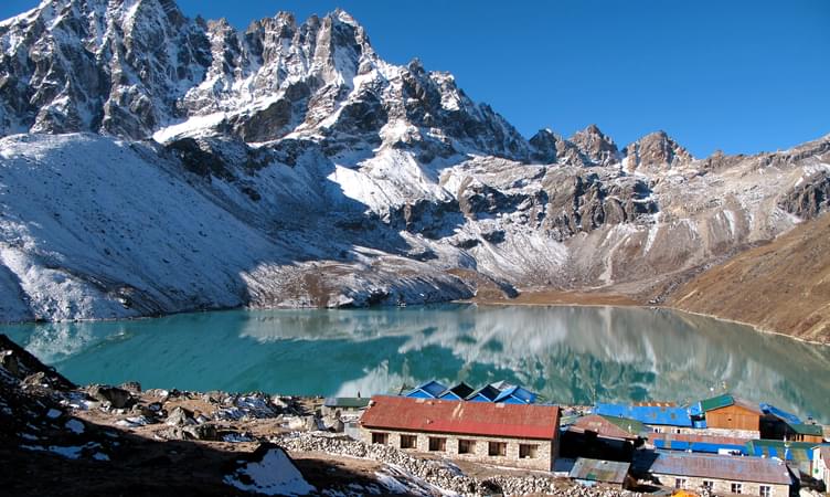
About GoechaLa Pass Trek:
GoechaLa trek is nestled at a height of 16,207 ft, with a closer look at the third-highest peak-Mt. Kanchenjunga. It is a dream and desire for hundreds of adventure lovers. Bounded by the mesmerizing flora and fauna, which are so vibrant and colourful to cheer up one's mood.
The GoechaLa pass trek is a bundle of big summits, making it an absolute adventure to embark on. The trail link with the famous Kanchenjunga National Park, where one can witness the true nature, enough to revitalize your senses. To watch the mountains clearly, April and May are the ideal months. Since the sky is completely clear during this time and the sunset-sunrise views can be captured.
Departure Dates (2024)
March-23,24,30,31
April-1,6,7,13,14,20,21,27,28
May-4,5,6,11,12,18,19,24,25,26.
June-1,2,8,9,15,16,22,23,29,30
GoechaLa Pass Trek Quick Facts:
GoechaLa Trek duration: 10D/9N
Maximum Altitude: 16207 ft
Difficulty Level: Difficult
GoechaLa Trek Distance: 90 Km
Temperature Range: April - June: 15 to 22 Degrees (Days); -1 to 7 Degrees (Nights), September – Nov: 10 to 15 Degrees (Days); -5 to 5 Degrees (Nights)
GoechaLa Trek Best Time: April end - May And September - November
Railway Station: New Jalpaiguri (NJP) is the nearest railway station, which is 150 km away from Yuksom
Airport: Bagdogra Airport which is 155 km from Yuksom
ATM: Yuksom is the last point where you can find the ATM.
Starting and Ending point: Yuksom
Best of


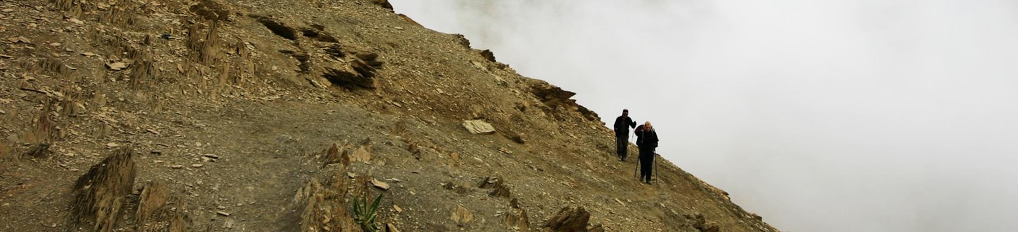
The Kuari Pass Trek
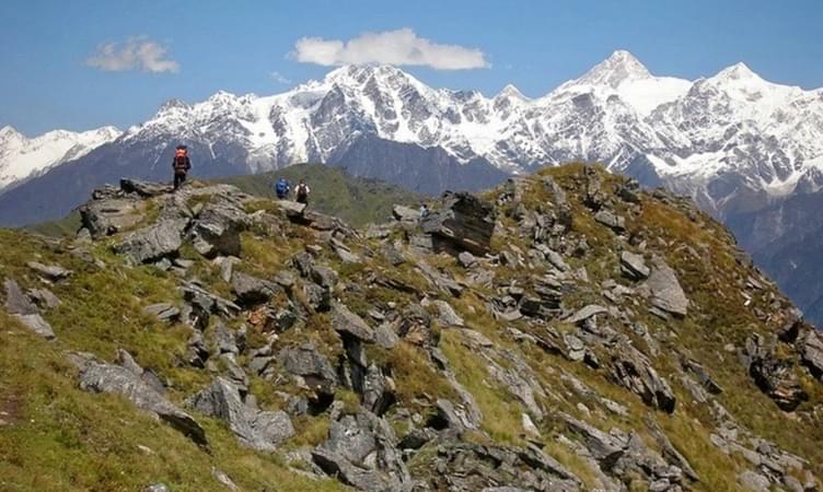
It was Lord Curzon’s initiative which led to the discovery of the trekking trail to Kuari Pass. The Kuari peak stands at an altitude of 4,264 metres and can be reached through a trekking trail that starts from Joshimath. The region has some of the grandest mountains of the Himalayan range namely, the Kamet (7756 m), the Chaukhamba (7128 m), the Trishul (7120 m), the Nanda Devi (7817 m) and the Nanda Devi East (7434 m).
The Kuari Pass trek gives you the wonderful opportunity to enjoy breath-taking views of these mountains. This trekking trail is comparatively quite easy as compared to other trails for high altitude trekking in India.
The trek begins at Joshimath in the Chamoli district of Uttarakhand. The Chamoli district is of great religious importance for Hindus in the country due to the Panch Prayag which is formed by the confluences of the Rivers Nandakini, Pinder, Kaliganga, Dhauli Ganga and Birehiganga.
The trail will take you through quaint little Himalayan villages which offer magnificent views of the Himalayas and a sneak peek into the life of the locals. During these walks, you can get to know more about the culture and traditions of the people here. The path is lined with trees in a beautiful hue of yellow and orange under a clear blue sky with cotton candy clouds forming interesting shapes.
The snow-capped mountain peaks stay by your side all along amazing you with their majestic and intimidating sizes. You will also pass through oak and deodar forests during this trek, which is pure delight to the senses. These jungles are rich in flora and fauna and you can spot fiery red flowers on rhododendrons.
You also get to walk through Himalayan meadows called Bugyals which offer the best view of the Himalayan beauty. The best of the Bugyals is the Gorson Bugyal. You will visit Auli, which is best known for its winter skiing slopes. Your trekking trail will take you to the Vinayak Pass and the Tali peak, from where you can get a panoramic view of the valley below. On reaching the highest point of the trek i.e. the Kuari peak which stands at an elevation of 13, 990 feet, you are rewarded with a mesmerising view of the majestic peaks of the Himalayas.
Best Season: December - January
Difficulty Level: Moderate
Max. Elevation: 4,264 m
- 3D/2N
- 3D/2N
Meals during Kasol and Kheerganga Trek:
Note: All the pictures shown on the web page are for reference only & should be considered illustrative. It may not represent the camp that you will be allotted in actual. Some web pages may have an associated image of a particular camp. The Actual camp may vary due to a variety of reasons like availability, Quality, No of bookings, Maintenance etc. Thrillophilia reserves the right to change product images and specifications at any time without notice.
- 3D/2N
- Mcleodganj
- 3D/2N
This trek can be availed at any day in a month provided the group size is above 4 people.
Start Point/End Point: Mcleodganj - Bhagsu Nag Taxi Stand
Start Time/End Time: The trek starts at 10:00 AM on day 1 and ends around 02:00 PM on day 3.
About Triund and Laka Glacier:
Triund is the easiest Himalayan trek. With breathtaking views of the Kangra valley and the snow-covered Dhauladhar ranges, it is also very picturesque. The Triund and Laka Glacier trek exhibits stunning nature and offers a spectacular view of the entire Kangra valley.
About the Laka Glacier Trek With Triund:
Triund trek near Mcleodganj has gained vast amounts of popularity in the recent years for the scenic beauty and adventurous nature of the trek. Situated at a height of 9500ft above sea level, the views from the top of the Triund hill will never fail to mesmerize you with the sheer beauty of the entire valley in front of you. With a large number of travelers and adventure lovers trying on the trek, every year, this activity goes the extra mile and takes you to the famous Laka Got glacier, to have some fun and frolic before availing the chance of camping there. You will have a chance to stay in Alpine style tents on triple sharing basis.
Embark on this exciting Laka Glacier Trek expedition and get amazed with the breathtaking view of this region. Start your trek from Mcleodanj early in the morning while exploring the true and unspoiled beauty of nature hidden in the Himalayas till you reach Triund for the camping overnight. Explore the most popular and the perfect route on your trek to Laka Got Glacier, and upon arrival, play with the snow and make a snowman. Don't forget to take pictures. Enjoy the sights of vast green snow-capped capped mountains, while you set up camp here. End your tour by heading back to Mcleod Ganj with lots of memories.
Quick Facts:
Trekking distance: 13 km
Maximum Altitude:3,200 meters
Difficulty Level: Easy To Moderate
ATM: Mcleodganji is the last point where you will get ATM.
Group Size- Min 4 people
Best of


.jpg?gravity=center&width=90&height=90&crop=fill&quality=auto&fetch_format=auto&flags=strip_profile&format=jpg&sign_url=true)


- 3D/2N
- Mcleodganj
- 3D/2N
Nestled at an elevation of around 9,626 feet above the sea level, the pristine Kareri Lake is a beautiful shallow freshwater lake, which can be reached by hiking the even serene 26 kilometers long Kareri Lake Trek. Kareri Lake gets its water supply from the thick snow melting down the Dhauladhar mountains and eventually outflows as a breathtaking stream. This spectacular destination in the majestic Dhauladhar range is home to lush pasturelands, exotic perennial flowers, and dense conifers. Other major attractions in this place that Kareri Lake Trekking will reward you with include an ancient Lord Shiva temple and the gaddi kothis.
About the Kareri Lake Trek:
For those of you who are planning to conquer the Himalayan Mountains, then trek to Kareri lake is a great option for you. located at an elevation of about 2,950 meters in the Kangra district of Himachal Pradesh. This glacial Kareri lake trek will take you through a journey of the most scenic views. Trek through the lush green forest filled with chir and chilgoza pines as you continue your trek.
The endpoint is feasible to take the private cabs to reach Mcleodganj. This trek is also a favorite among the shutterbugs and the nature lovers who can spend some time close to nature while clicking their best shots.
Quick Facts About Kareri Lake Trek:
Maximum Altitude: 9,650 Ft.
Temperature: 8°C to 20°C
Start Time: 09:00 AM
Kareri Lake Trek Difficulty Level:- Easy To Moderate
Approx Trekking Km:- 26 Kms (To & FRO)
Stay during Kareri Lake Trek Himachal:
Stay in Alpine/ Dome tents on double/triple/quad sharing basis.
Meals during Kareri Lake Trek Himachal:
Lunch from day 1 till the breakfast of day 3 (All the meals are included, veg meals will be provided)
How to Reach:
The nearest airport is Gaggal Airport at Dharamshala about 20 km away. The Main Square is the epicenter of McLeodganj Town which is surrounded by most of the Hotels, the start point can easily be reached through convenient public and private transportation from here.
Note:
This Kareri Lake trek can be availed on every Weekend. Open even for Solo travelers as well. Send the inquiry for more available dates.
- 4D/3N
- Haridwar
- 4D/3N
For inquiry please call @ 7412020072
About the Chopta Tungnath Trek:
Tungnath trek is short and easy in the Chopta Tungnath trek which runs parallel to the sky-scraping Himalayan Treks. Tunganath is the highest temple of Garwal. During this hiking, one can enjoy a clear view of majestic peaks of Panchchuli, Nanda Devi, Nilkanth and Kedarnath. Chopta gives a picturesque view of the Himalayas. In the early spring, the Rhododendron forest glows red as the flowers bloom.
Your journey for the Chopta Tungnath trekking will start from Haridwar, in Haridwar will visit the famous Mandakini Valley, the river and lake. Then we will visit Chopta, which is surrounded by dense forests. From Chopta, we will start for Tungnath and Chandrashilla Top (Our last destination).
About the Destination:
Tungnath is always the starting point of the Chanadrashila summit trek which possesses a captivating beauty with the help of many deodar and rhododendron forests. Chopta has a myriad collection of pictorial sights to bewitch the visitors which is marvelously engulfed by huge vegetation in spring and summer. During winter it would be appealing to all eyes since the thick cover of snow will be an amusing part of the region.
The summit of the Chandrashilla peak provides a breathtaking 360-degree view. Views, which go far beyond the simple view of mountains.
Quick Facts About Chopta Tungnath Trek:
Temperature: Day: 8°C to 15°C and Night: -5°C to 3°C
Maximum Altitude: 11,154 ft
Chopta to Tungnath Trek Distance: 5 Km
Chopta Tungnath Trek Difficulty Level: Easy To Moderate
Railway Station: Haridwar is the nearest railway station
Airport: Jolly Grant Airport, Dehradun
Base Camp: Sari Village (6 hrs drive from Haridwar)
ATM: Last ATM is in Ukhimath, around 13 km before Sari.
The Patalsu Peak Trekking Adventure takes you on a thrilling journey to the summit at 13,800 ft., offering breathtaking views of the Dhauladhar ranges and Kullu Valley. This 11-hour trek, starting from Solang Valley in Manali, promises diverse terrains, including dense forests, meadows, and rocky snow-covered paths, making it a truly exhilarating experience.
Accompanied by an experienced local guide, you’ll also learn about the mountain’s fascinating history and wildlife. With a light lunch included and seamless planning through Thrillophilia, this adventure is perfect for nature enthusiasts and thrill-seekers alike.
Best of


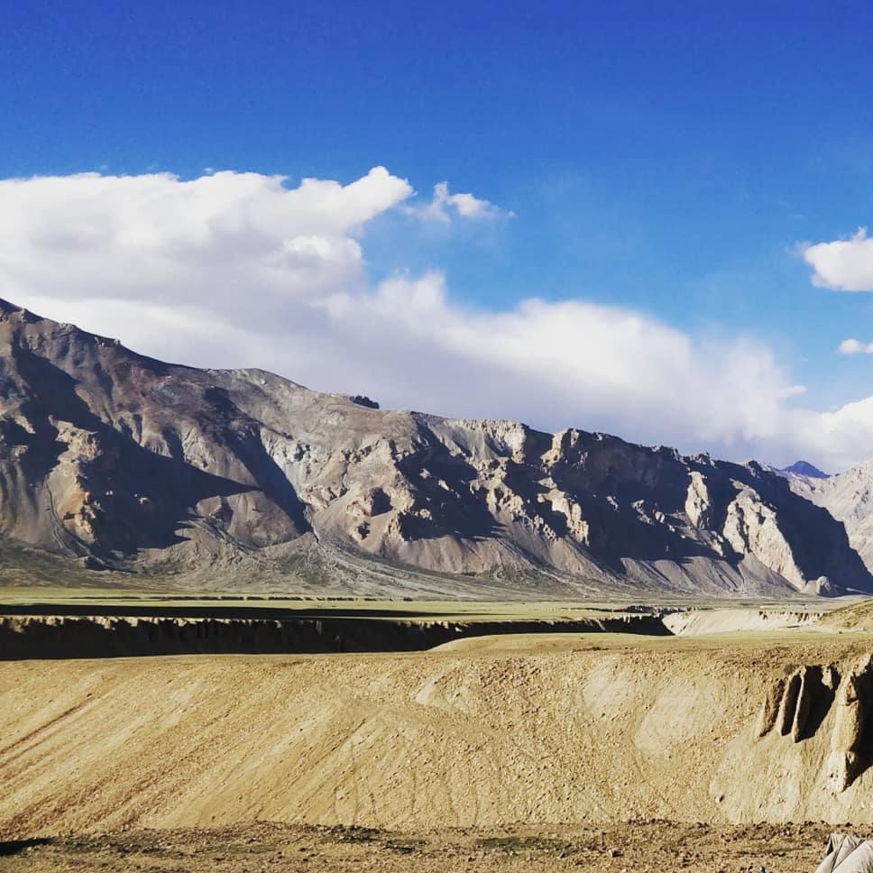
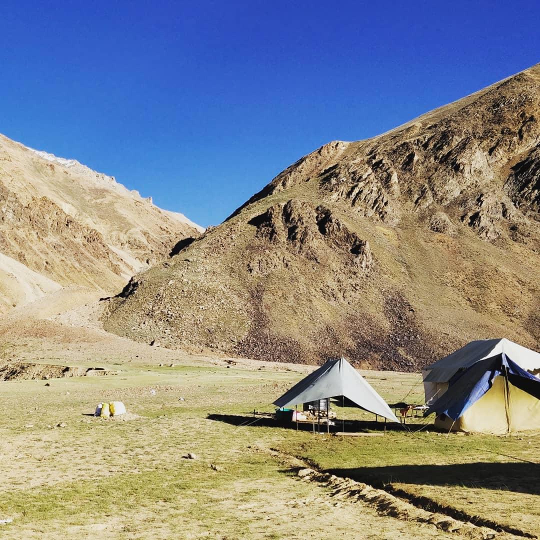
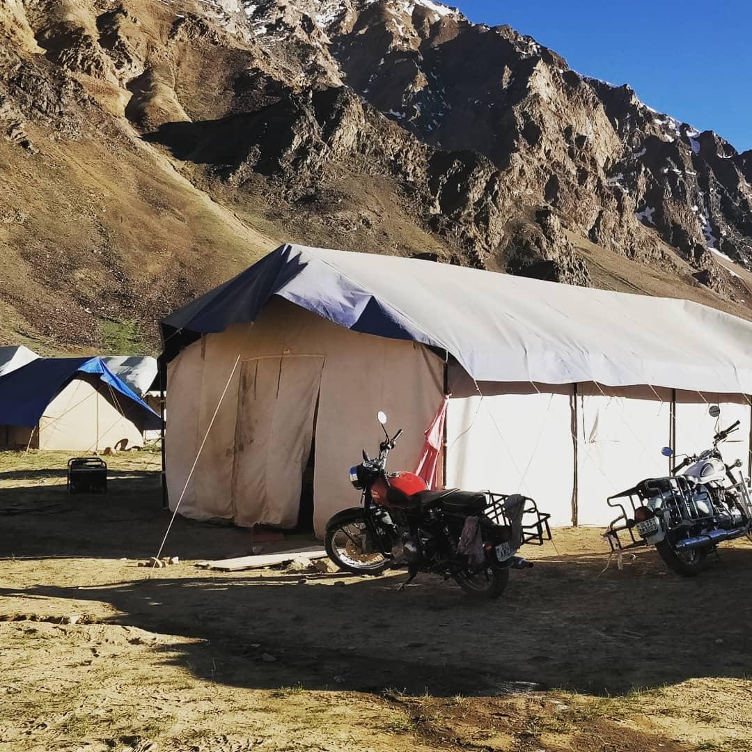
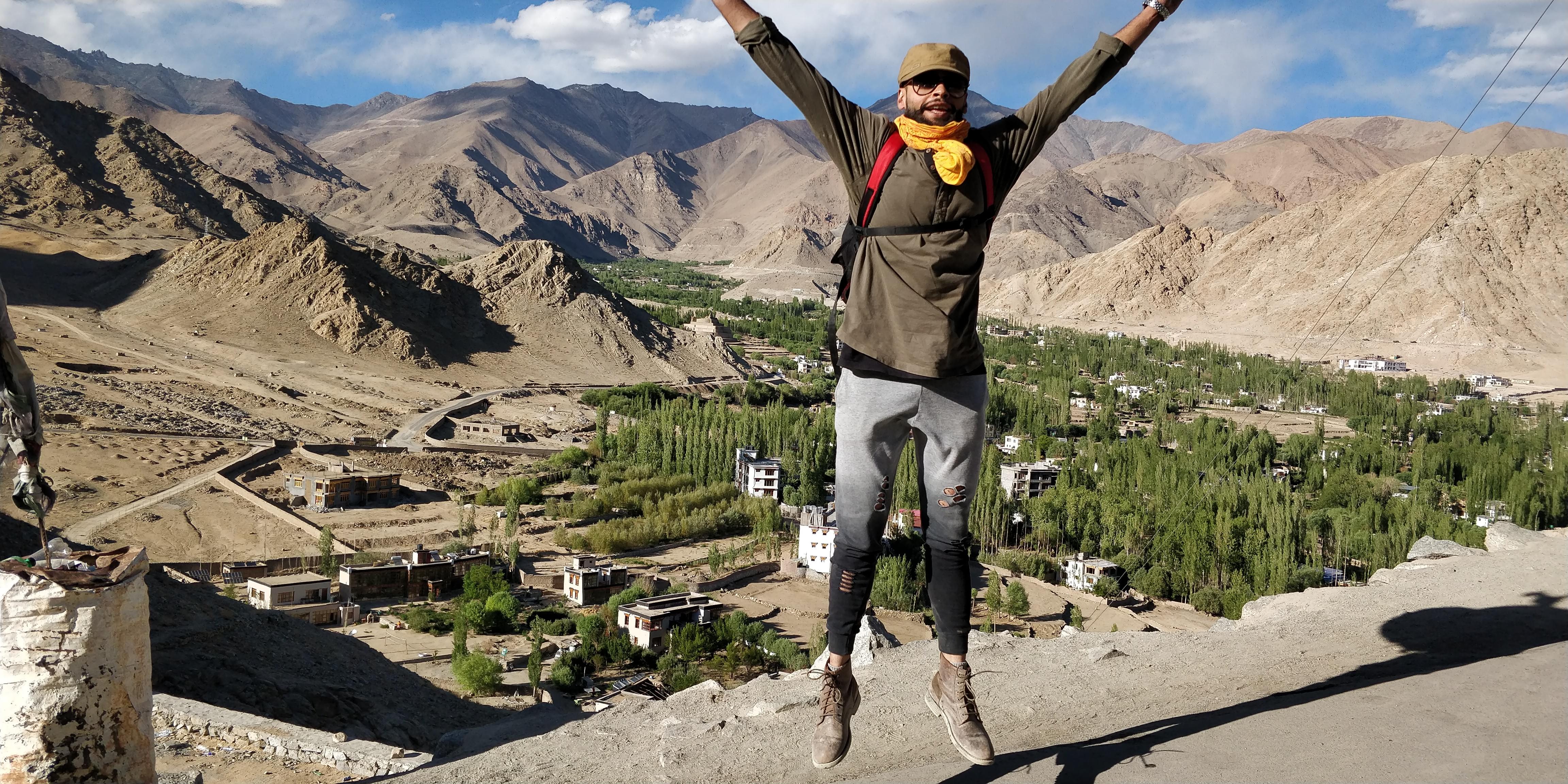
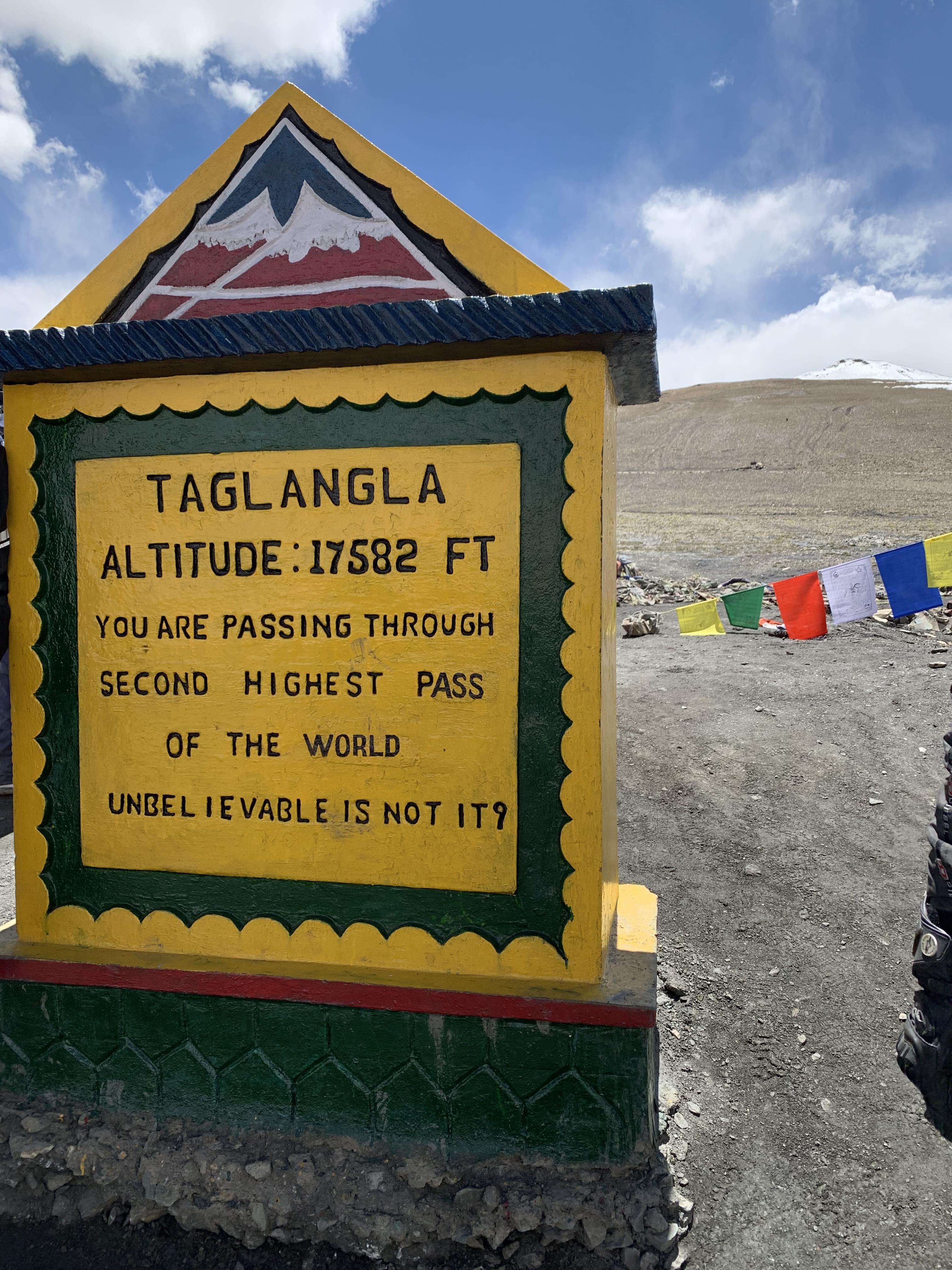
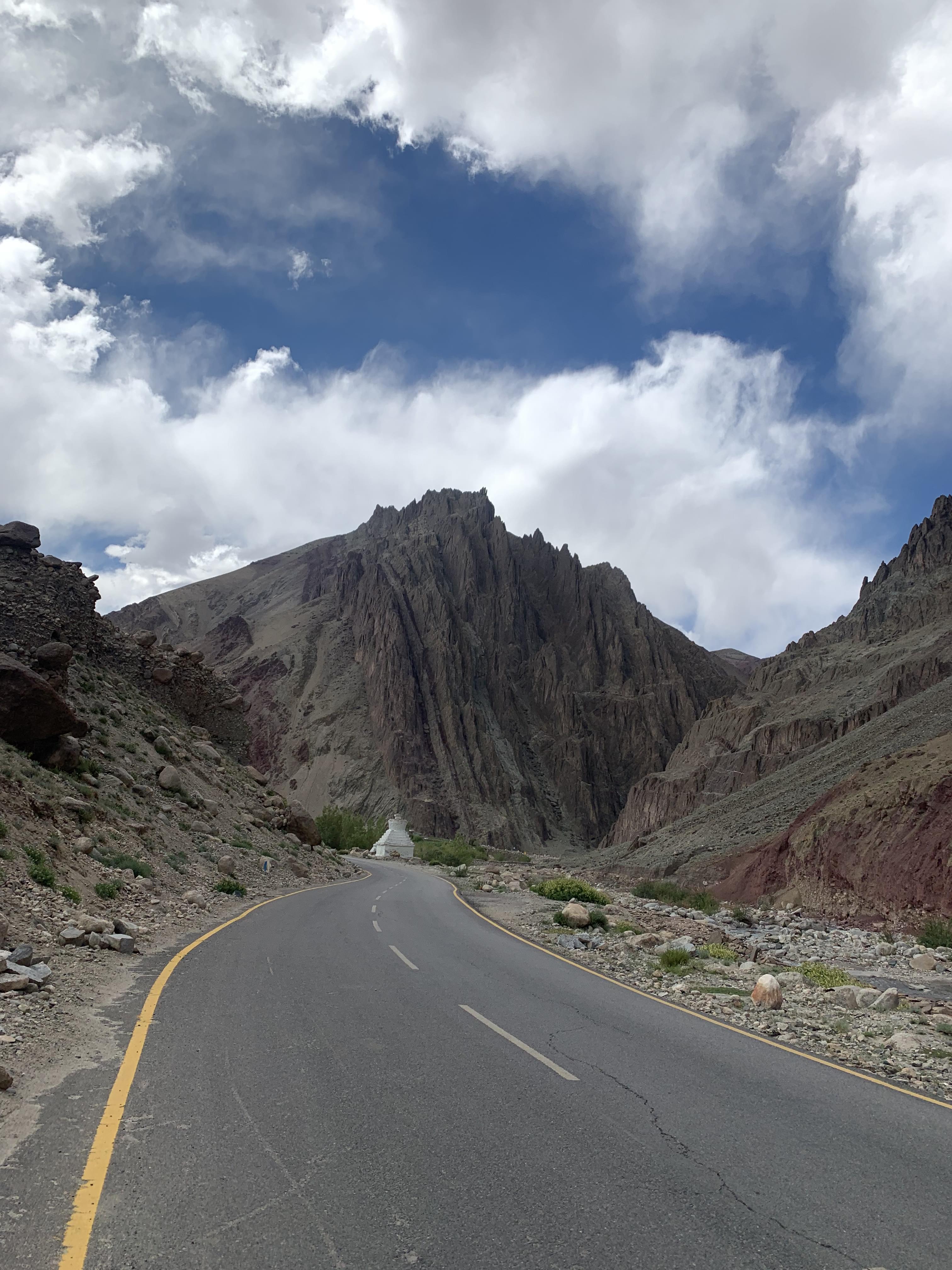
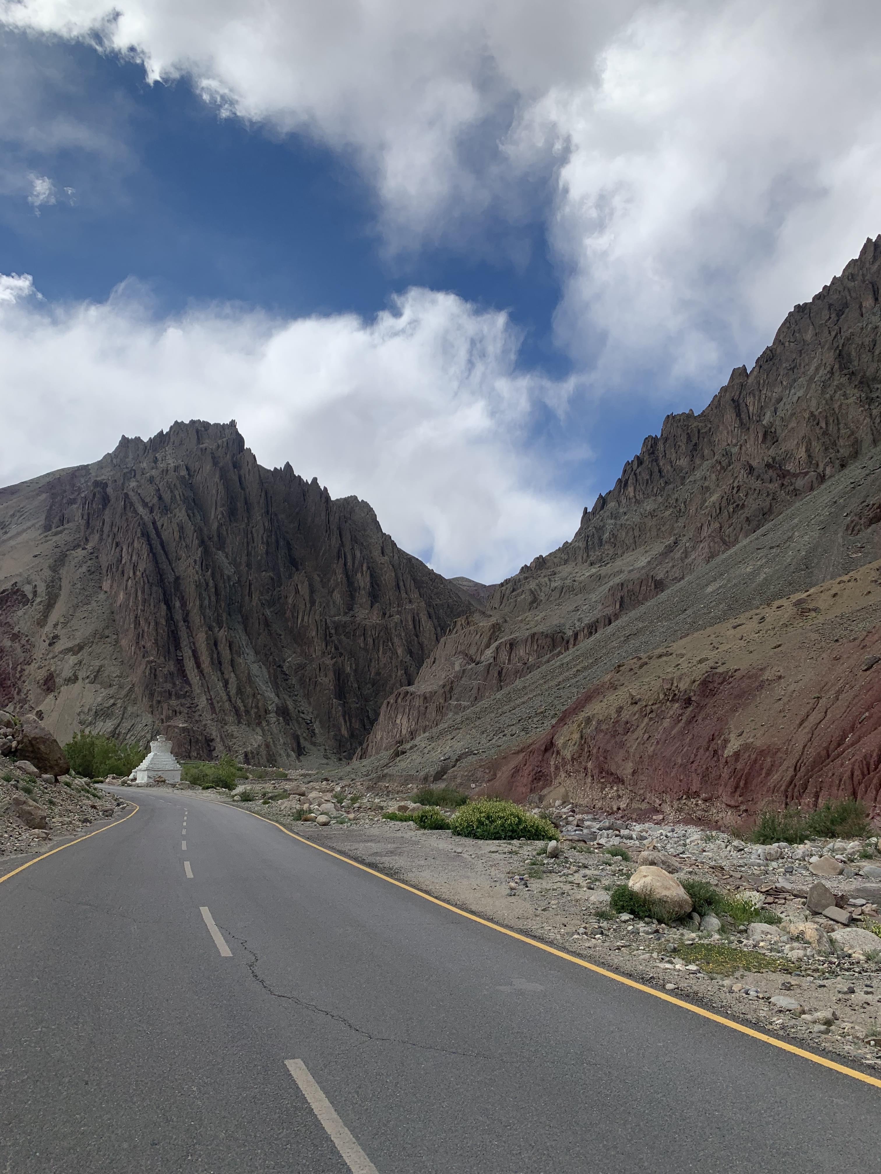
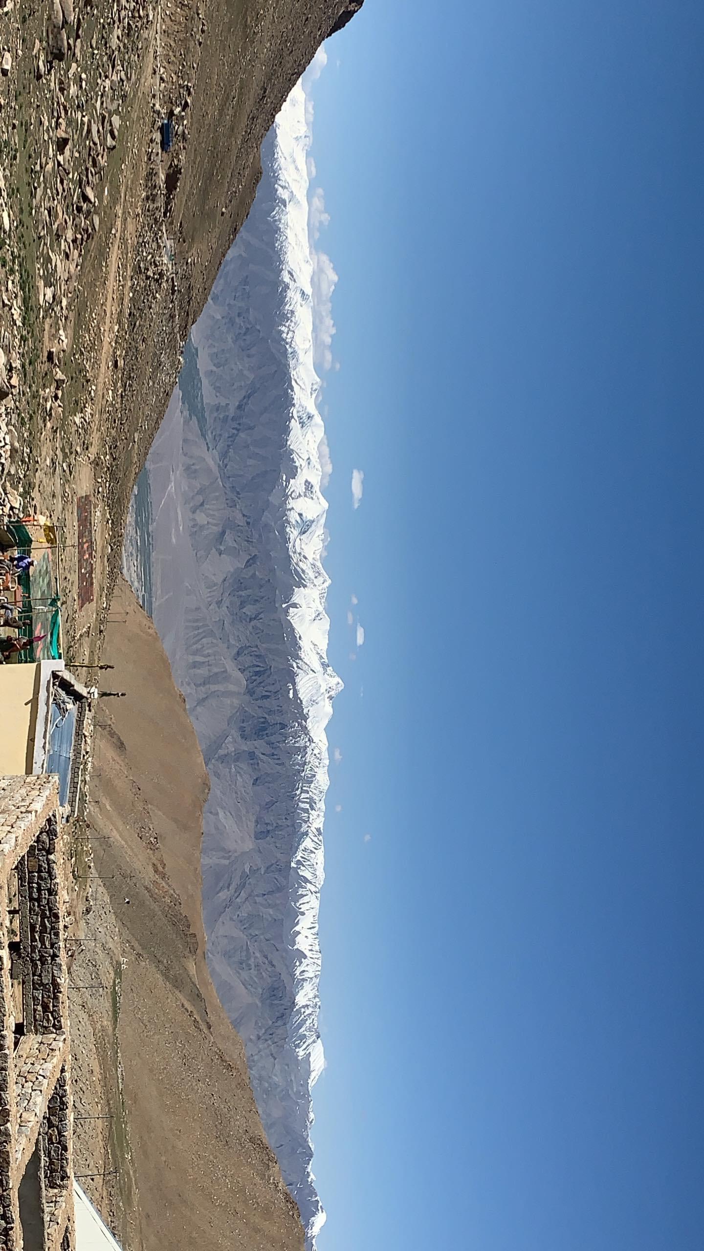
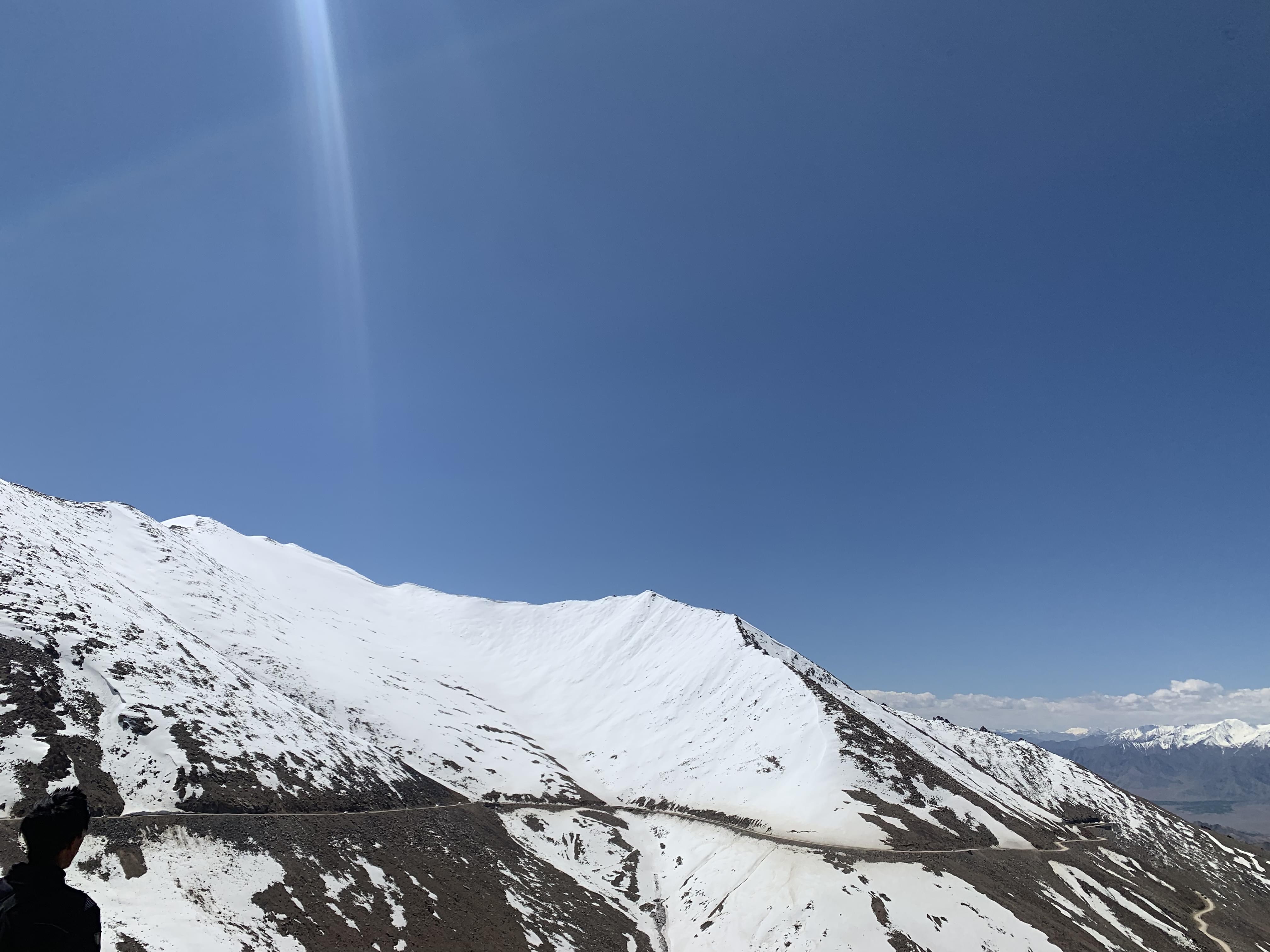
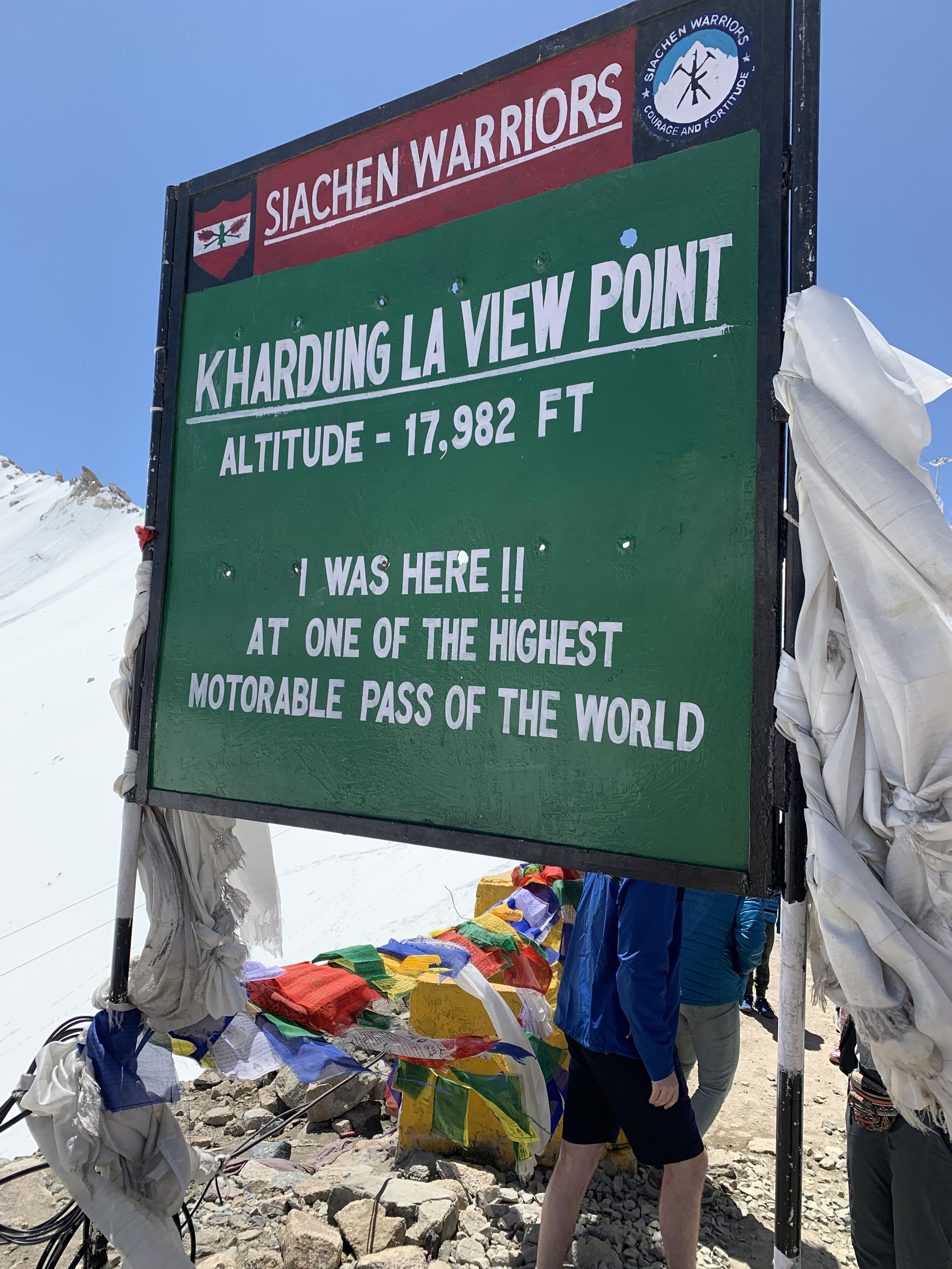
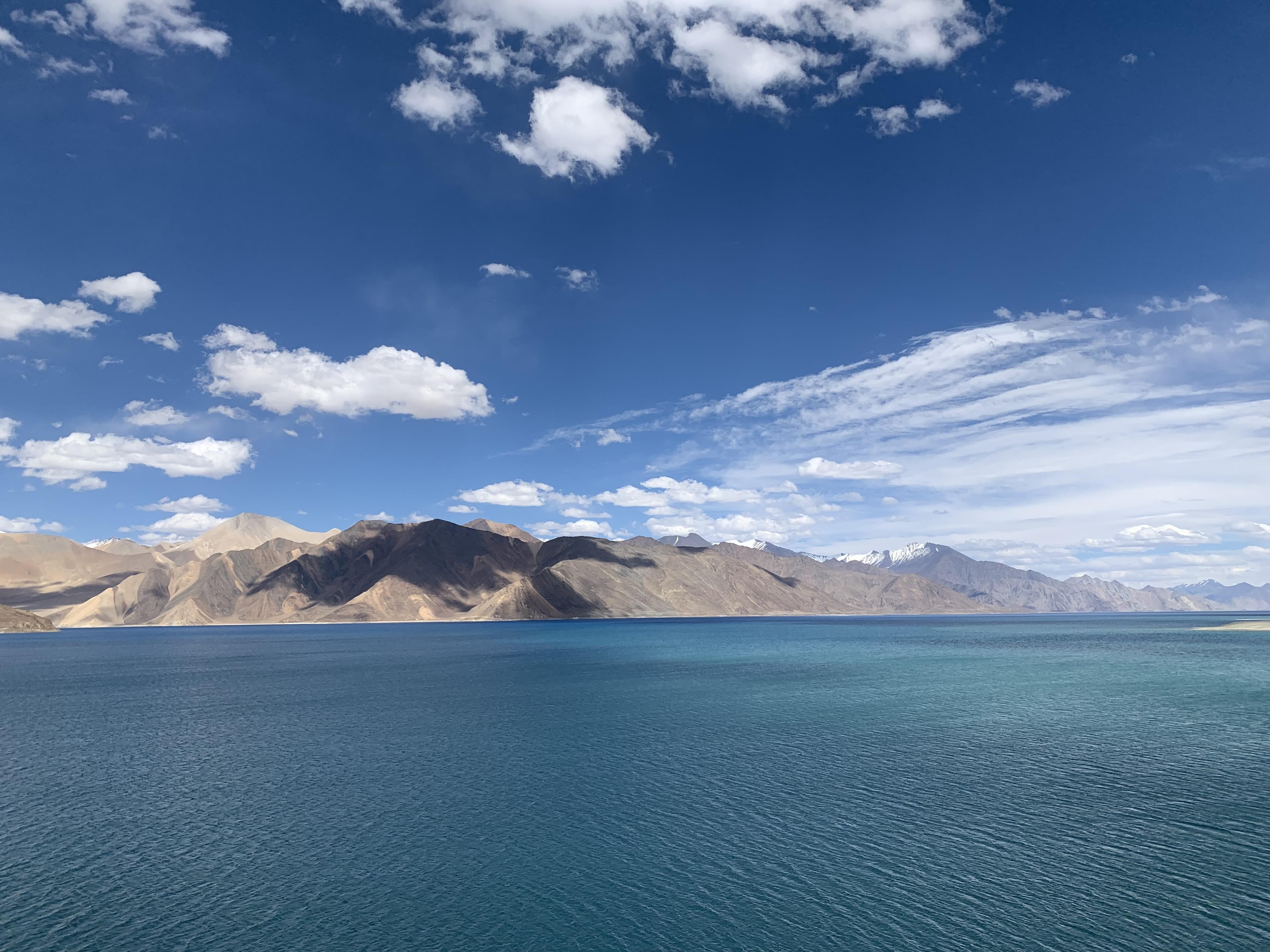
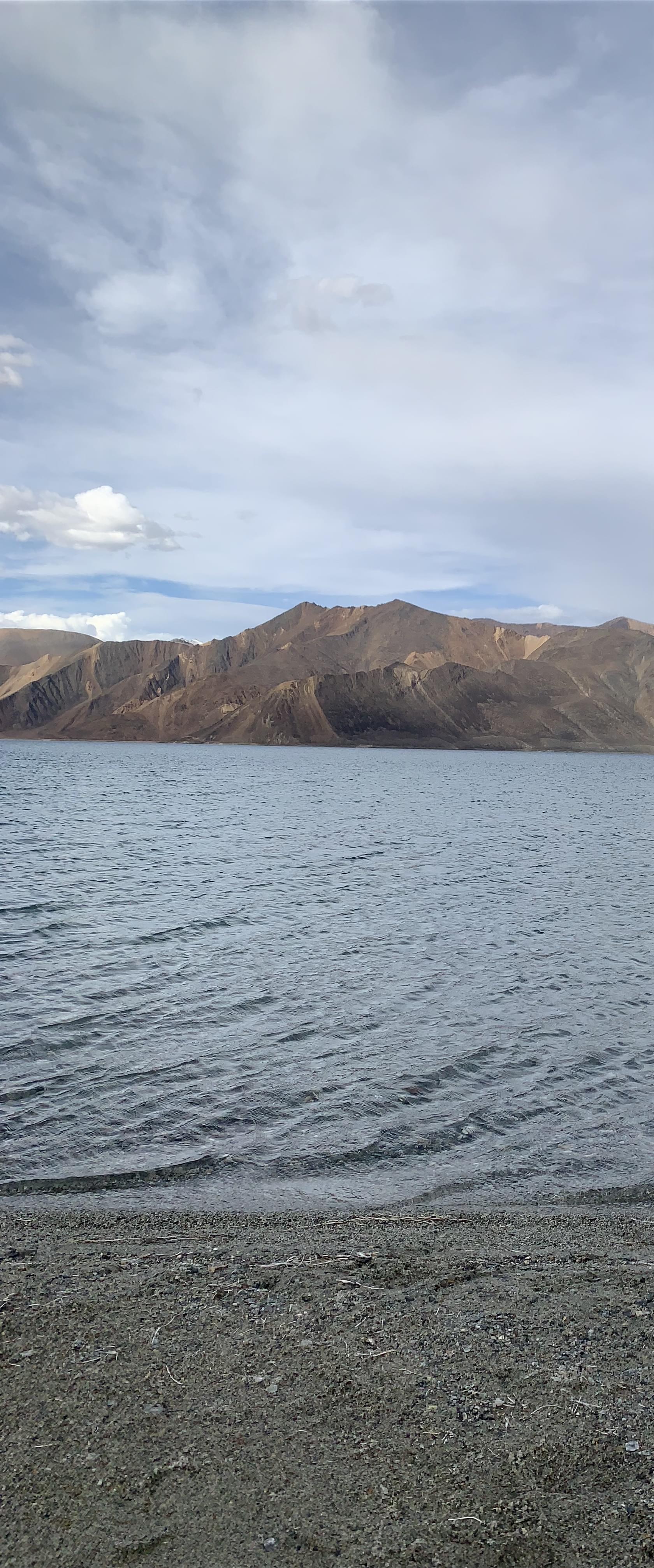
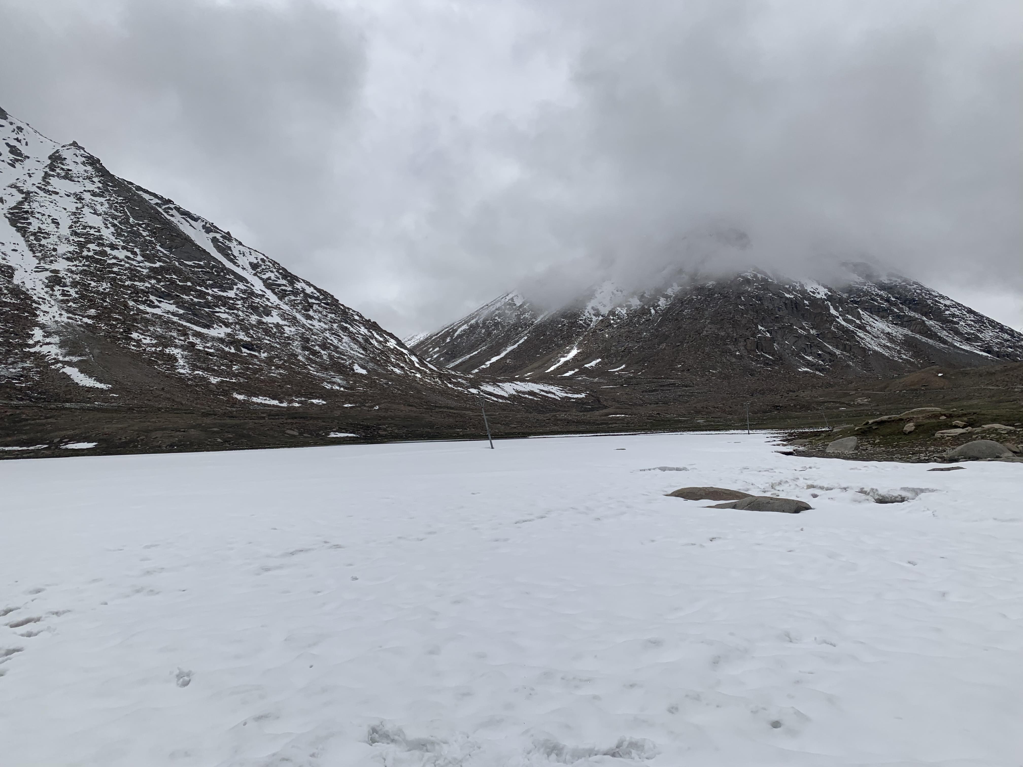
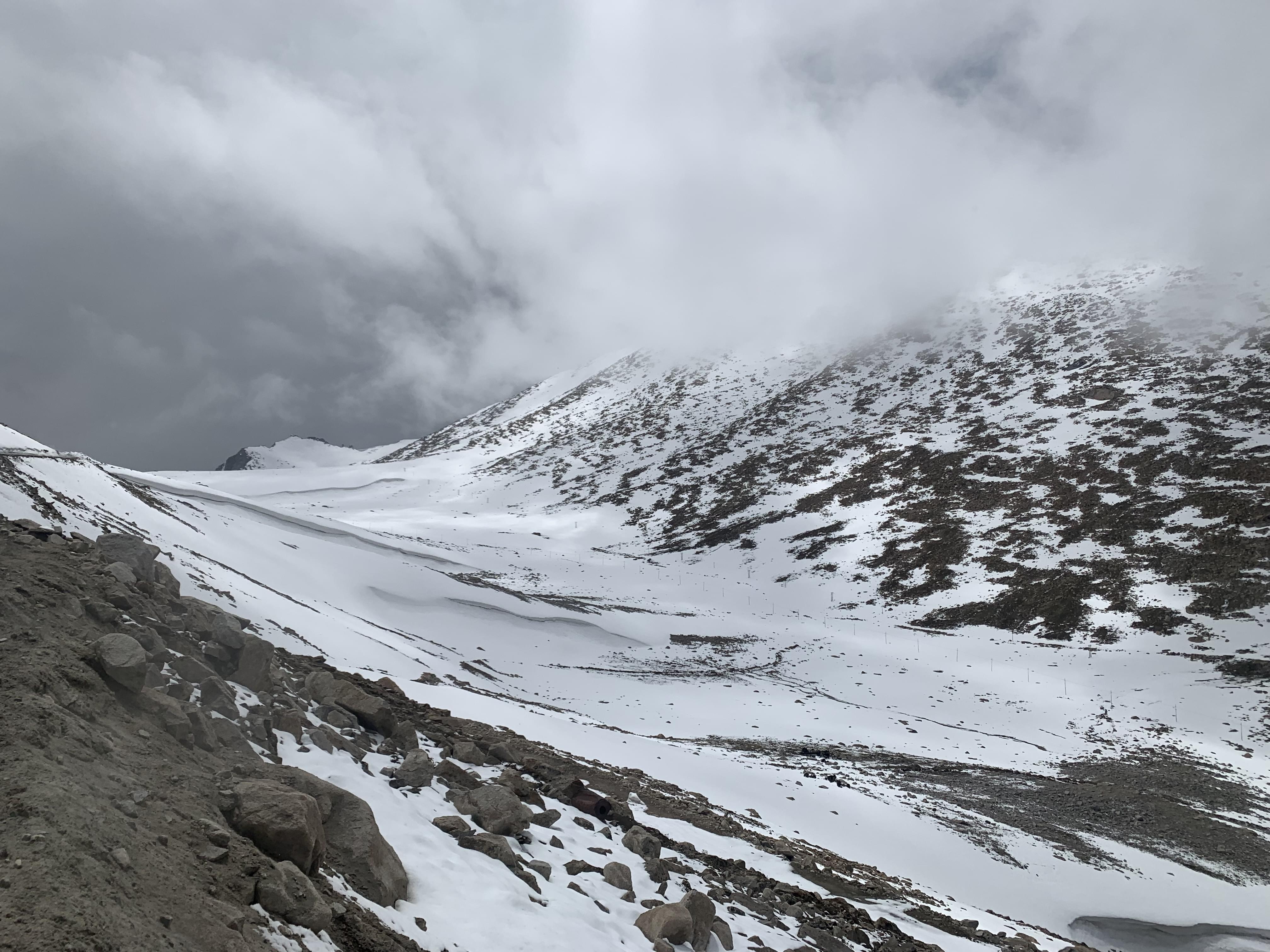
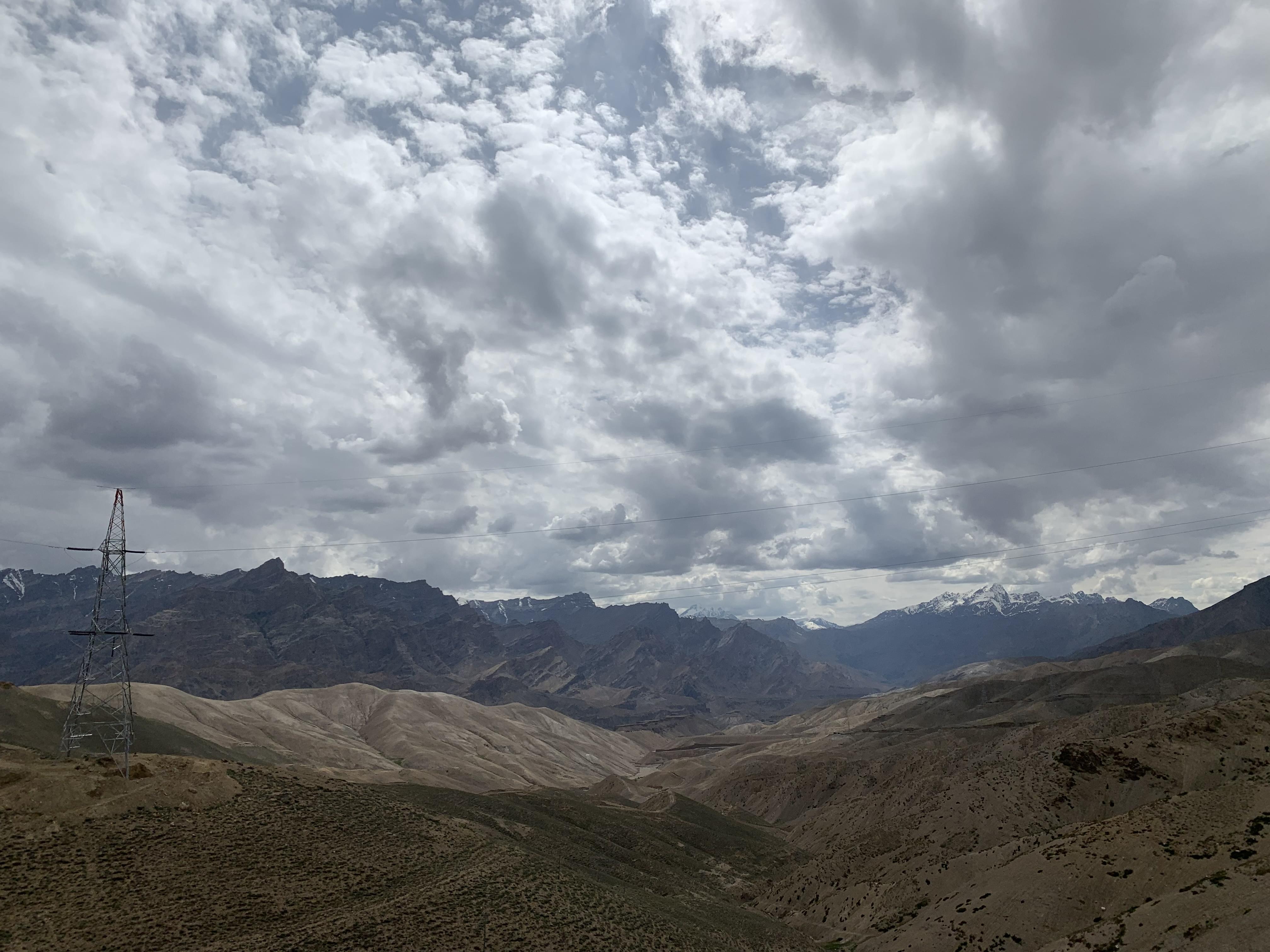
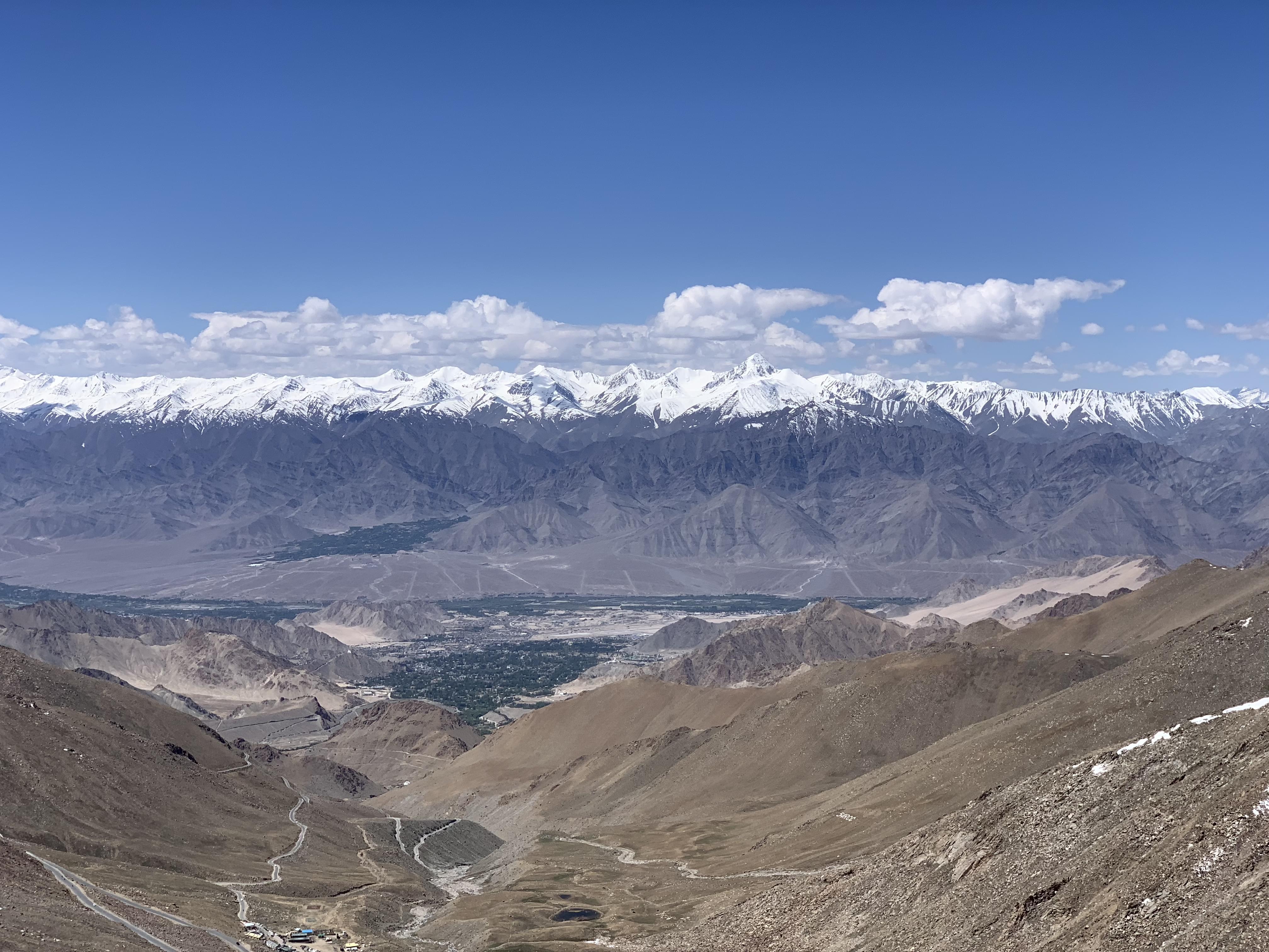
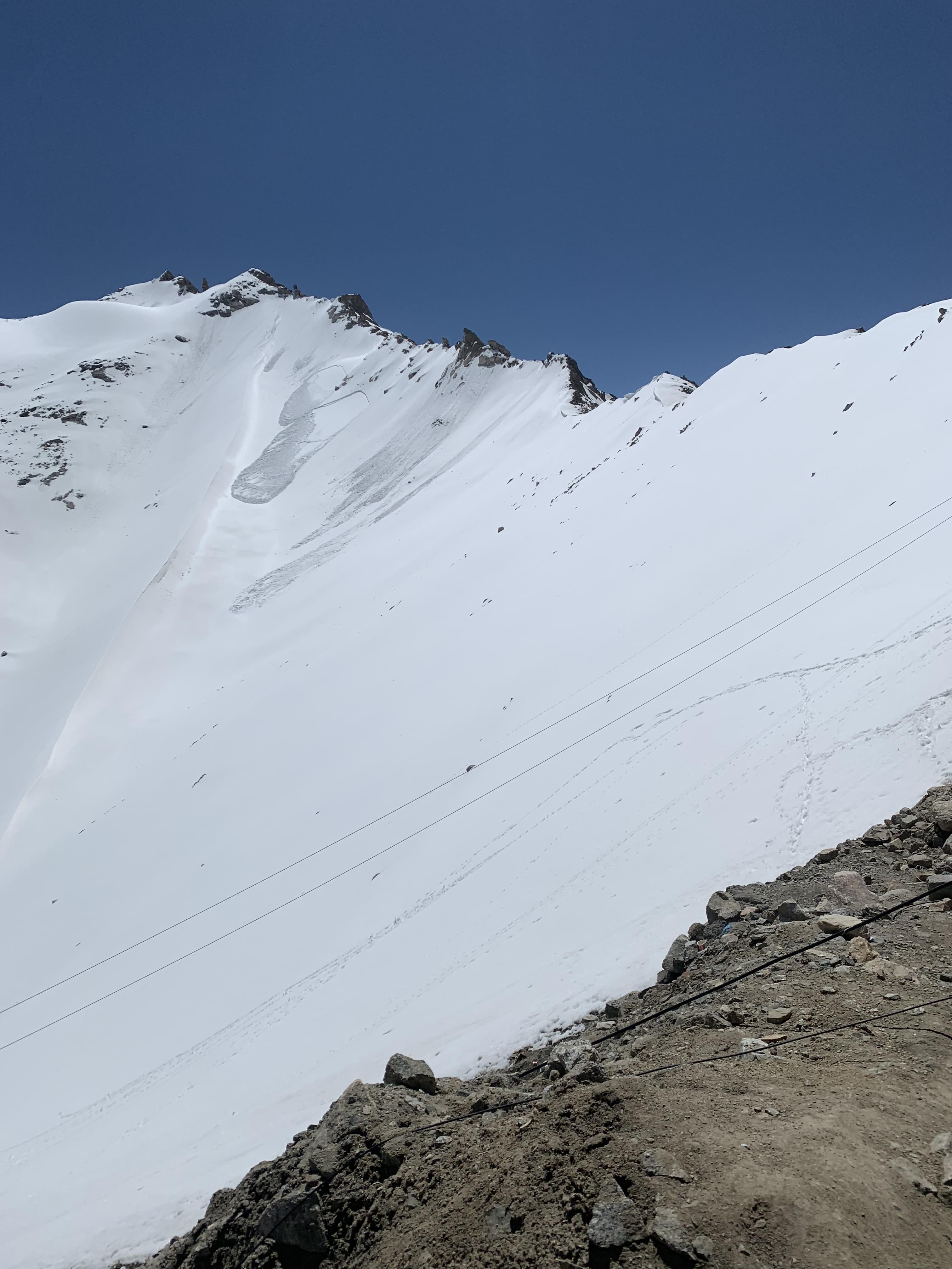
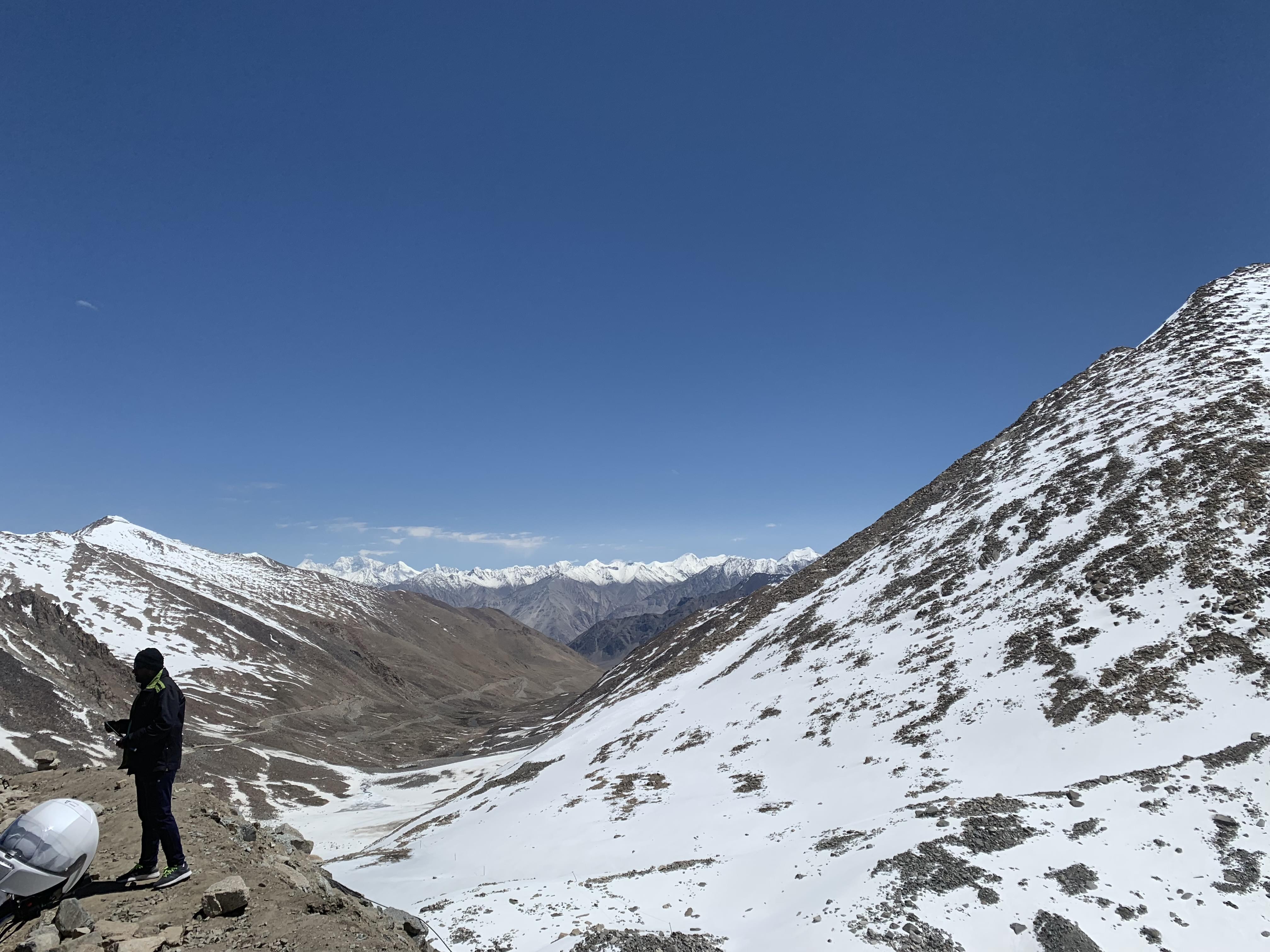
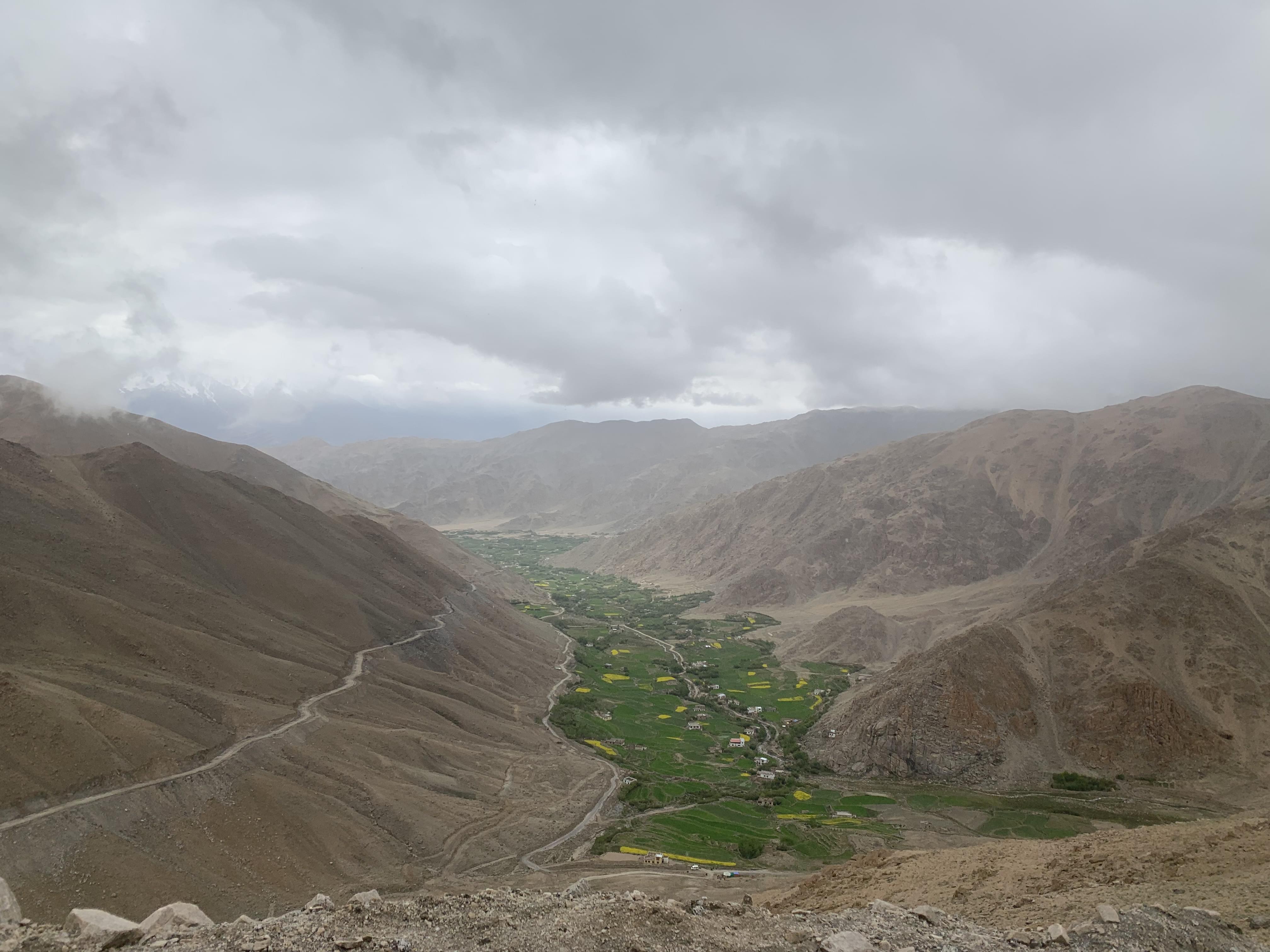
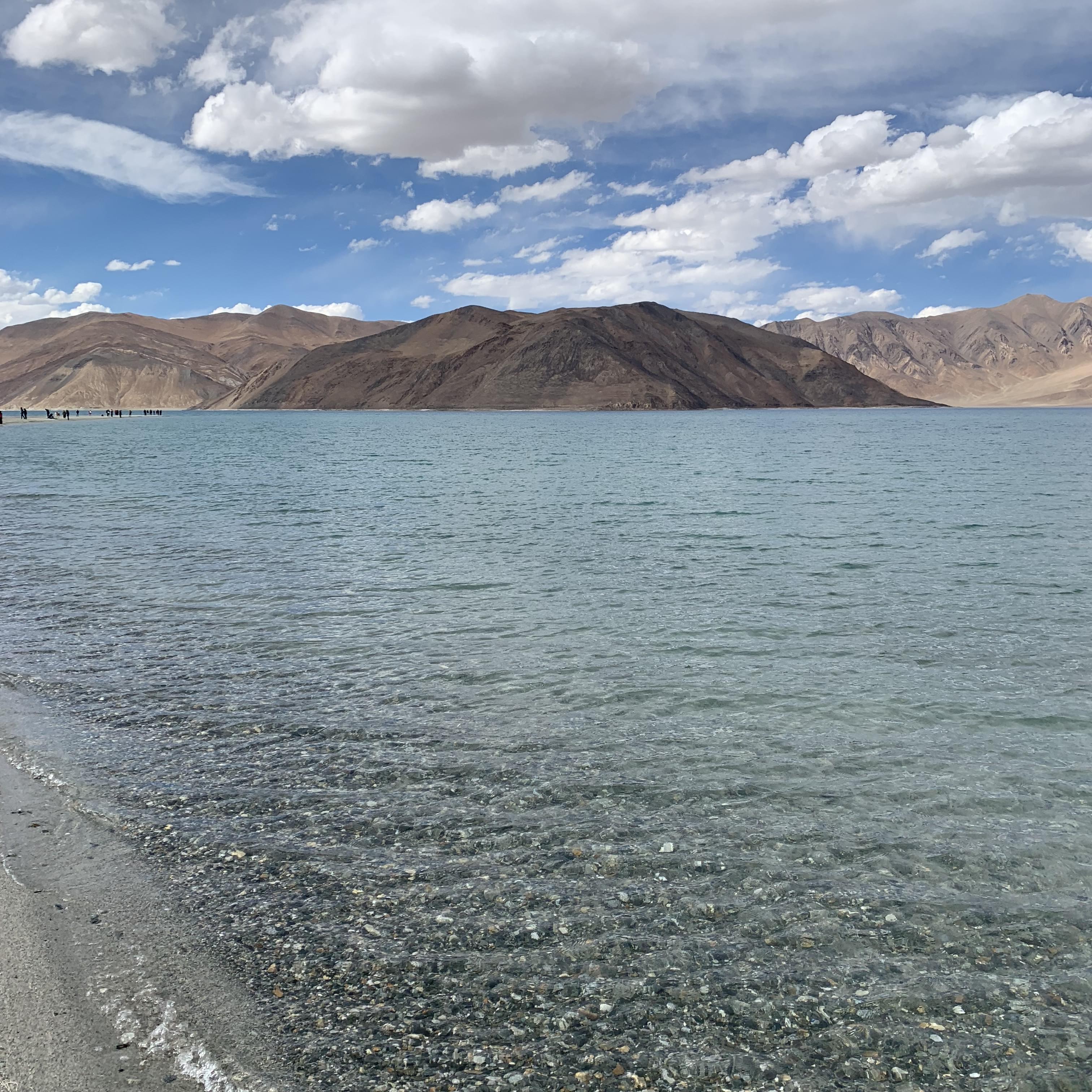
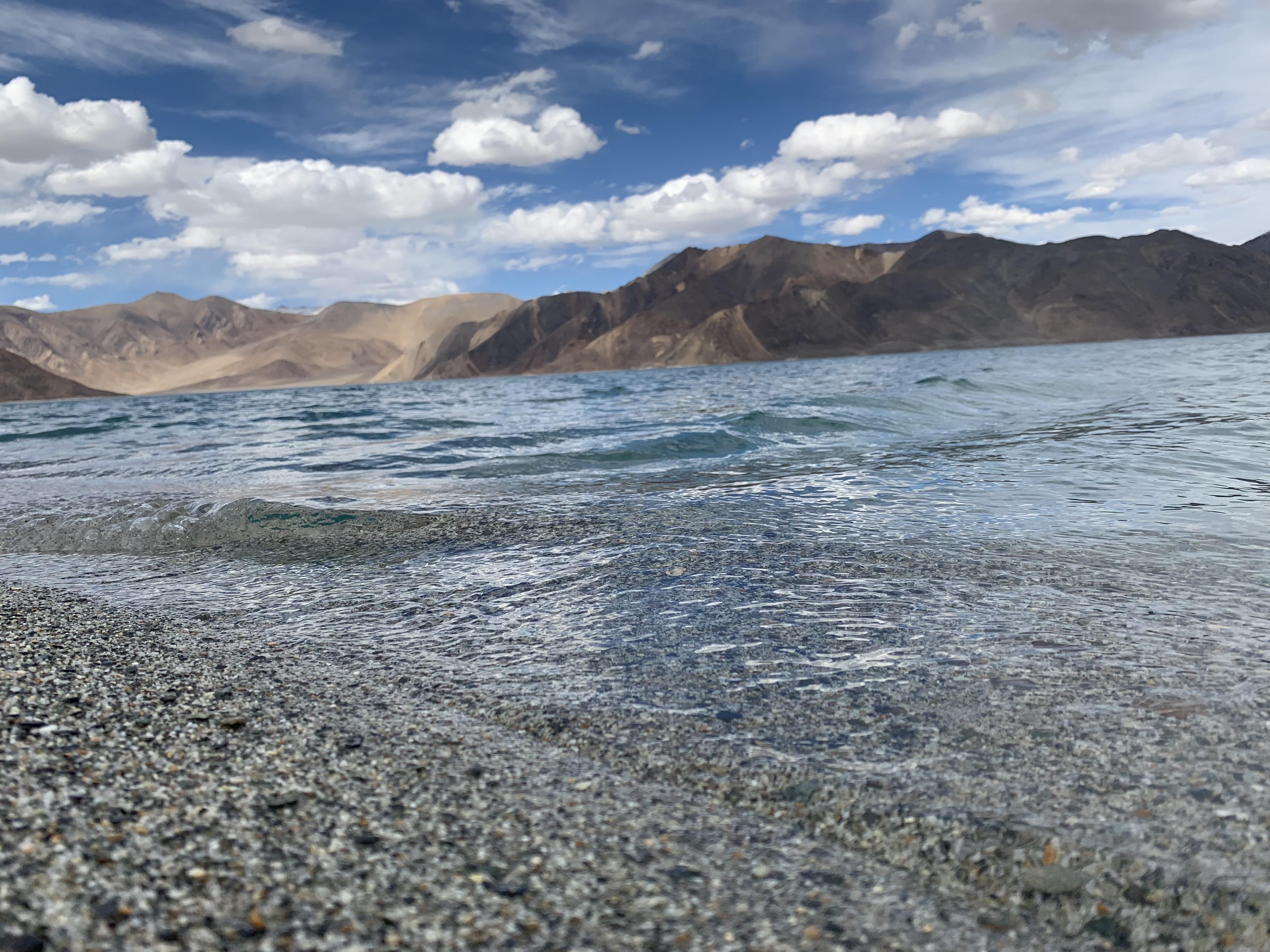
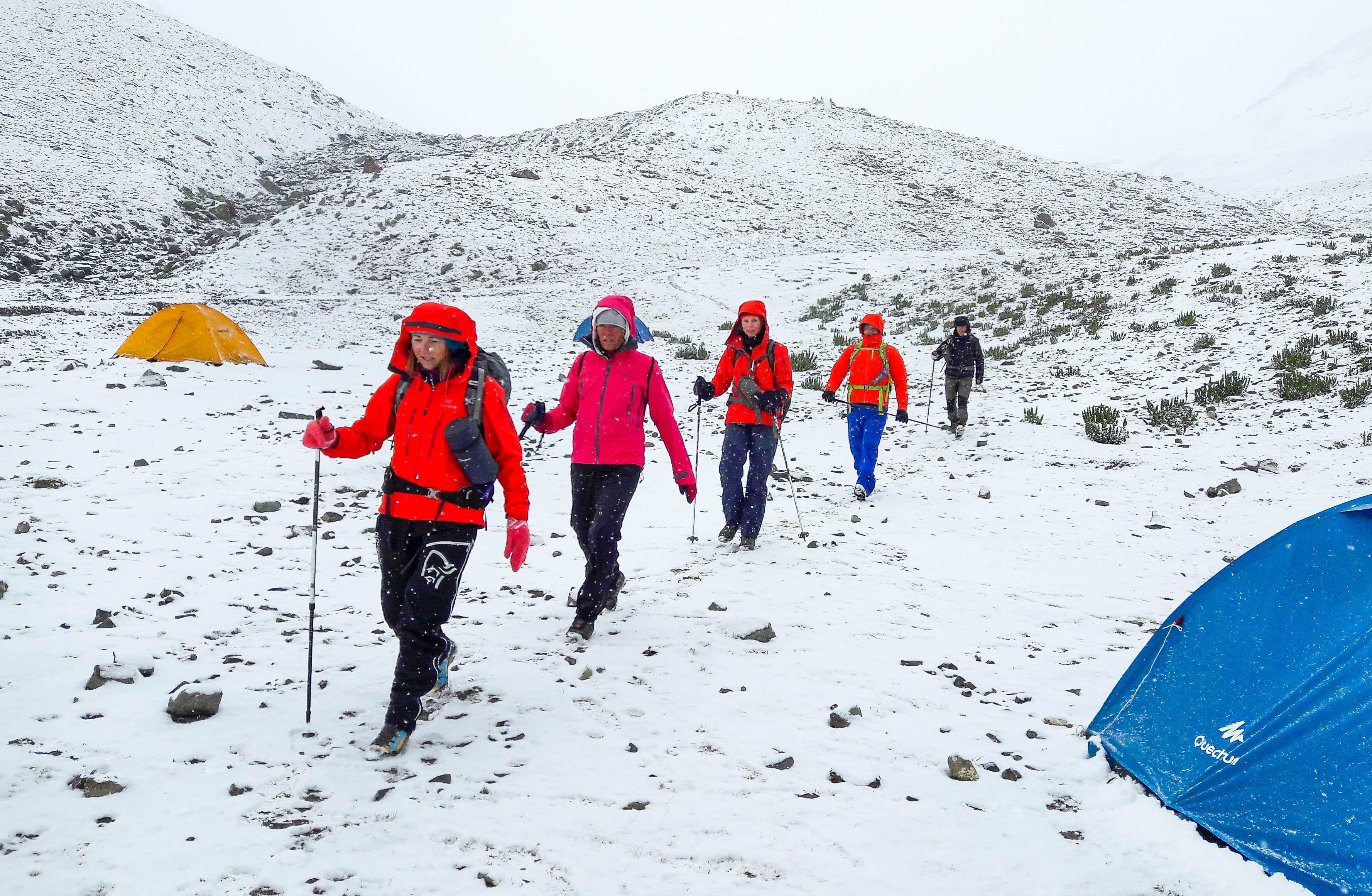
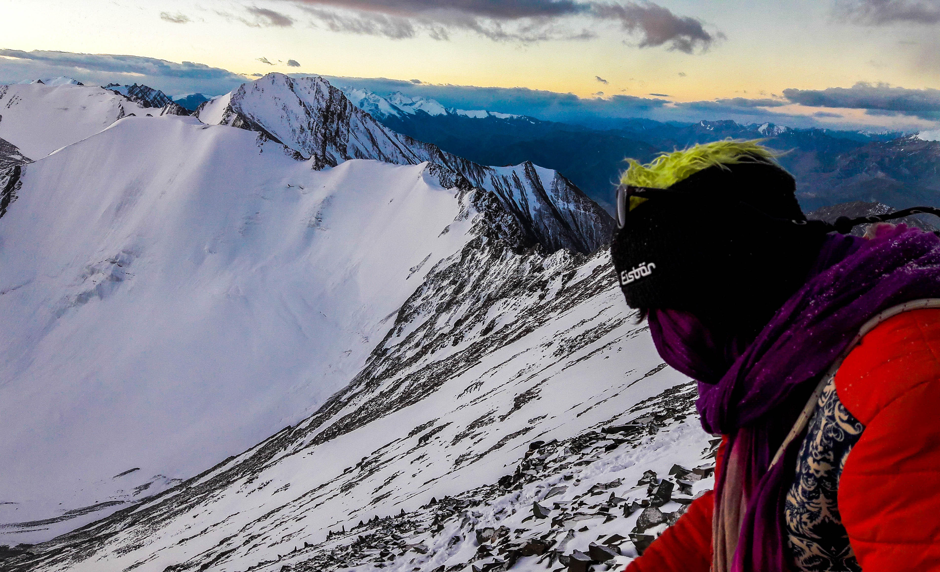
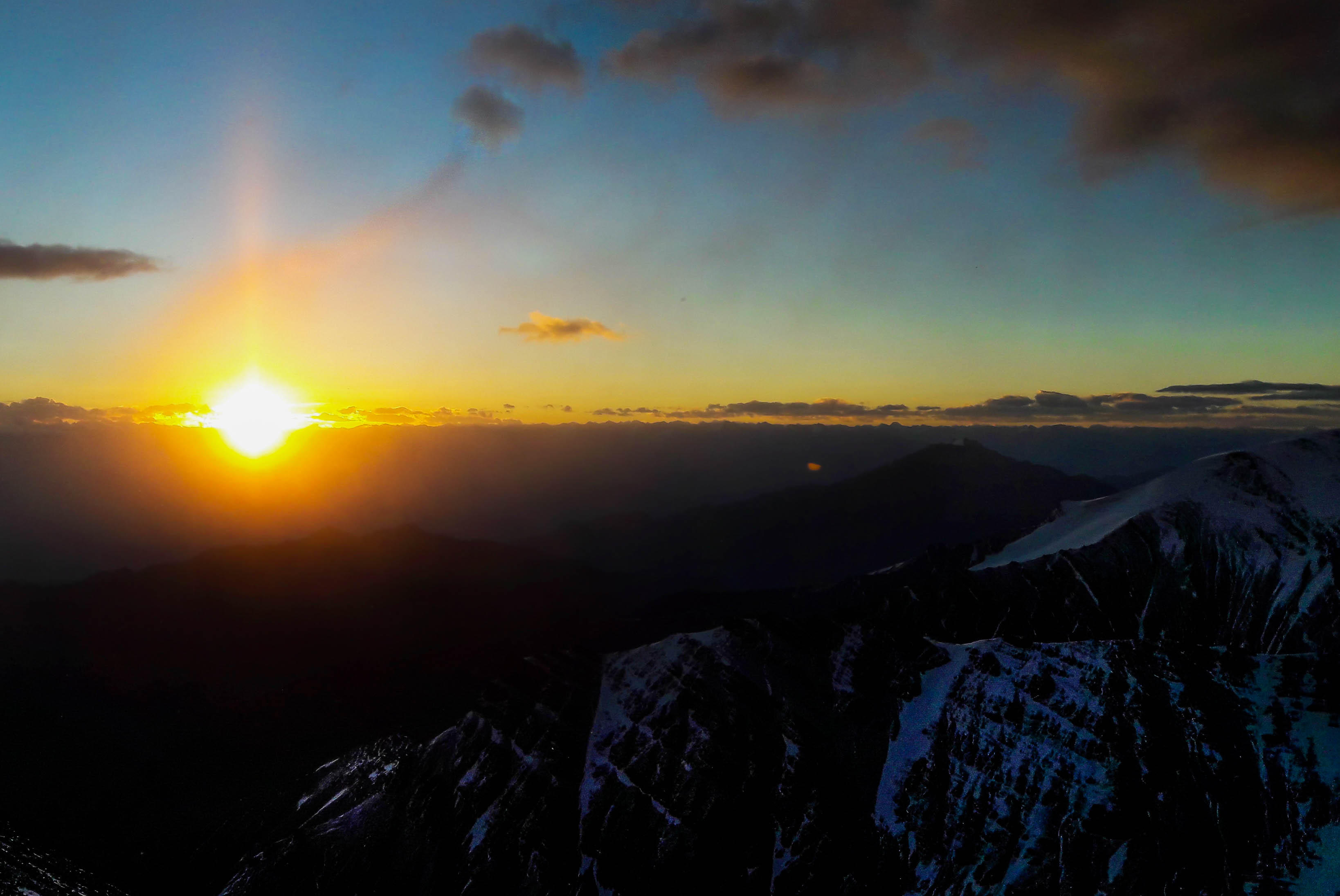
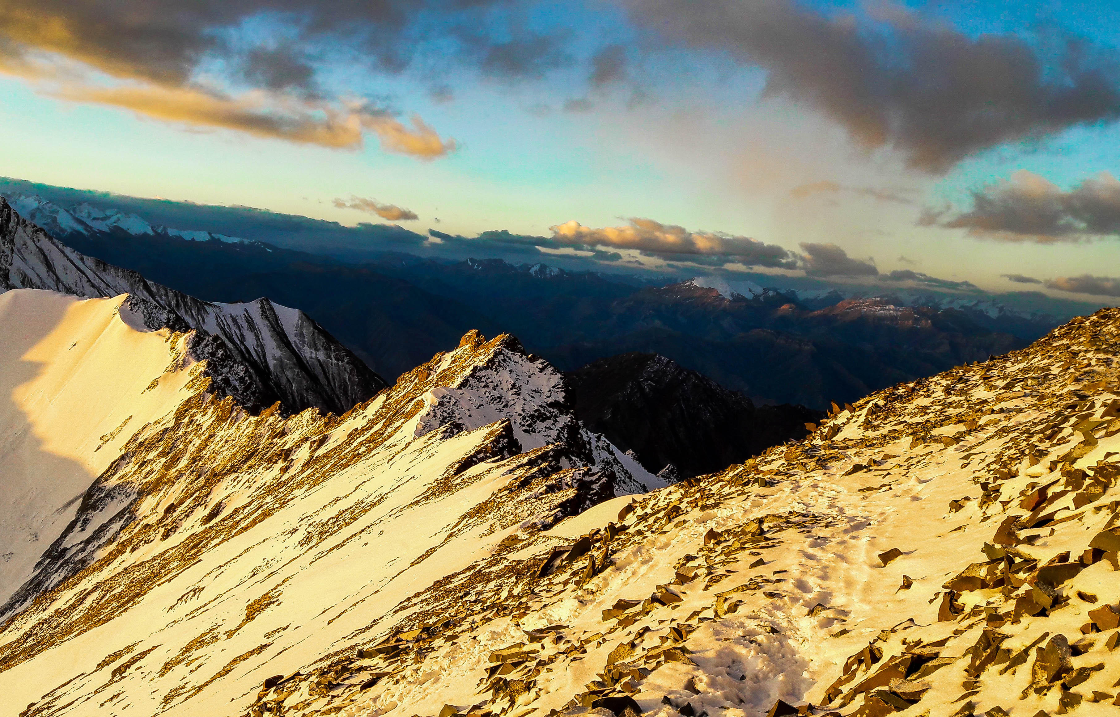
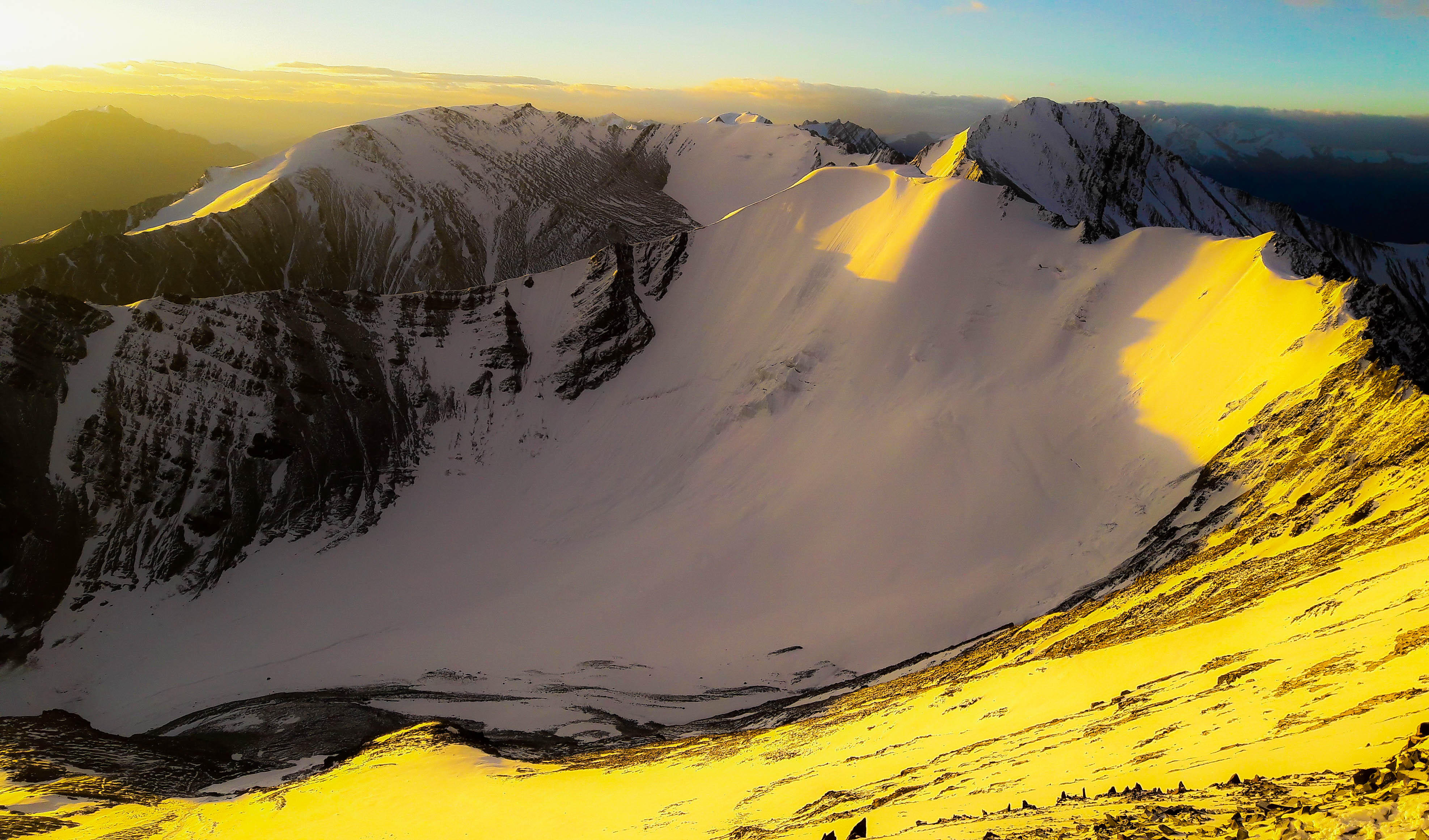
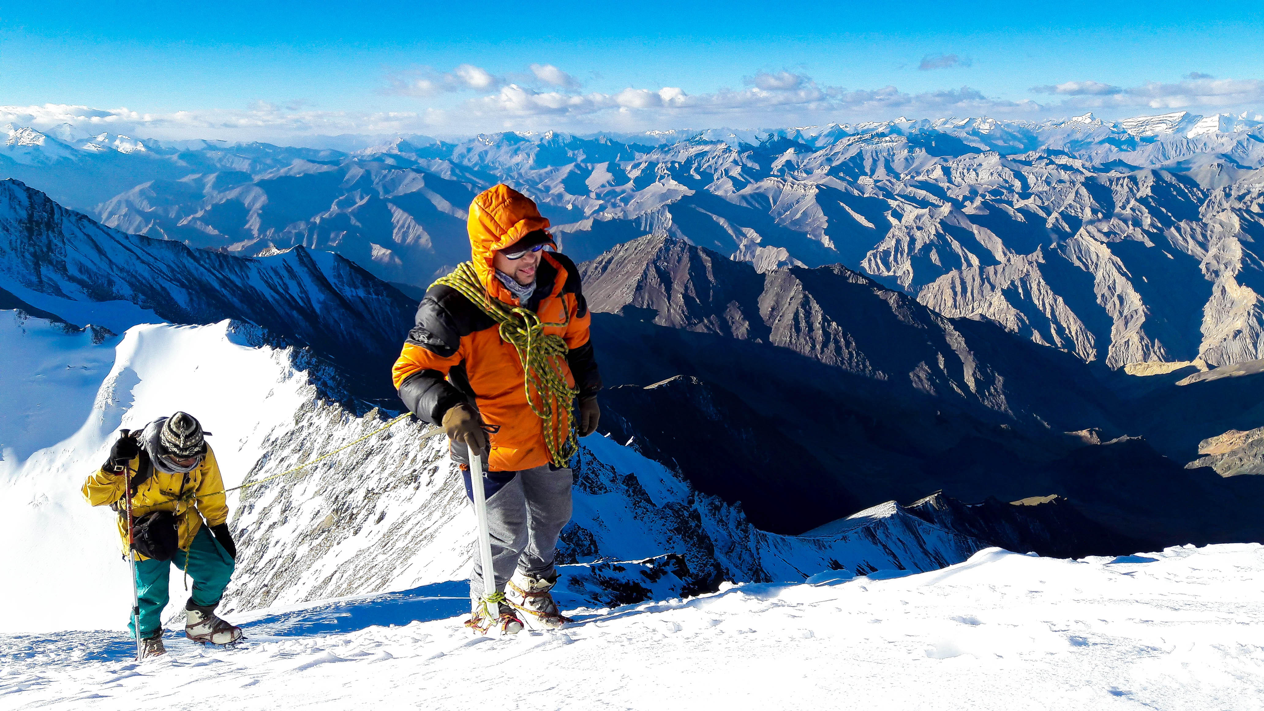
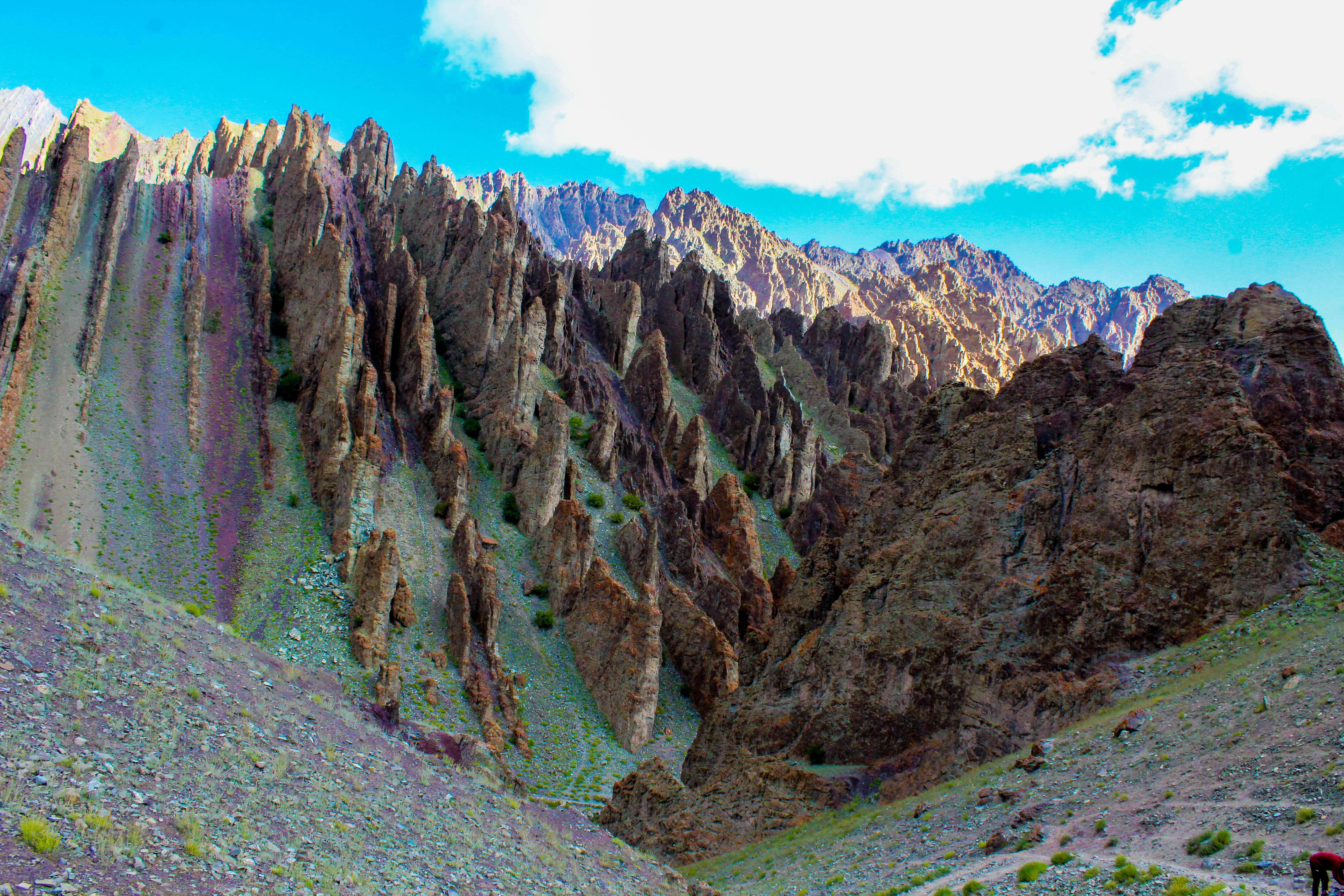
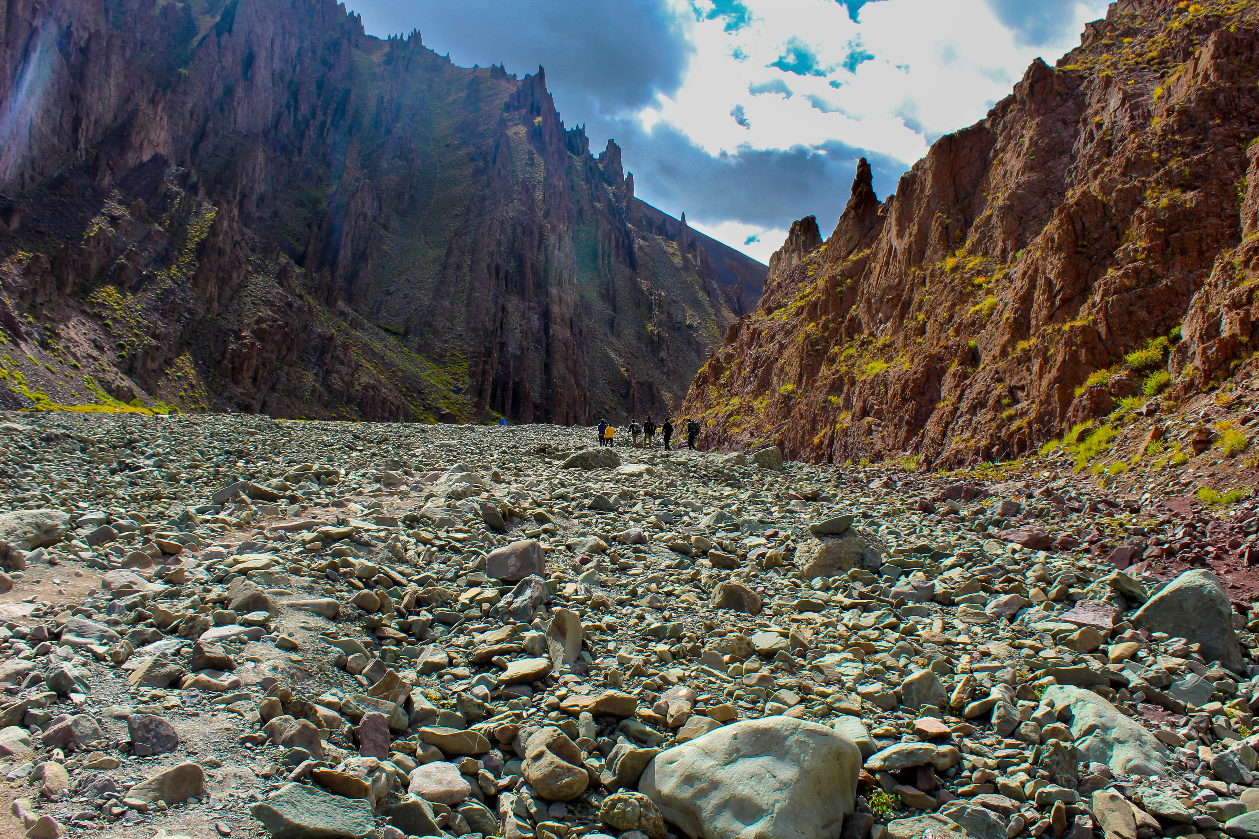
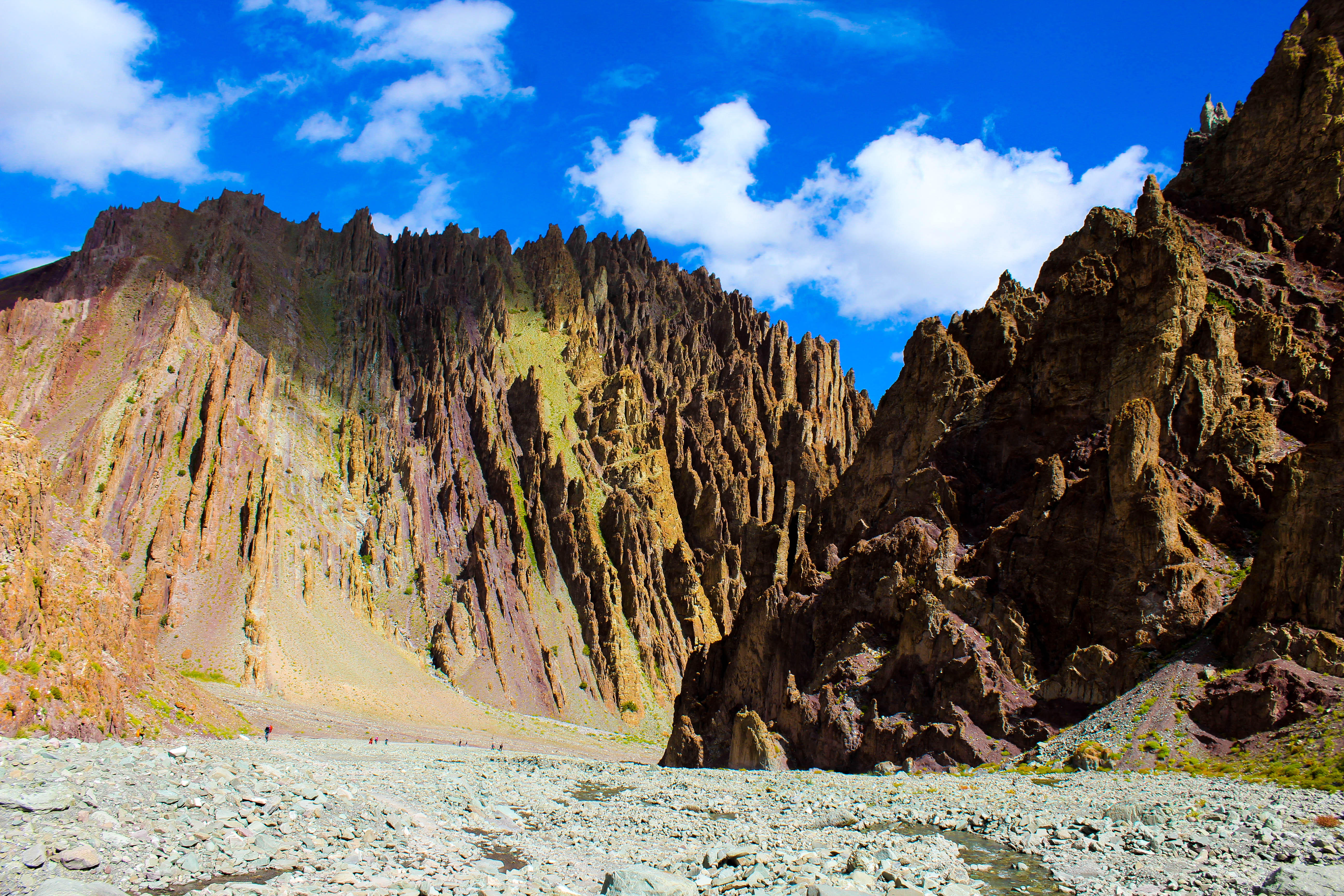
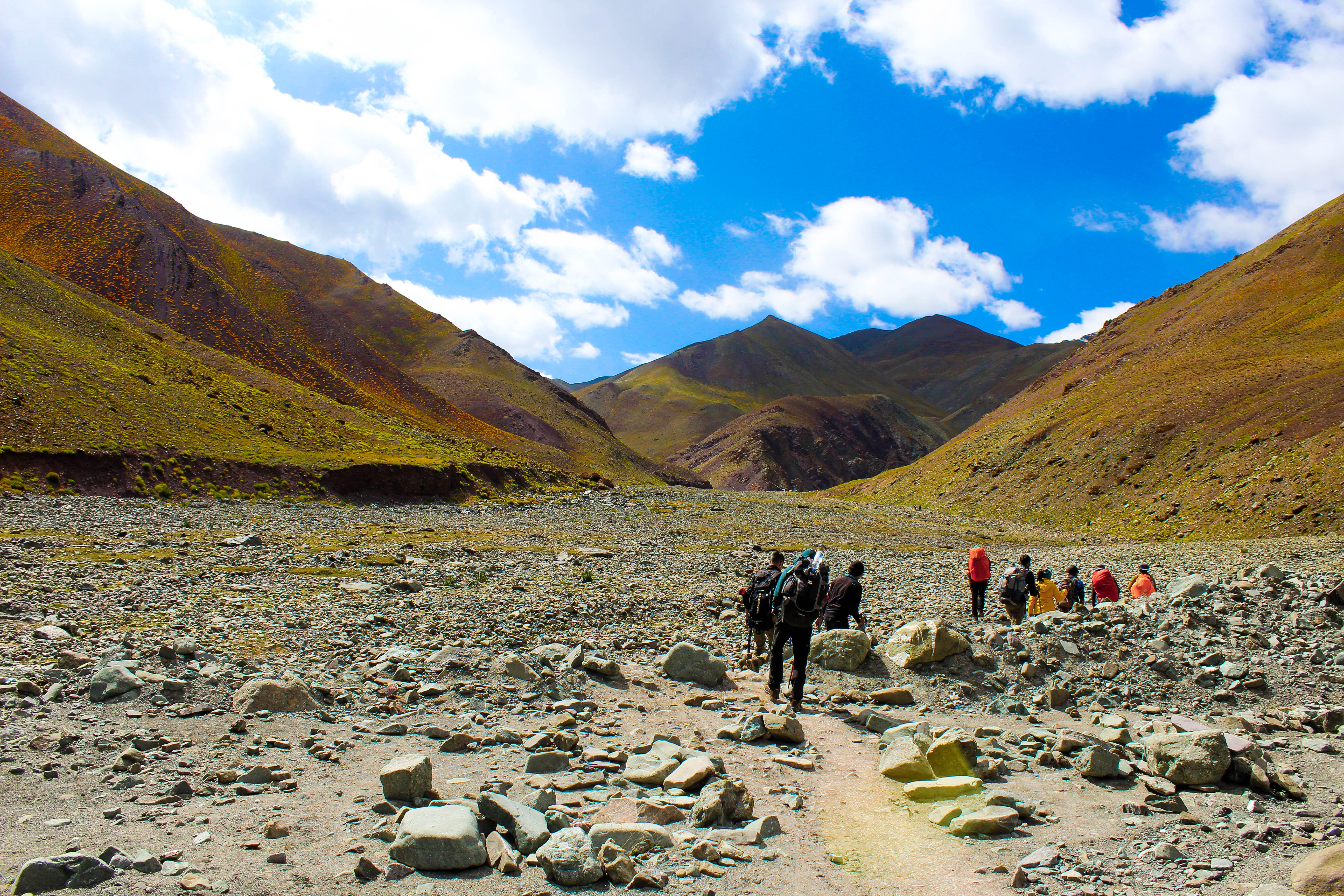
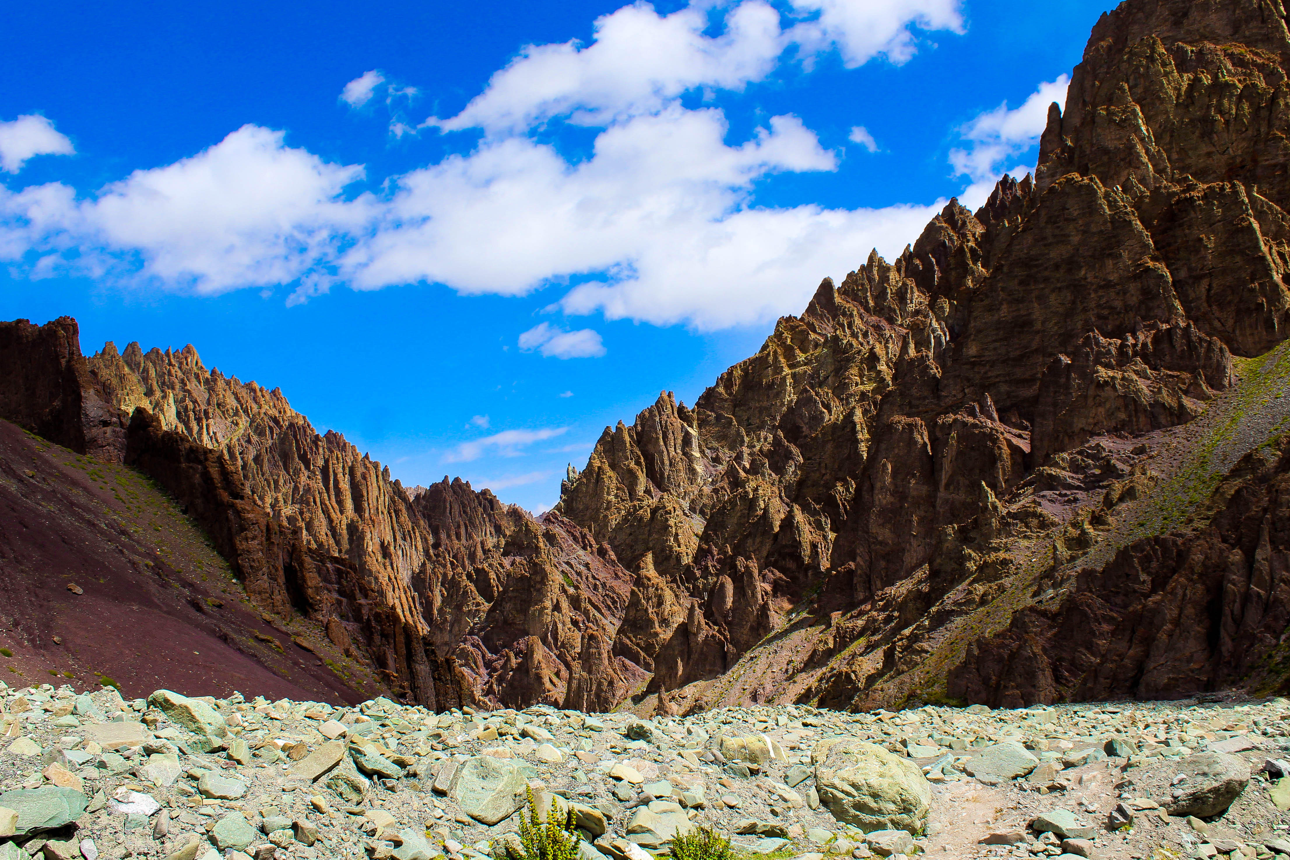
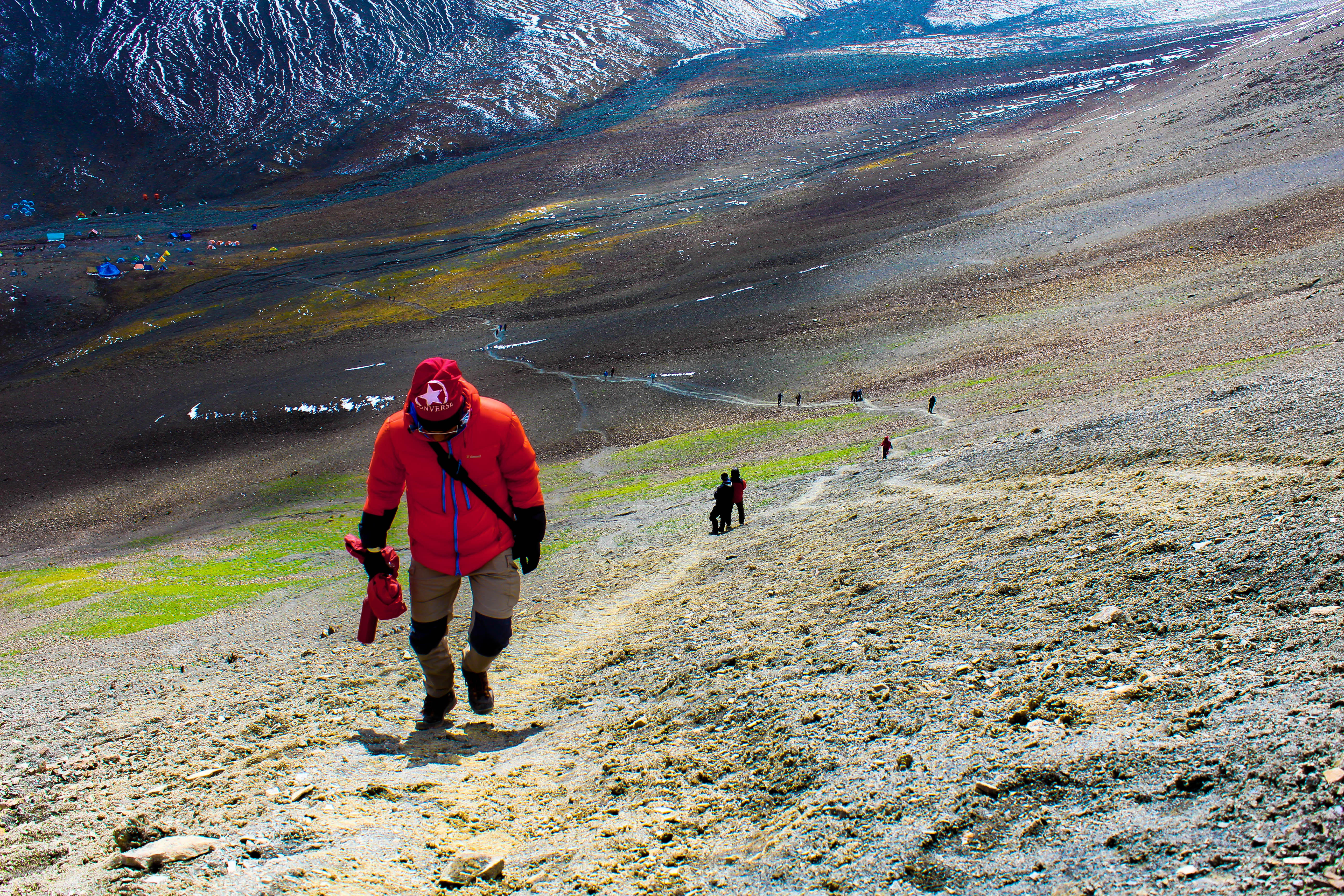
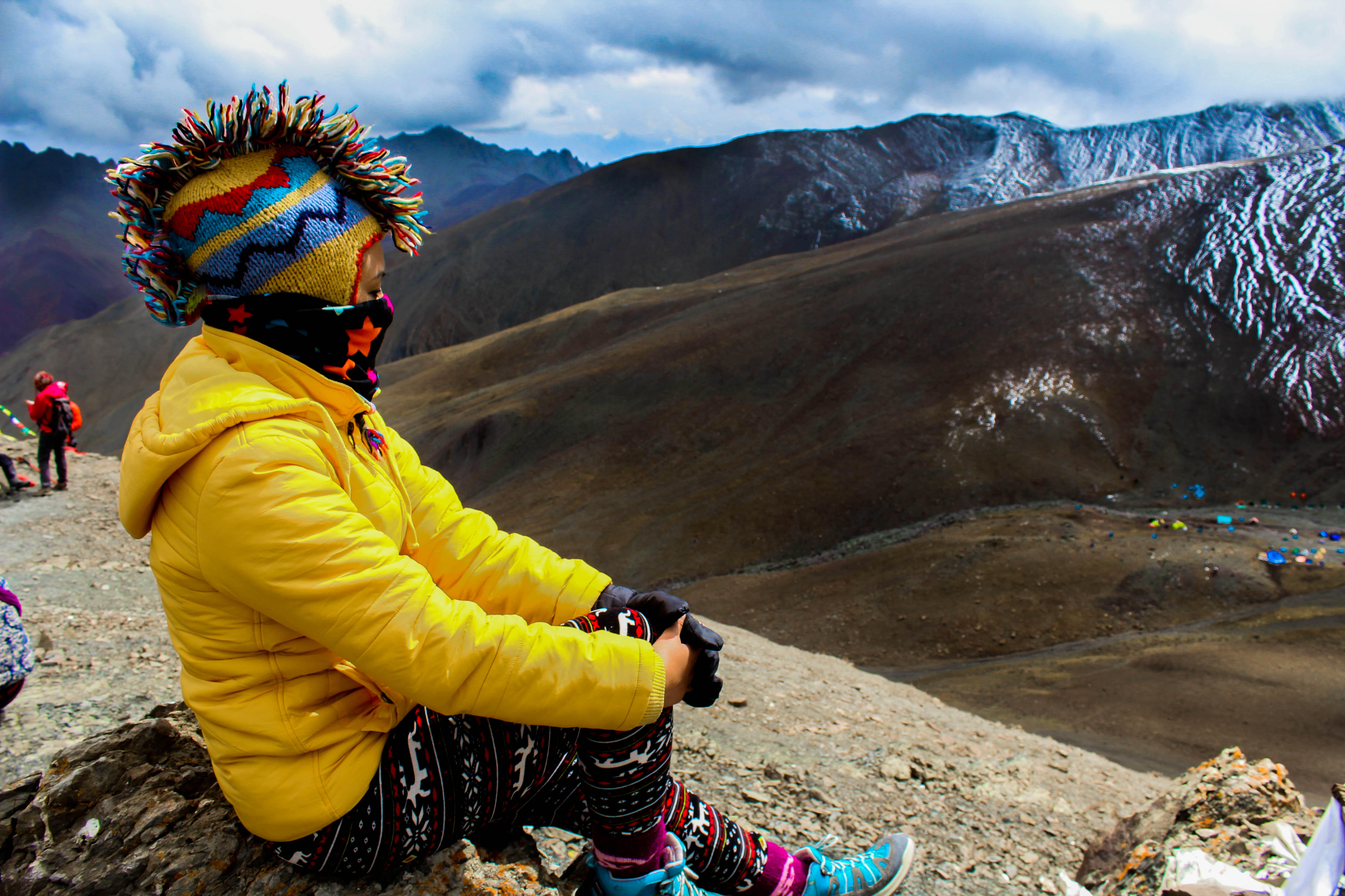
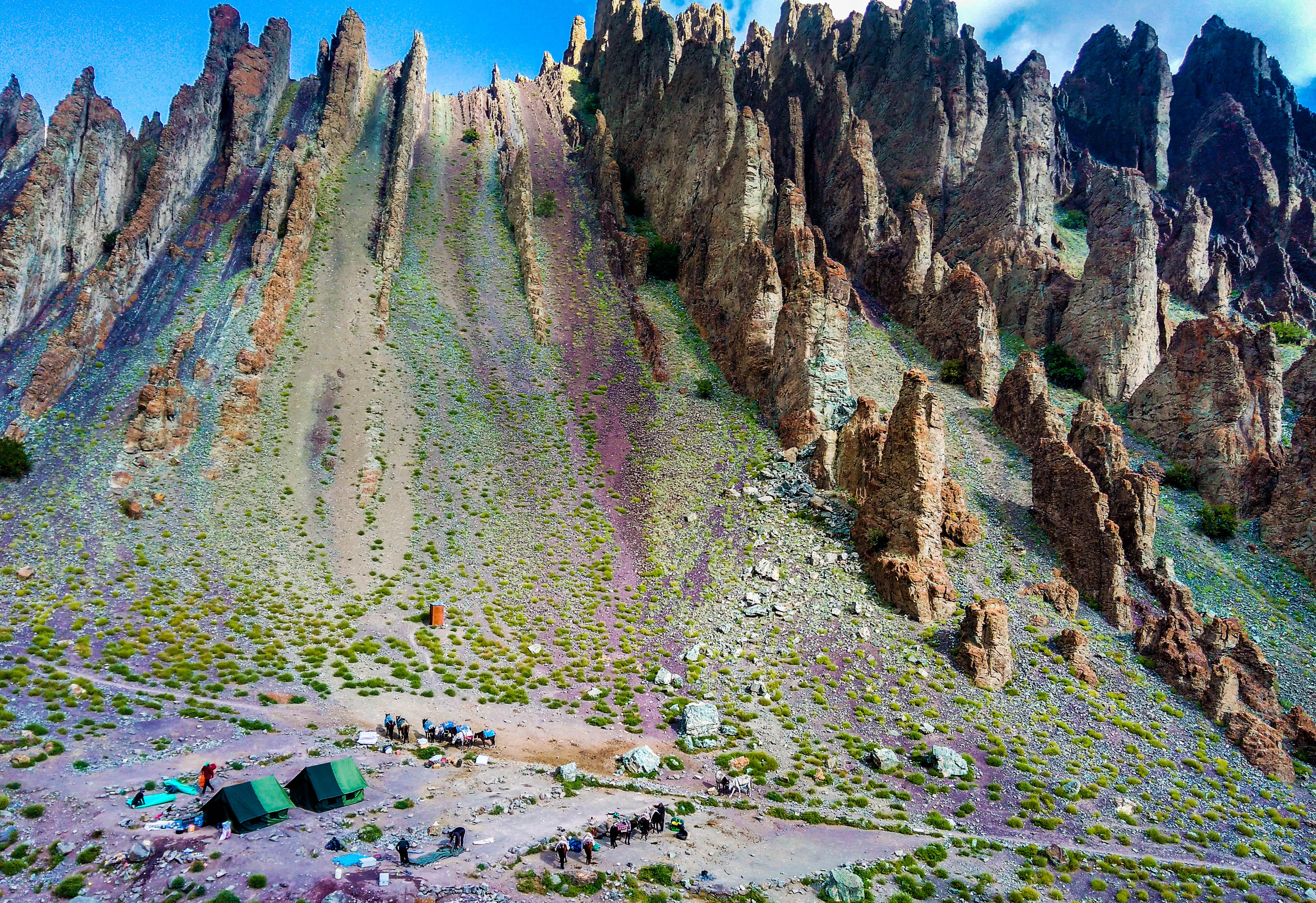
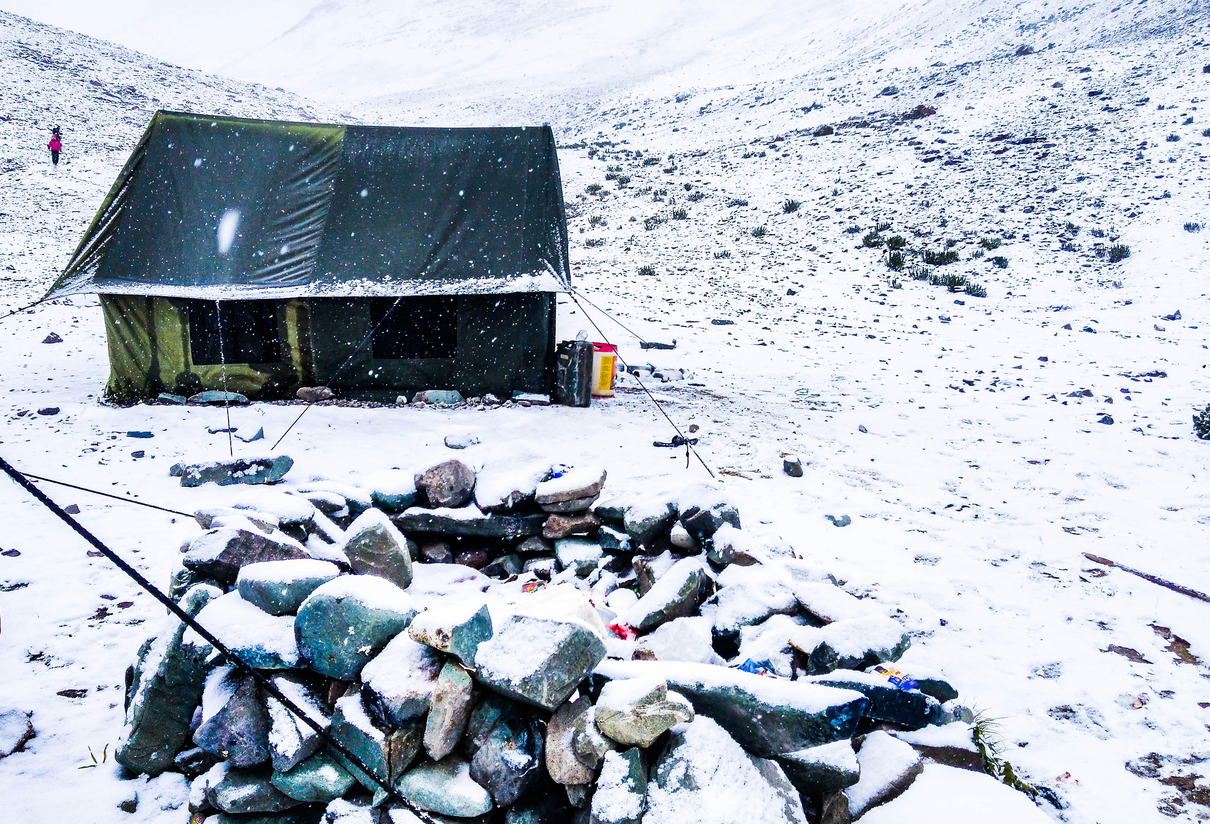
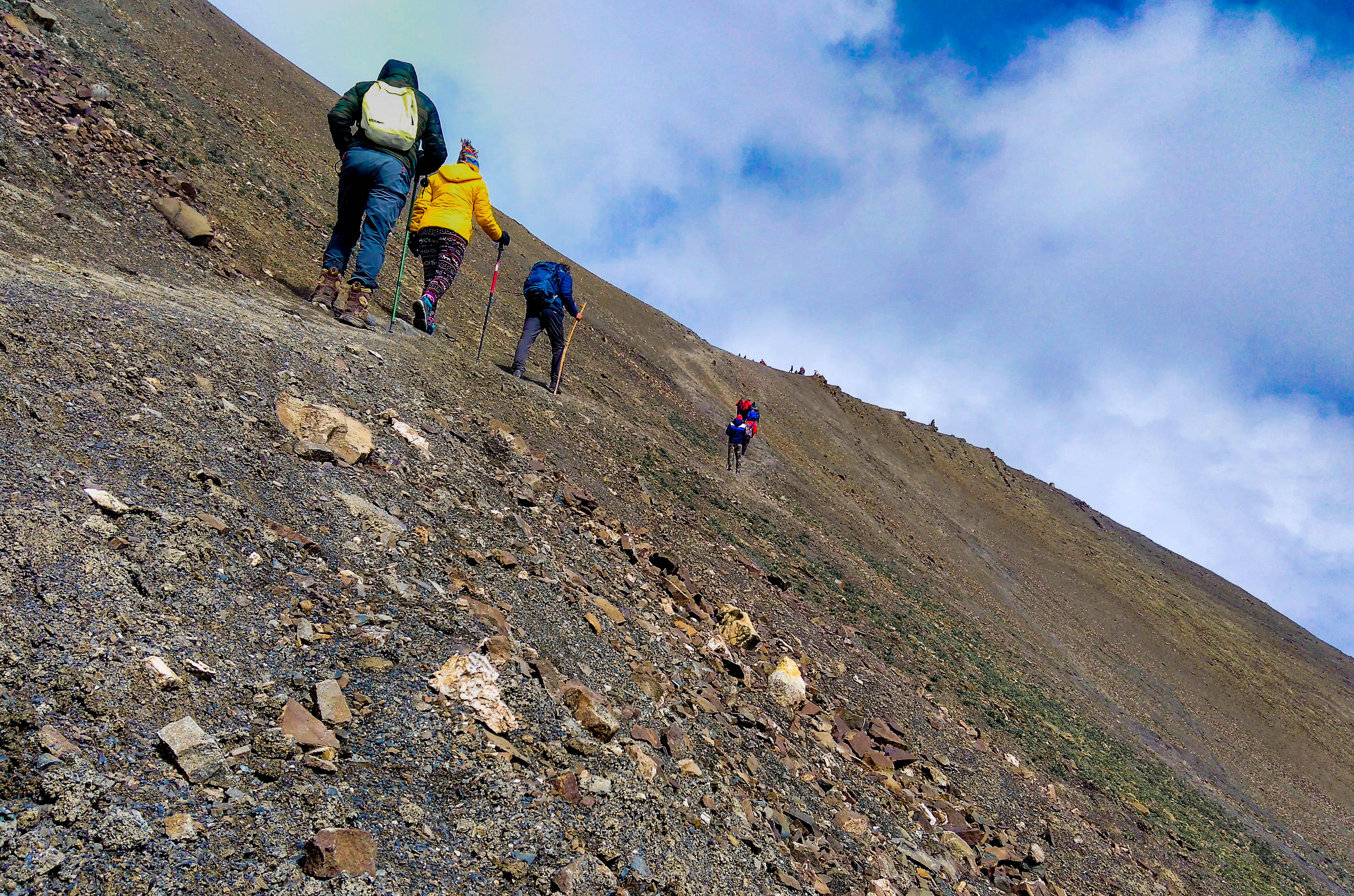
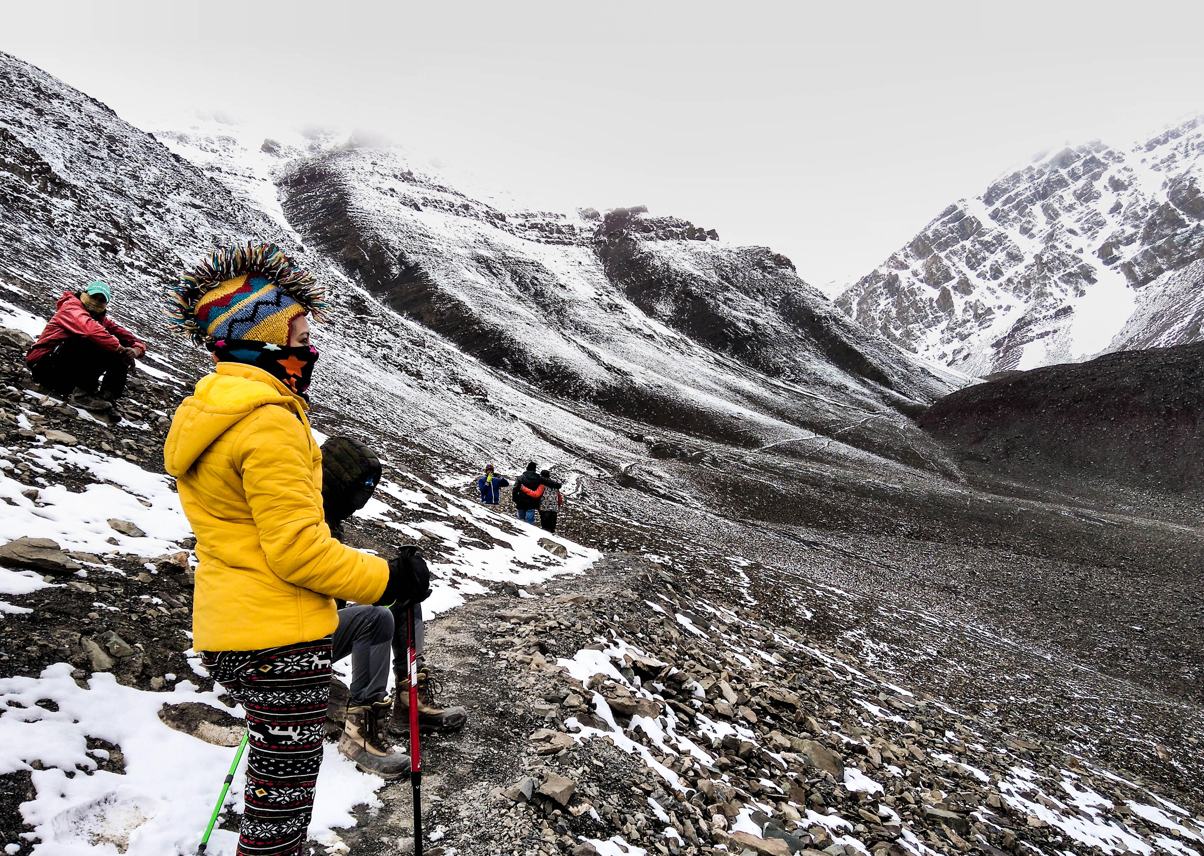
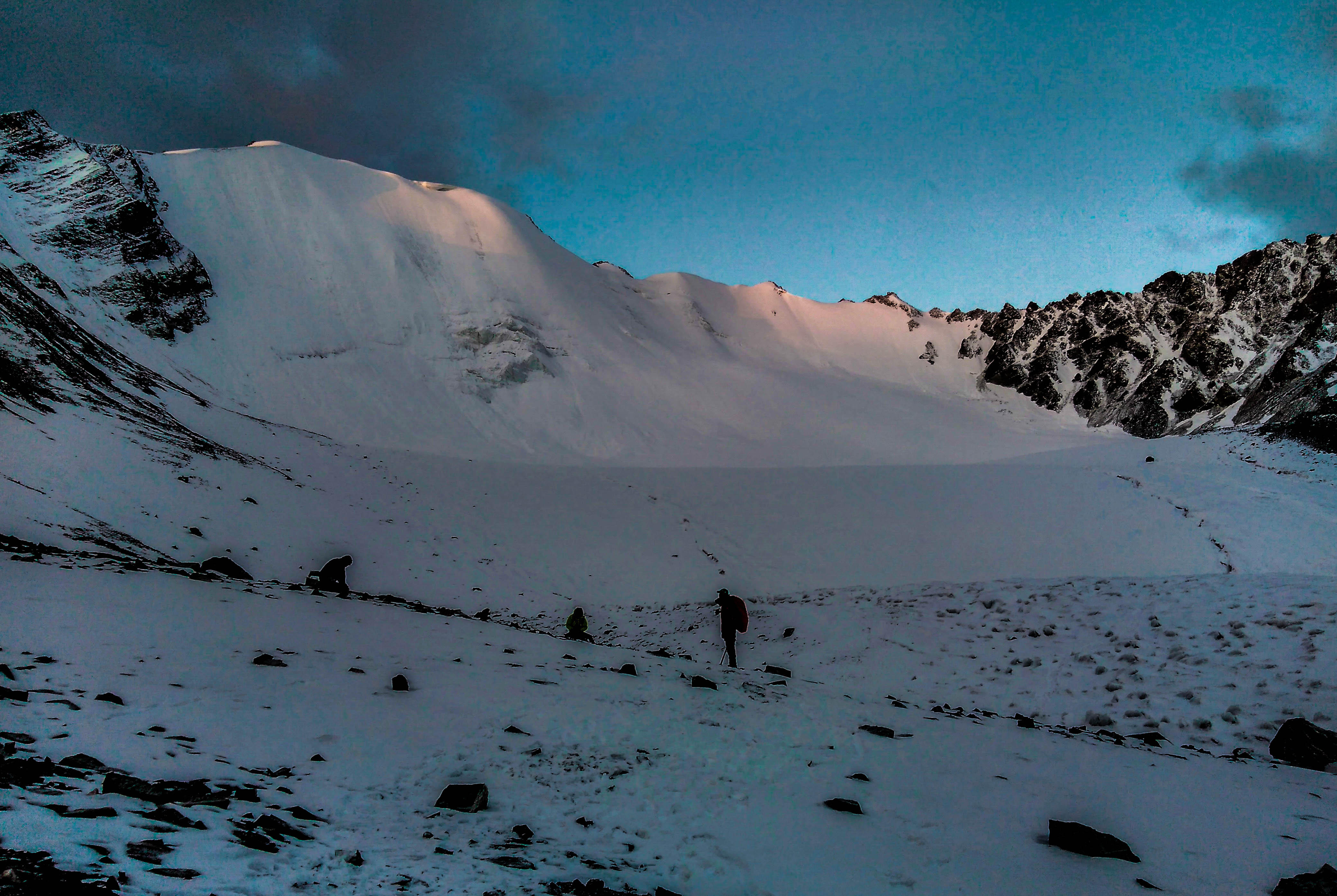
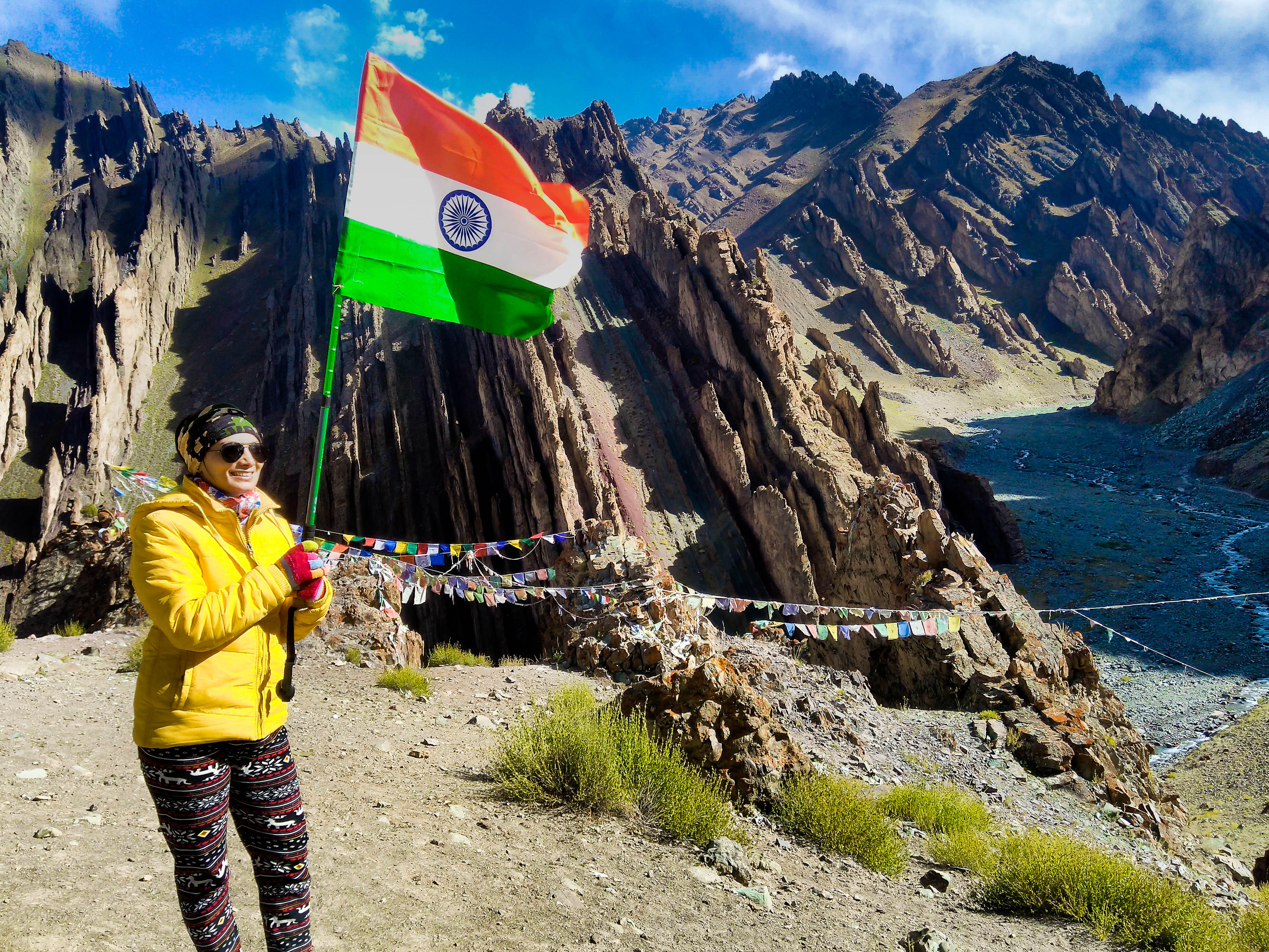
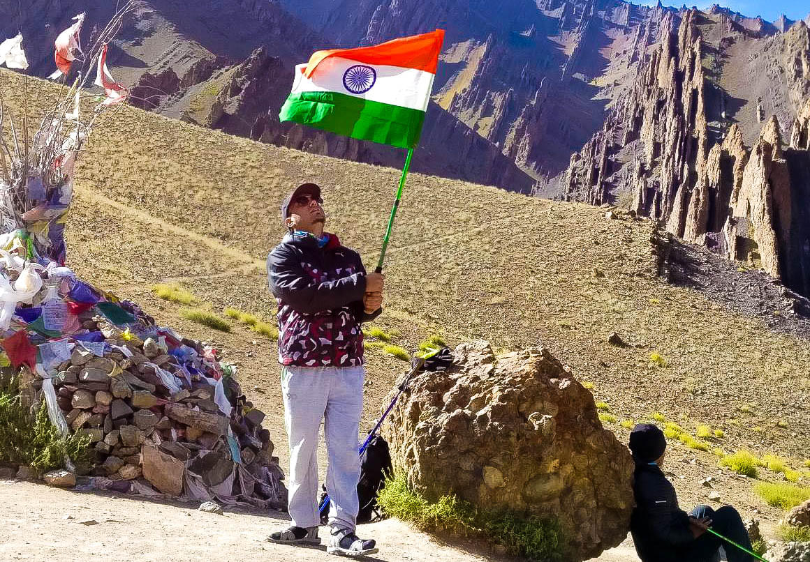
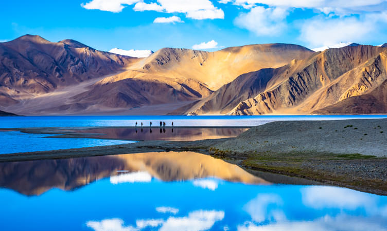
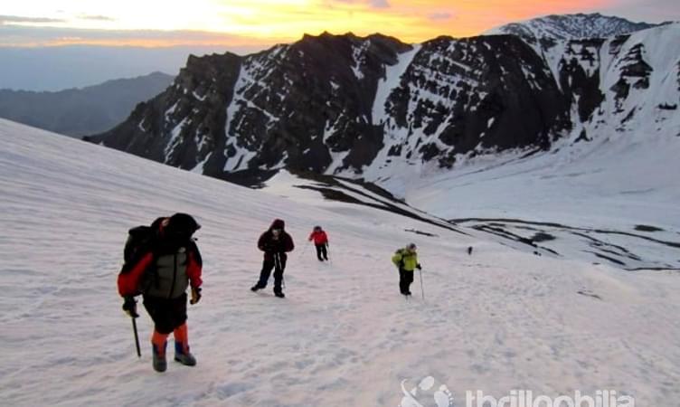
Stok Kangri Trek
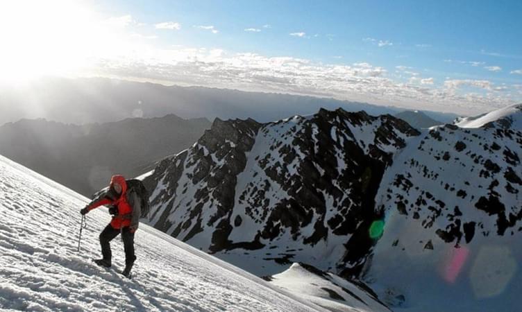
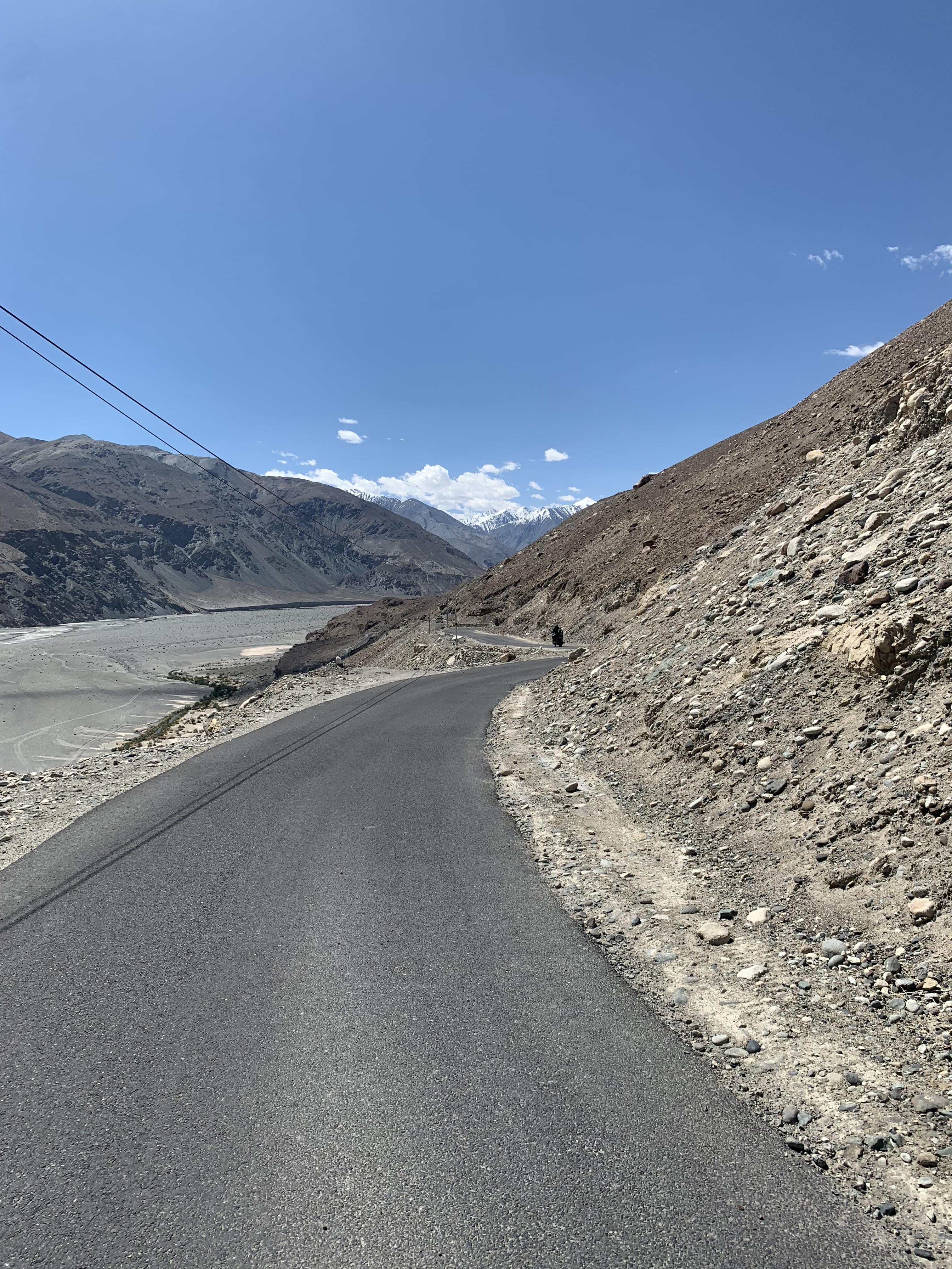
Stok Kangri, Ladakh is one of the most popular places for high altitude trekking in India. Although the beauty of Ladakh draws in innumerable tourists and trekkers from all over the country and the world, the Stok Kangri trek isn’t really suited for anyone and everyone.
It is advisable that only experienced trekkers set out on this expedition as the climatic and geographical conditions of the place may not suit novice or amateur trekkers. Nonetheless, Stok Kangri is one of the most beautiful tourist destinations in the country. It is for this reason that the Stok Kangri trek forms an inevitable experience while trekking in India.
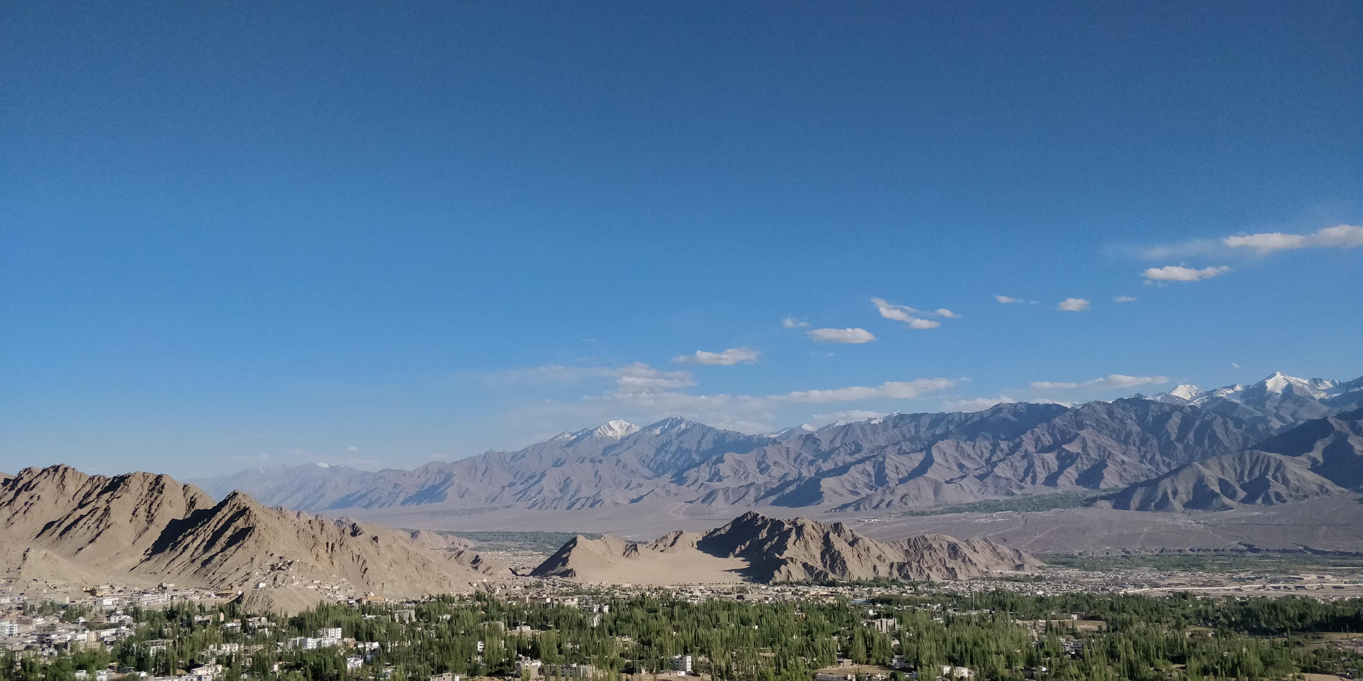
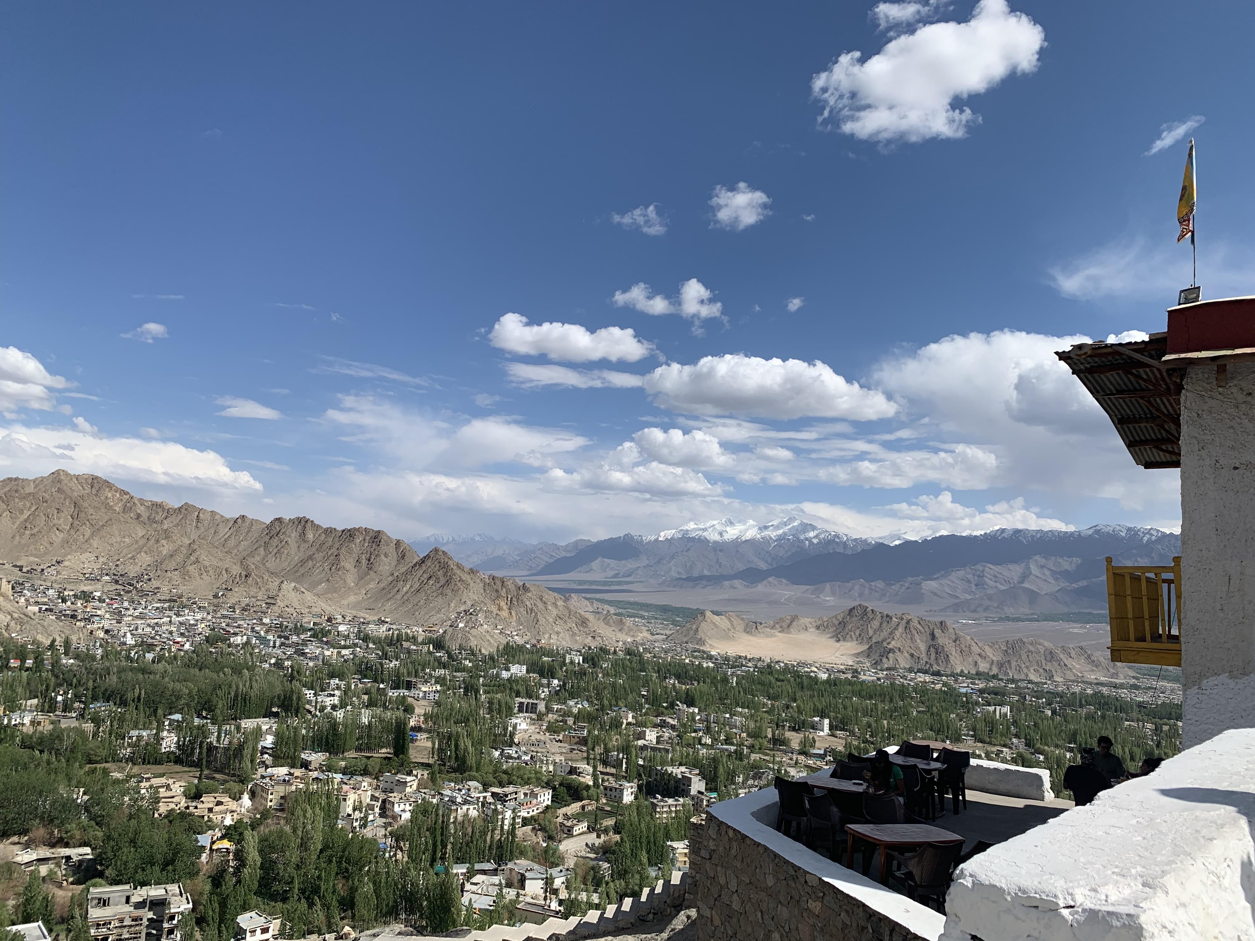
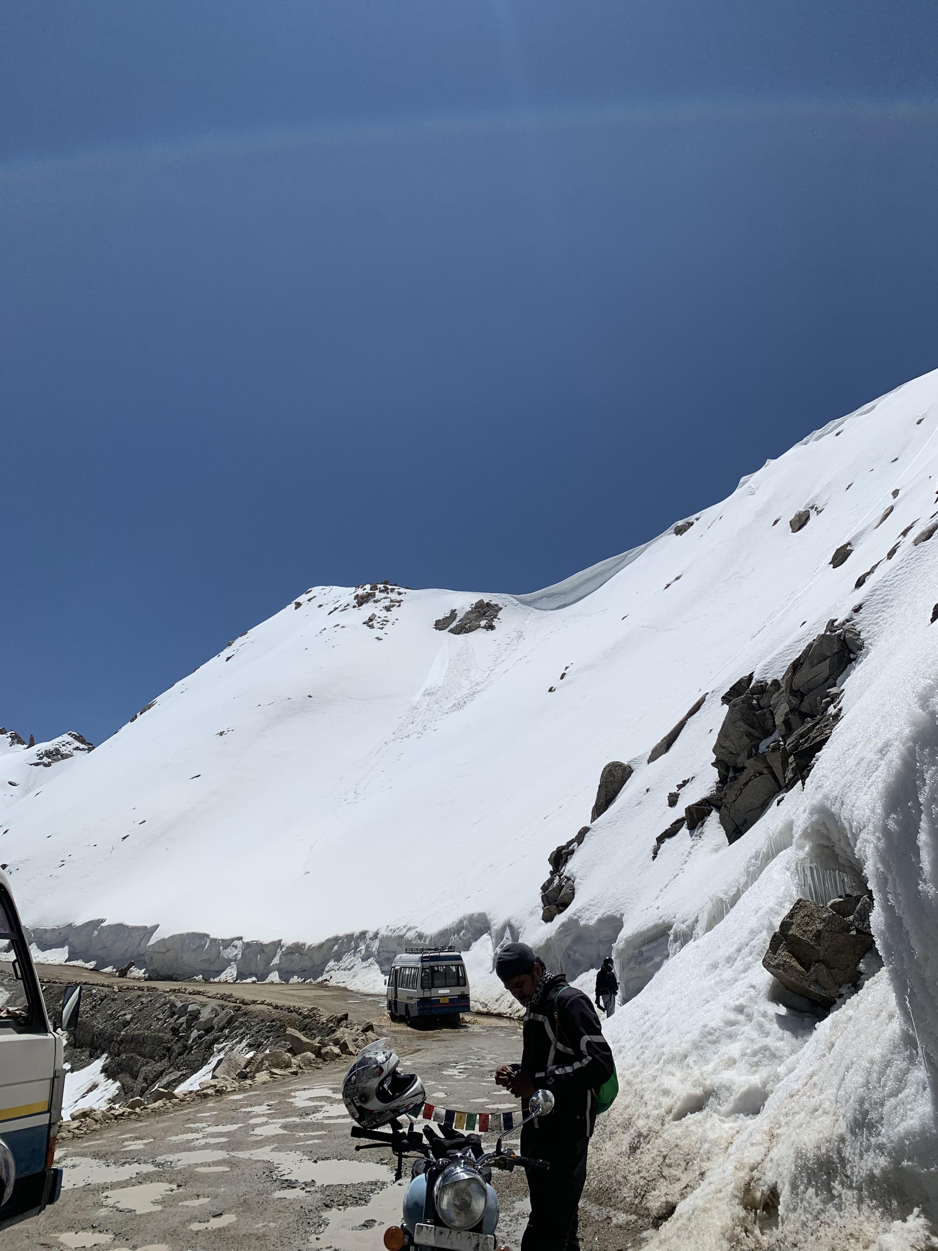
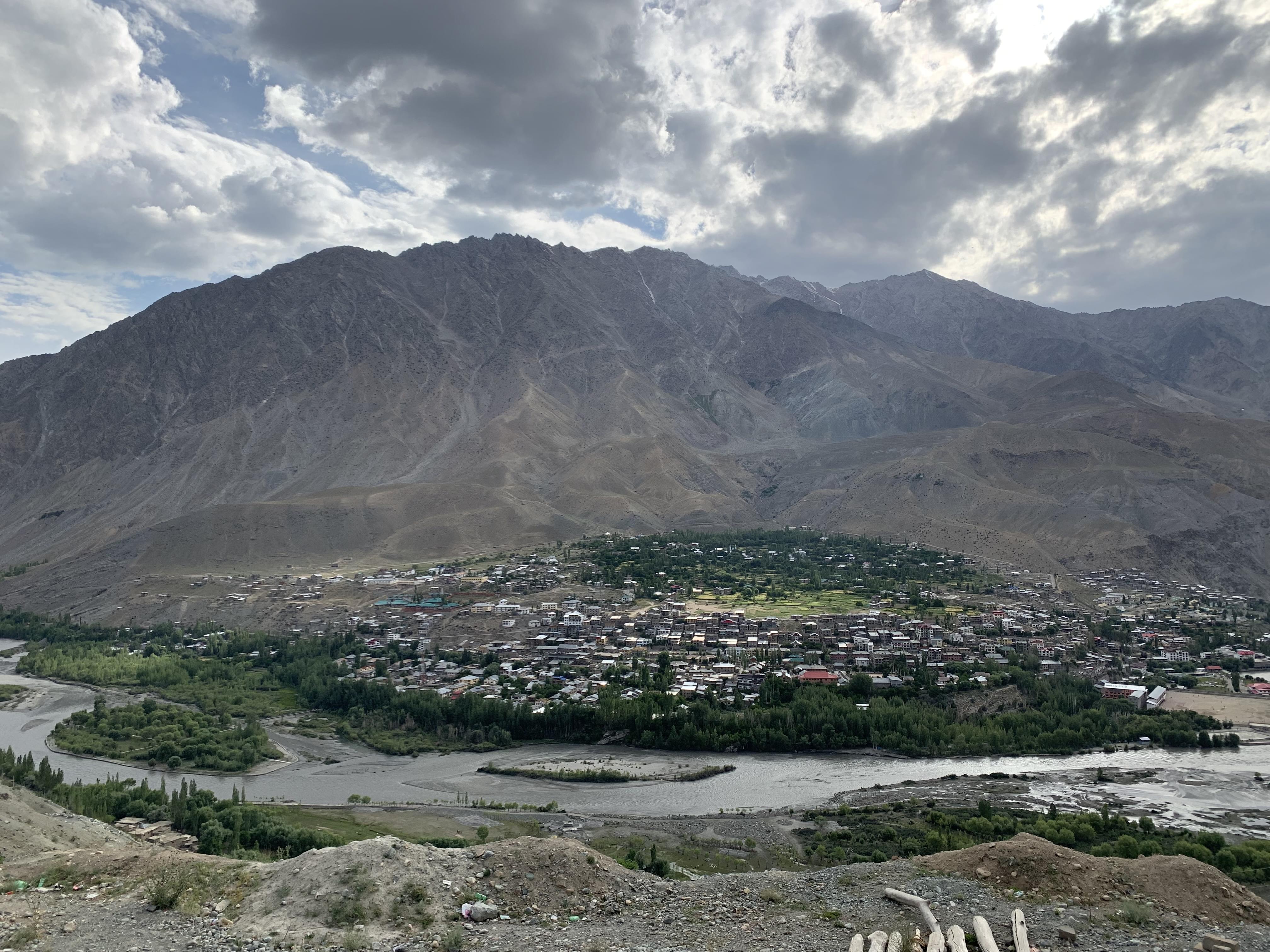
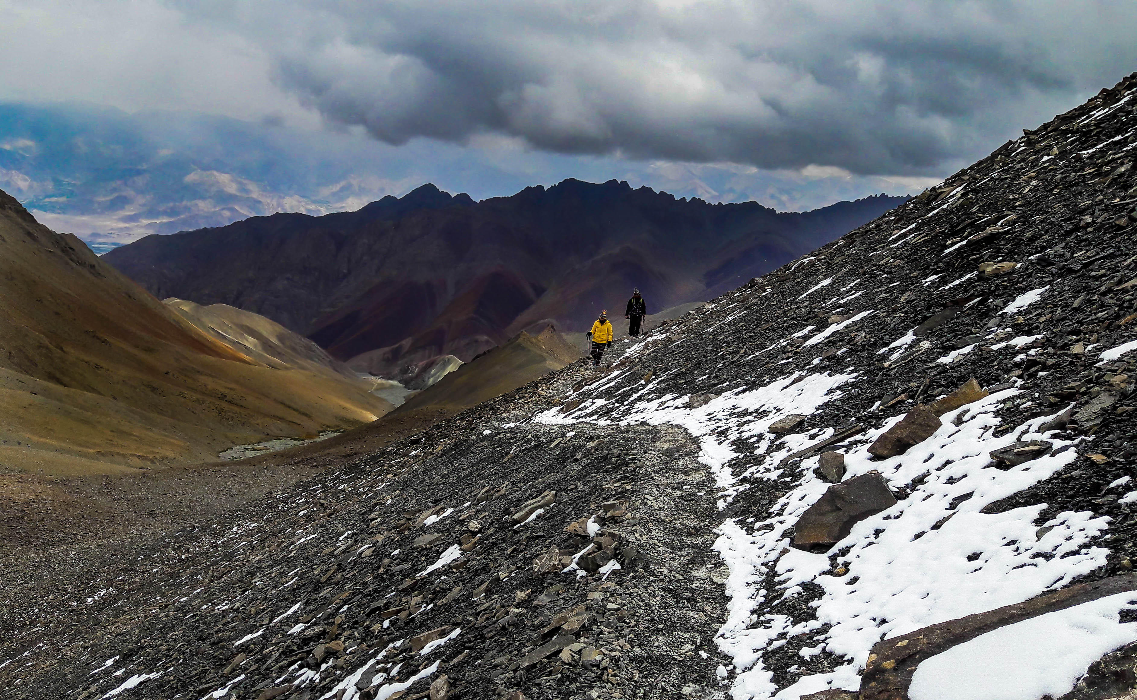
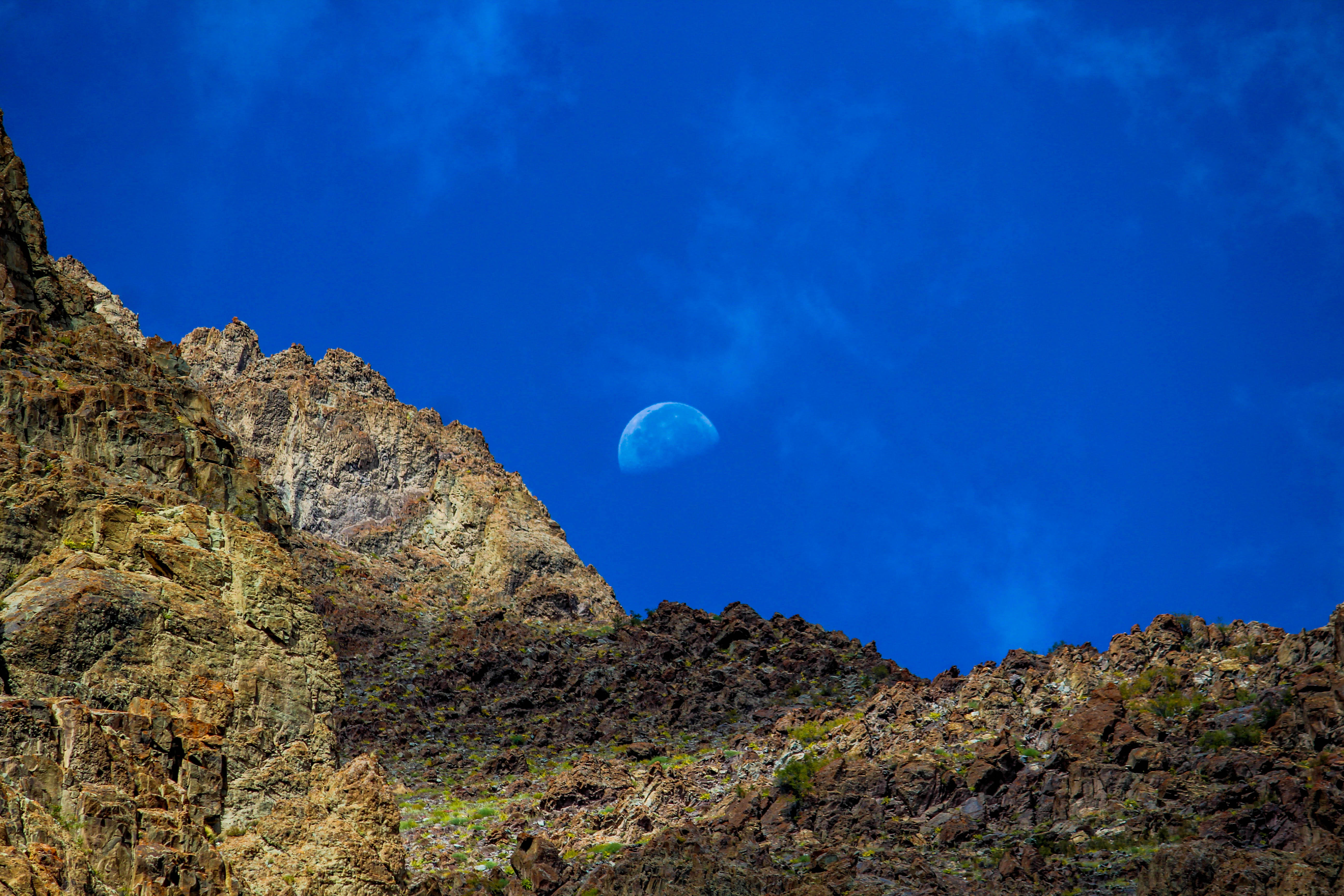
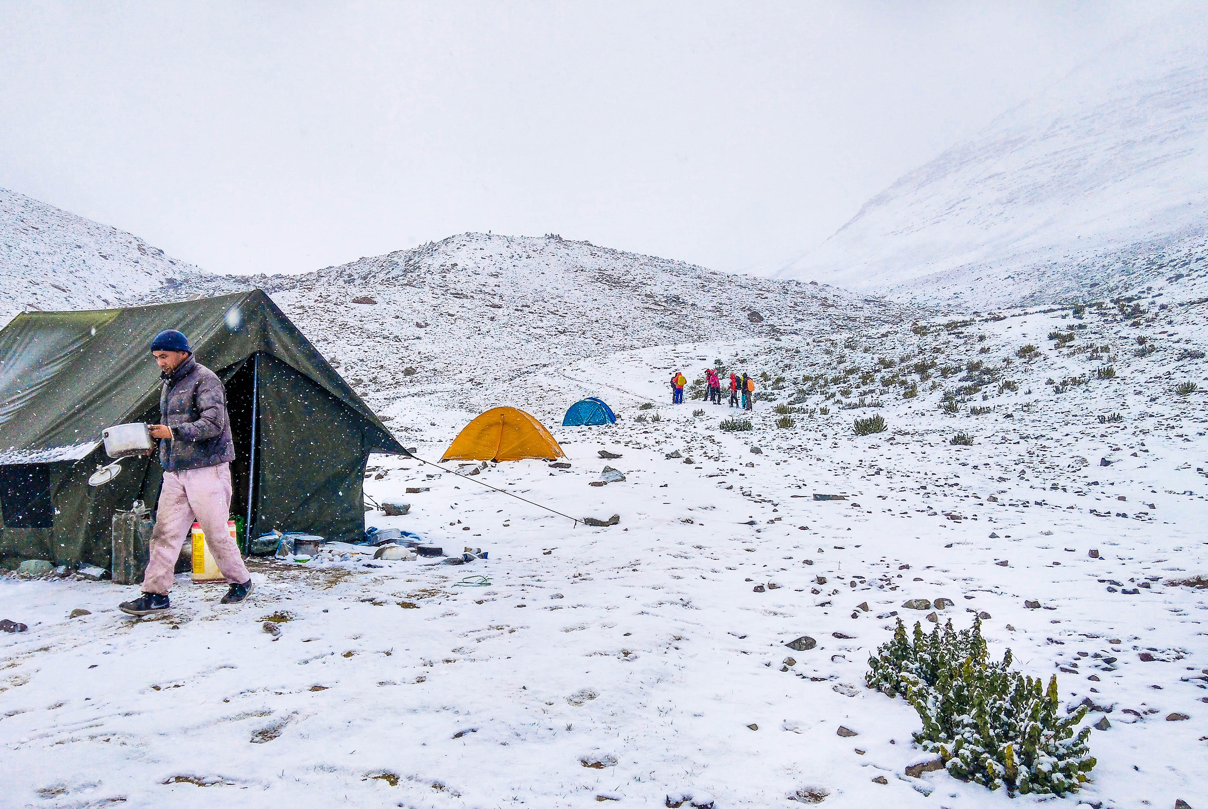
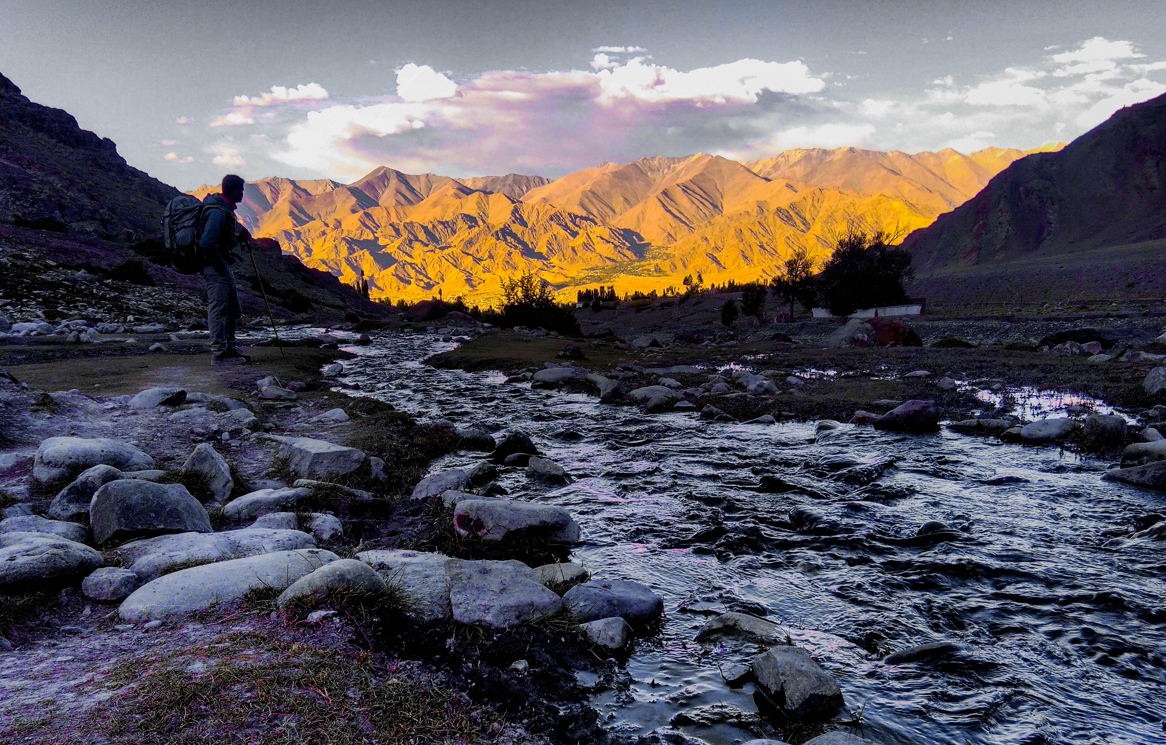
The trek usually lasts for a maximum of ten days. The trek begins from Leh, which is noted for its natural beauty and warm and hospitable people. During the first couple of days of the trek, you can move around Leh, go sightseeing and get acclimatized to the weather of the region. These couple of days will prepare you for the trek ahead. You will next be taken to Chang Ma via Stok Village by road.
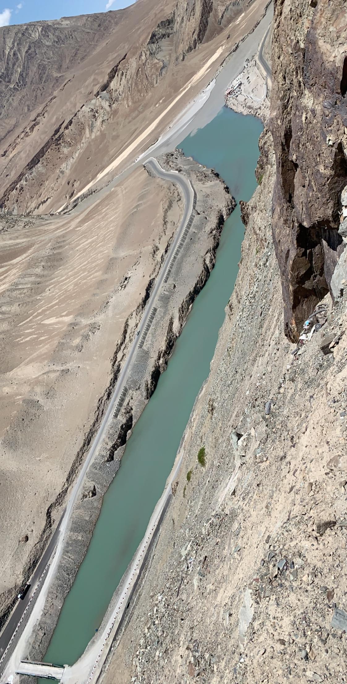
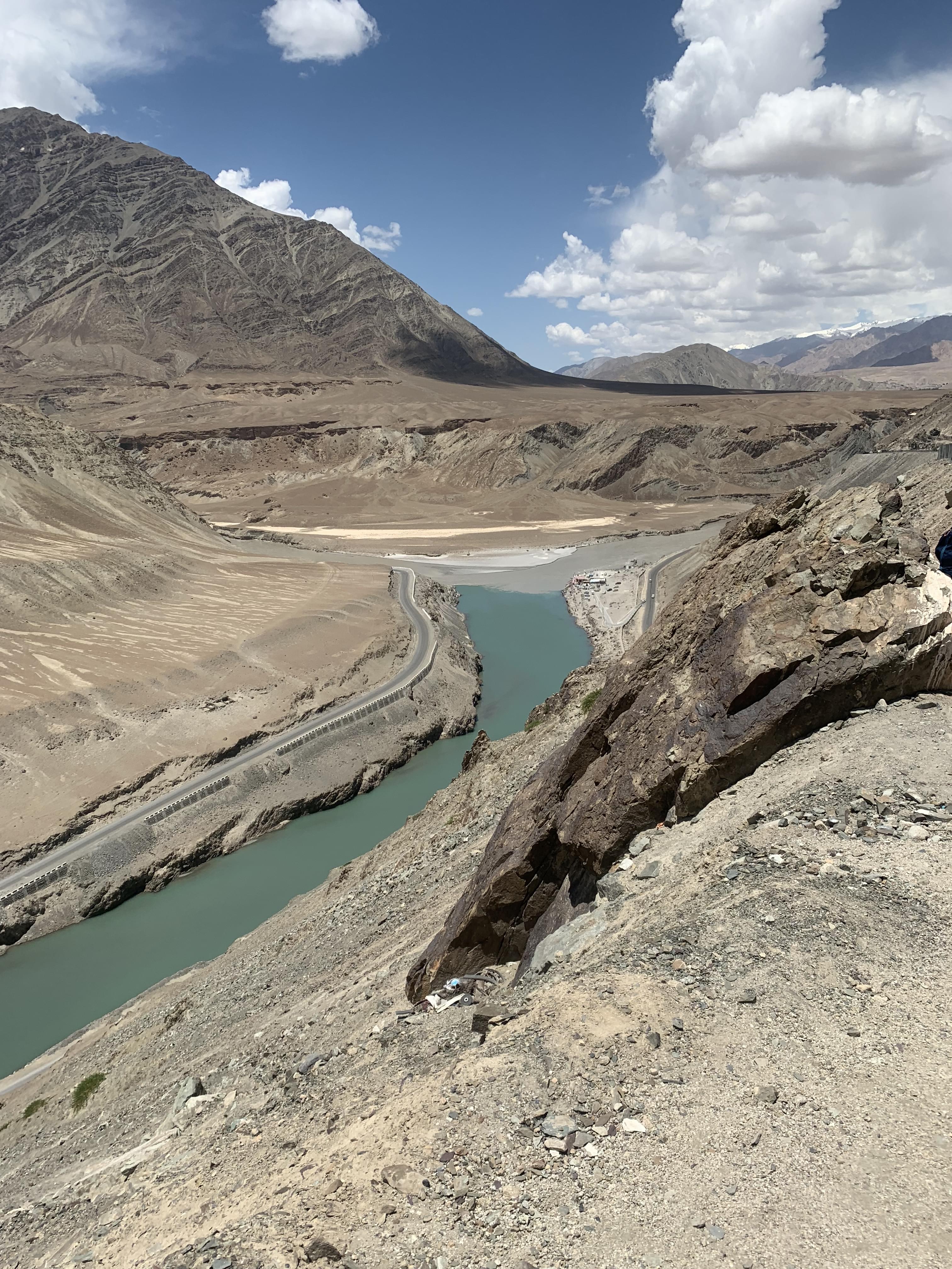
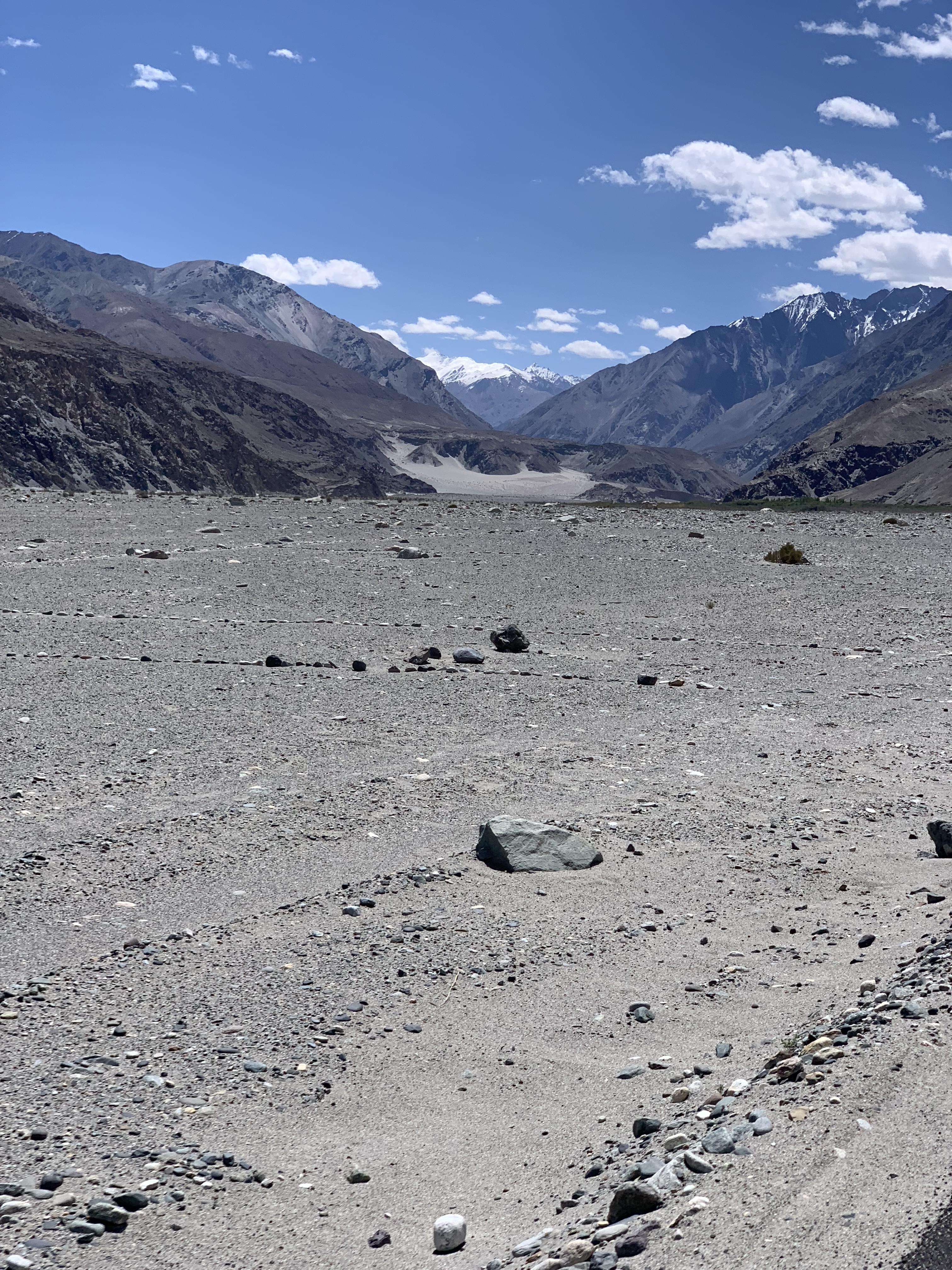
The journey from Leh to Stok Village takes you through a route of immense natural beauty. You can see the lush greenery, glistening snow peaks and scenic splendour of the region in this stretch. On reaching Chang Ma, you reach a snow-covered region and begin trekking. You will need to climb on for about three hours. From here you will head on to Manokorma, which is at an elevation of 14200 feet.
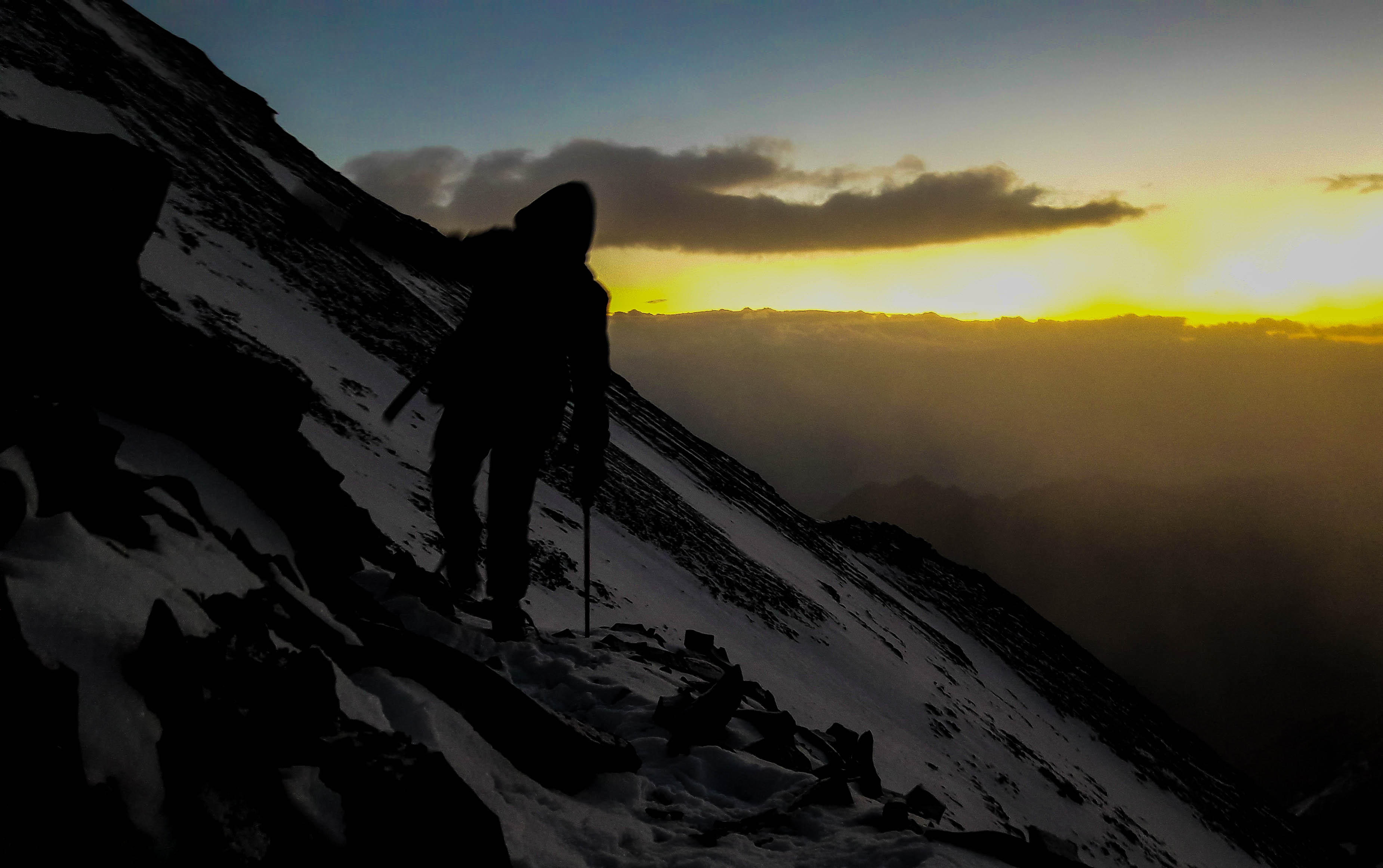
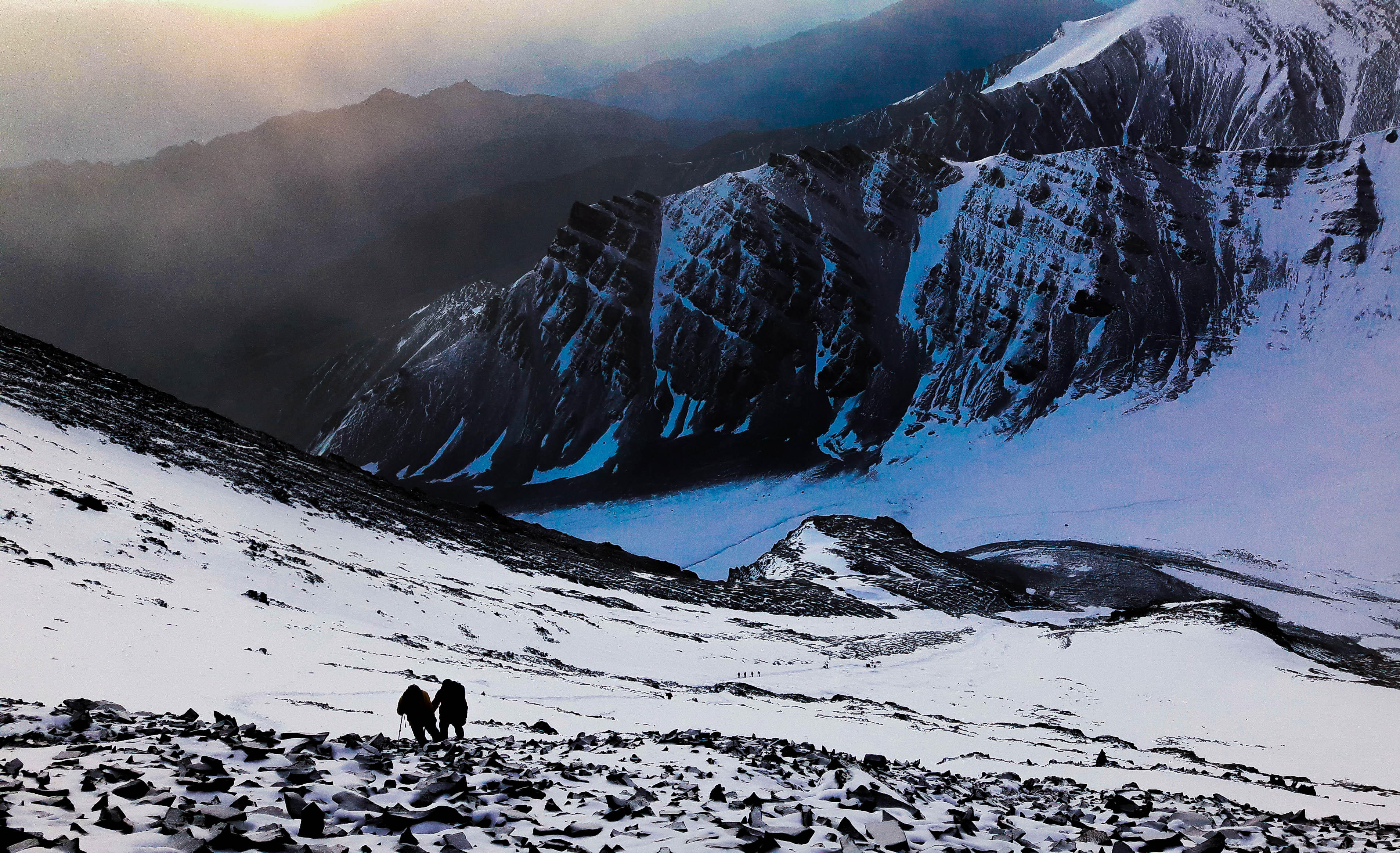
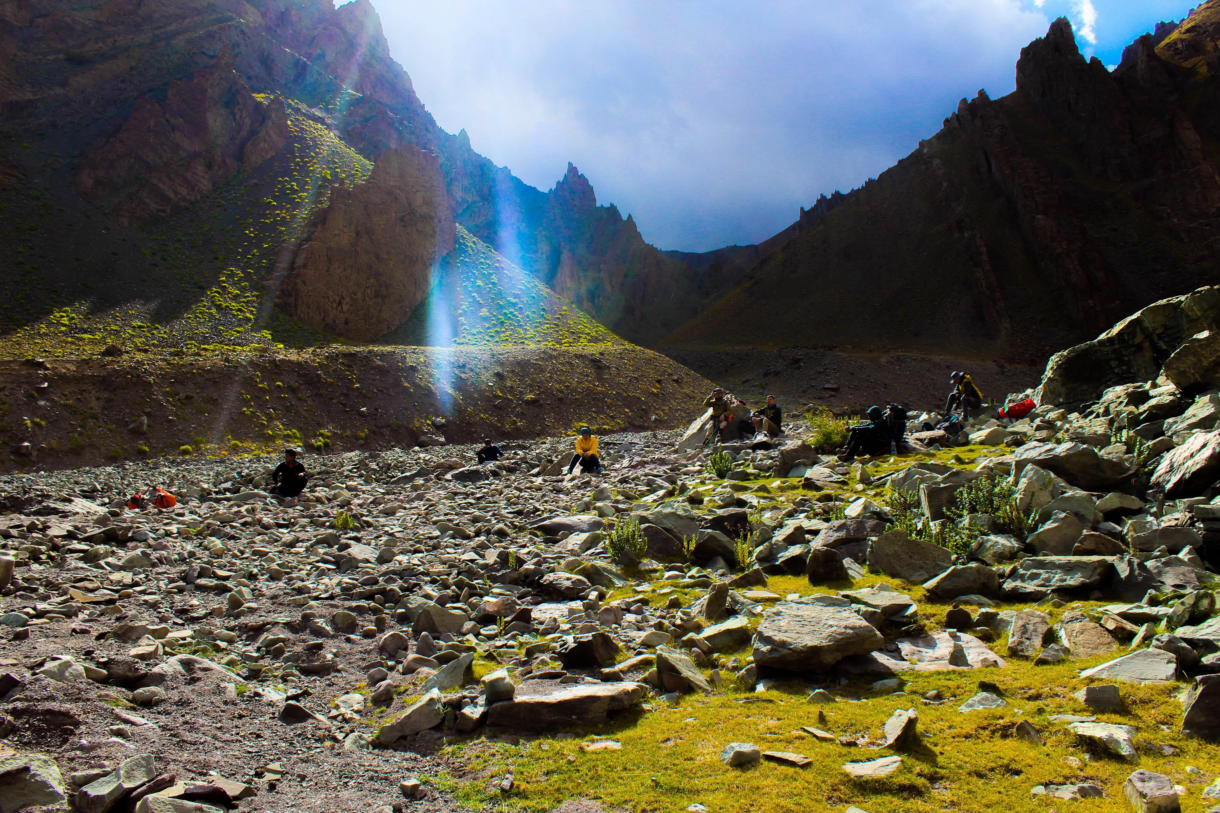
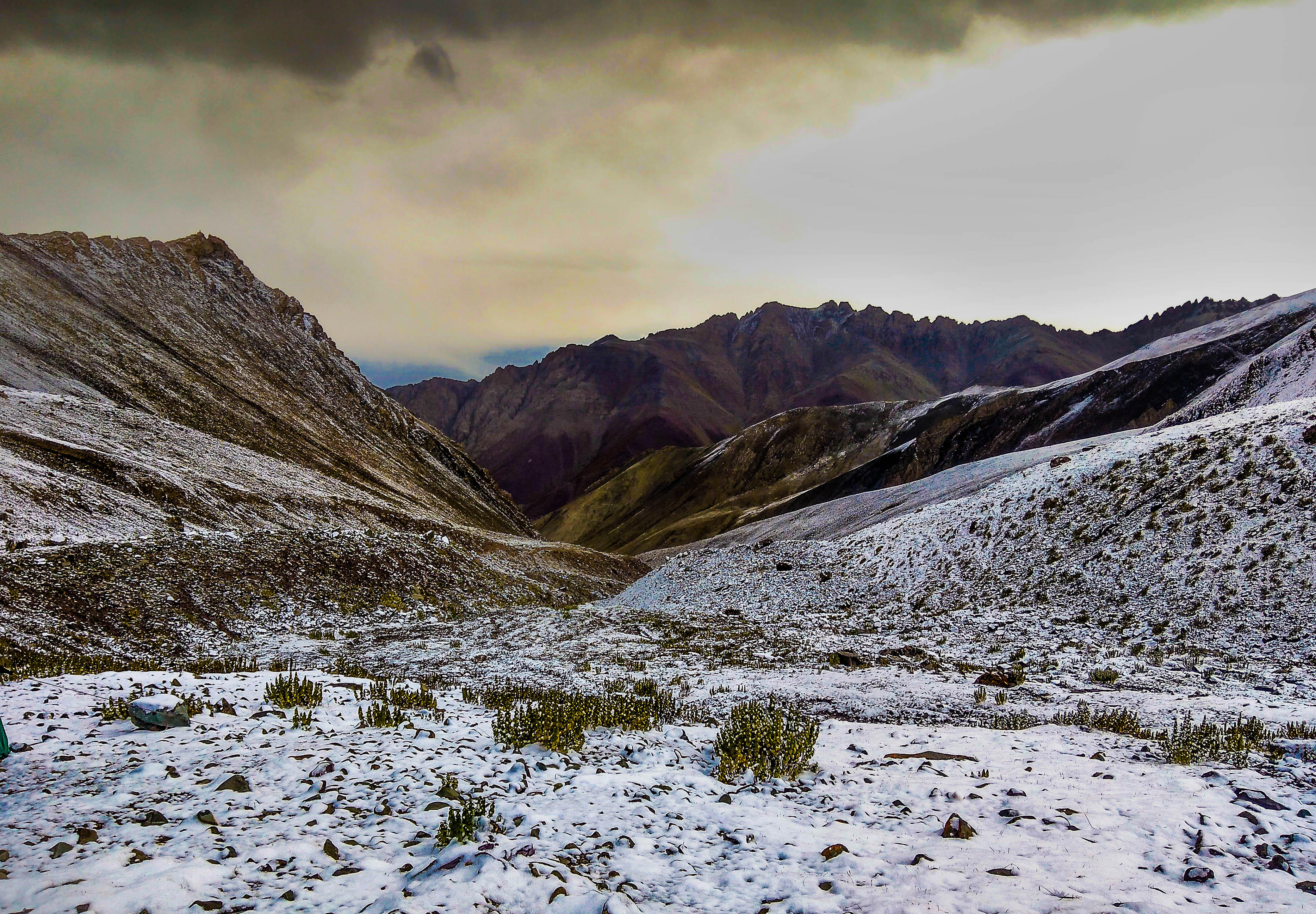
During the trek, you will be able to view some very beautiful peaks such as the Gulap Kangri, Parcha Kangri, etc. The base camp of the trek is at an elevation of 16, 300 feet. From here, the journey continues till you reach the Stok Kangri. The view from the Stok Kangri is simply amazing. This rewarding feeling is what draws trekkers from all over the world to high altitude trekking in India. The trek back to Leh is a bit arduous and you may need to be careful while climbing down the mountainous terrain.
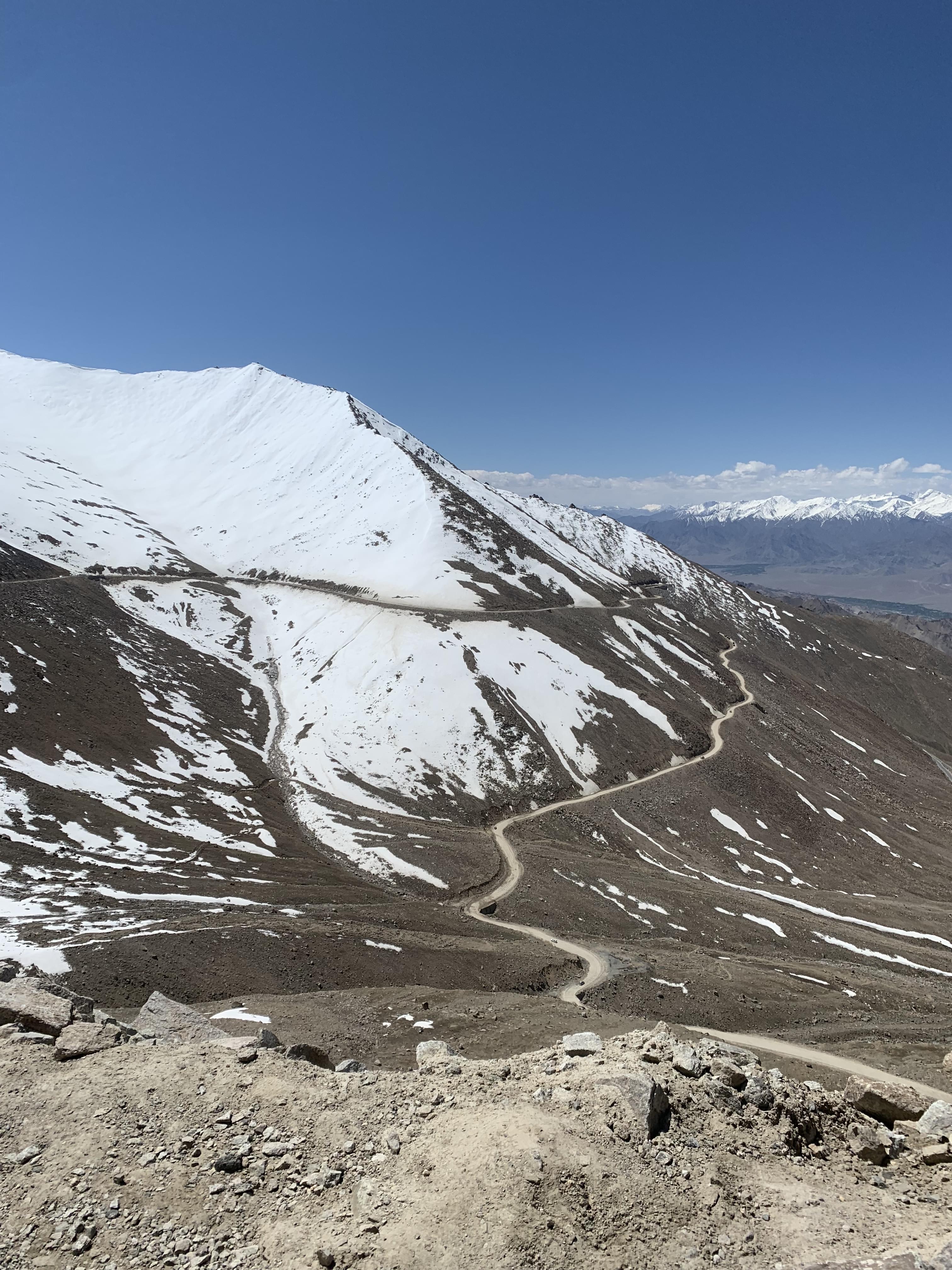
Best Season: June - October
Difficulty Level: Medium
Max. Elevation: 5000 m
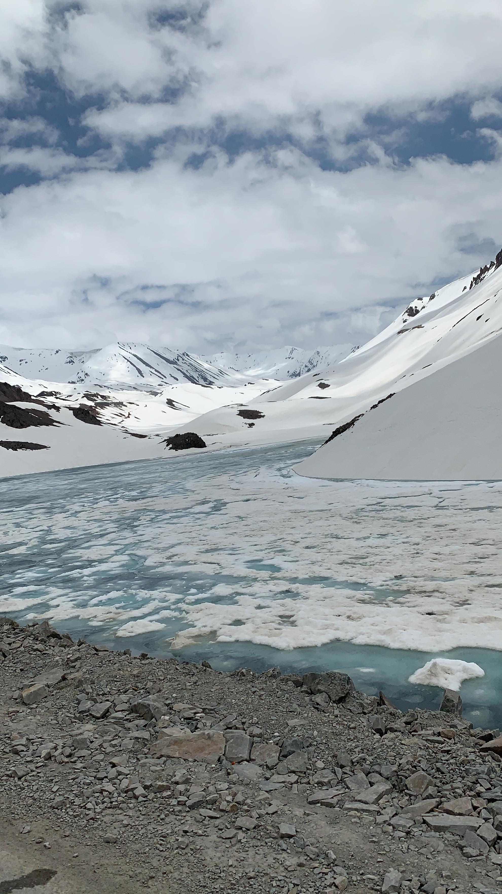
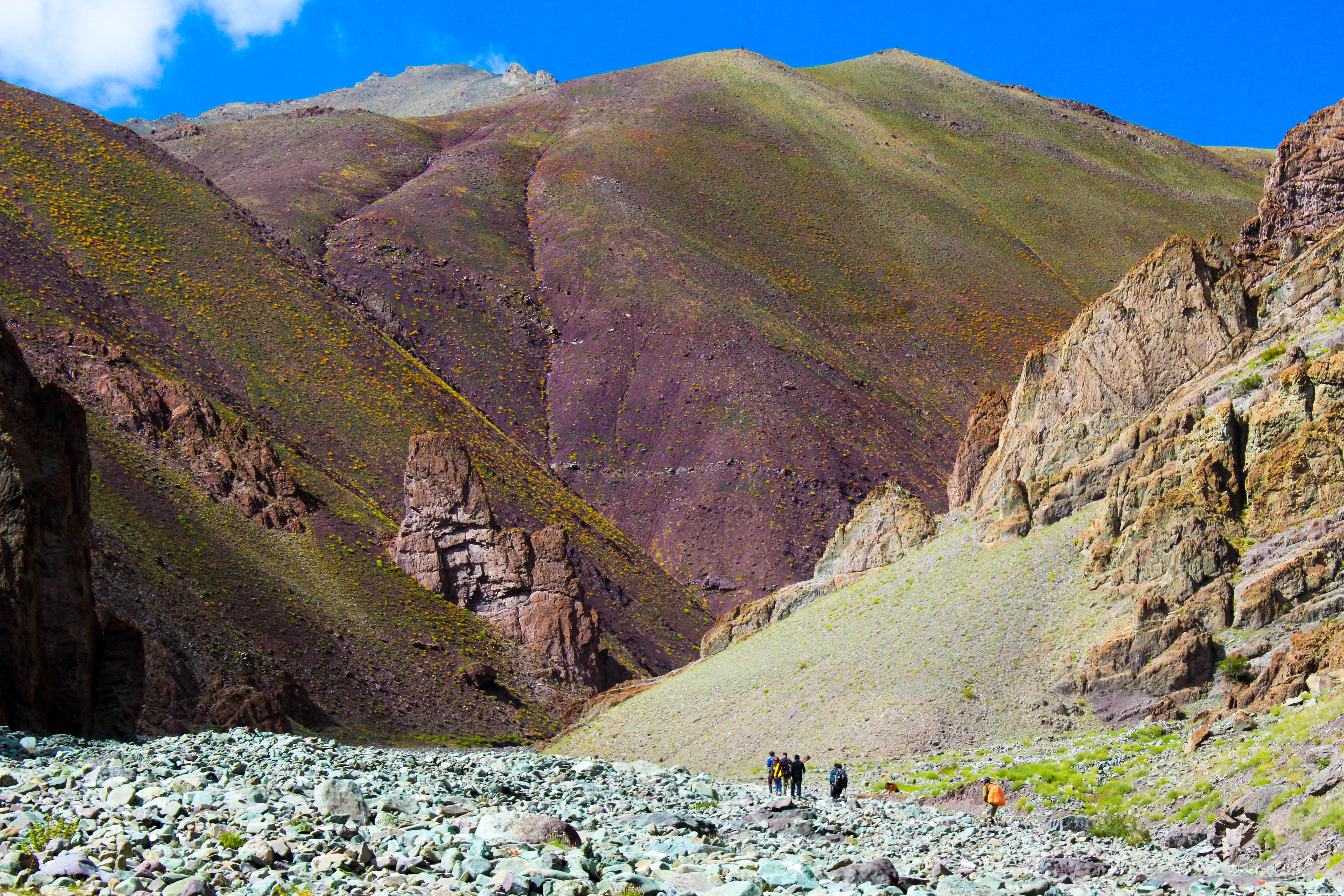
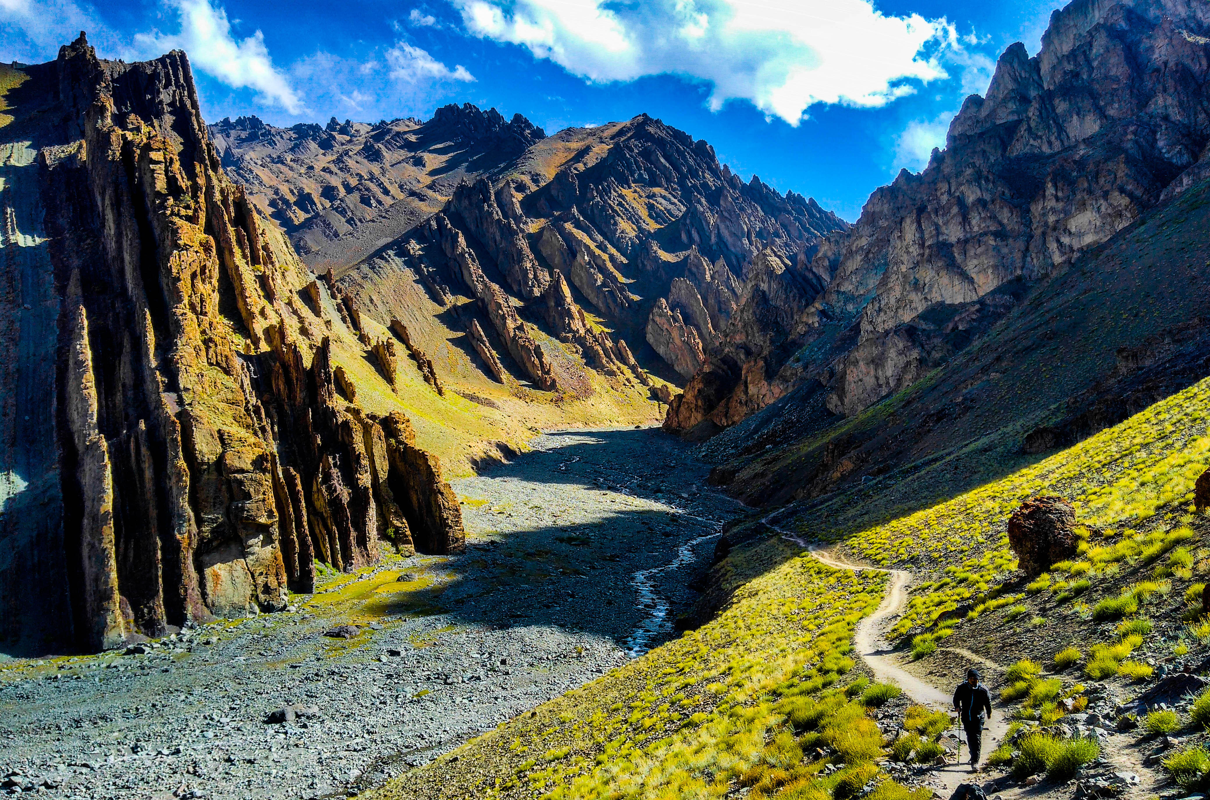
Pin Parvati Valley Trek
The Pin Parvati Pass is situated in the beautiful state of Himachal Pradesh. It connects the Parvati Valley in Kullu to the Pin Valley in Spiti. Remarkably, the landscapes on either side of the pass are in stark contrast to each other. While the Kullu side showcases a lush green and verdant landscape, the Pin side is mostly barren and devoid of vegetation. The two sides are quite different from each other even in terms of culture. While the Kullu side is predominantly Hindu, the Pin side has followers of Buddhism.
The Pin Parvati valley is a popular trekking destination. However, the place is still untouched by the evils of mass tourism and presents a clean and pristine picture to its visitors. It is believed to be one of the most beautiful places that trekkers can visit while trekking in India.
The trek to the Pin Parvati valley begins at Manikaran, moves along the Parvati River and ends at the Pin Parvati Valley, which has an altitude of 4900 m. The Pin Parvati Valley is also known as the ‘Valley of Gods’ and is located between the Dhauladhar range and the Pir Panjal range.
The journey to this beautiful valley commences at Manali from where the route will take you through lush green alpine forests, lakes, clumps of wildflowers, majestic mountain peaks, etc. On your way to the valley, you will cross the Mantalai Lake, which is a very important Hindu pilgrimage centre. The Pin Parvati peak has an elevation of 5319 metres, which offers a fantastic view of the nearby peaks namely, the Parvati South, the Parvati North, the Pinnacle and Kullu Eiger.
This wonderful journey will end at the sleepy little hamlet of Sagnum. From here you can take a jeep safari into the Spiti valley, where you can explore places of Buddhist importance and also visit some interesting villages before heading back.
This trekking expedition is one of the most interesting experiences of high altitude trekking in India. This trekking trail is often mentioned as one of the toughest trekking trails in India, but it is definitely worth the effort.
Best Season: May- September
Difficulty Level: Difficult
Max. Elevation: 4900 m
- 8D/7N
- 8D/7N
About Rupin Pass Trek:
The Pass is perched at 15250 ft in the surreal Himalayan mountain range of Himachal Pradesh. The trek is surrounded by the small hamlets from Dehradun of Uttrakhand to Shimla of Himachal Pradesh, which gives the reason to explore its local culture beauty. You will be greeted with stunning scenery such as cascades, verdant glacial meadows, the snow bridges are something incredible to cross, snow-kissed mountains, charming hamlets, big rivers, hanging villages, terrific forests, hundreds of waterfalls, and an exhilarating pass crossing as a whole, Rupin Pass Trek is a complete experiential trek to do.
Quick Facts About Rupin Pass Trek:
• Rupin Pass Trekking Duration: 7N/8D
• Maximum altitude: 15,250 ft.
• Rupin Pass Trek Difficulty: Moderate to Difficult
• Rupin Pass Trek Distance: 52 Kms
• Temperature: Day: 13°C to 18°C and Night: 0°C to 7°C
• Best Time for Rupin Pass Trekking: May-June (Pre Monsoon), Sep-Oct (Post Monsoon)
• ATM: Purola which is on the way to Dhaula has the last ATM point before your trek begins.
• Start Point: Dhaula, Uttarakhand
• End Point: Sangla, Himachal Pradesh


Roopkund Lake Trek
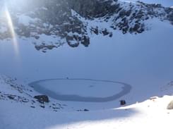
The Roopkund Lake is situated high up in the Garhwal Mountains in the Chamoli district of Uttarakhand. This lake is of much historical and religious importance. It was also called the Mystery or Skeletal Lake after a large number of human skeletons were found in it in 1942 by a Forest Officer.
Following this discovery, a number of scientists visited the lake to find out the reason for the skeletons being there and it was eventually concluded that the skeletons belonged to some pilgrims who were caught unawares in a flash hailstorm.
Due to the huge chunks of ice that came with the hailstorm, the pilgrims died due to injuries to their skulls. This story was aired in national and international media and since then, the Roopkund Lake has become a popular tourist destination.
The trek to Roopkund Lake showcases the best of Himalayan beauty. The trek begins at Lohajung, which is situated at an elevation of 3200 metres and goes on for five days till you reach the lake, which is at an altitude of 5000 metres. The first couple of days will take you through beautiful villages, forests, rivers and Bugyals.
The air will get thinner and thinner as you ascend and gain altitude. So it is very important that you are in the best of health and fitness when you set out for this trek. Higher energy levels will allow you to adjust better to the changing environment and enjoy the views offered by the region. Your team leader will also offer you tips on how to cope with the changing levels of the atmosphere.
The trekking trail followed during the Roopkund trek coincides with that of the Raj Jay Yatra pilgrimage route. This is conducted during a festival dedicated to goddess Nanda Devi and the residents of nearby village participate in this festival dressed in their traditional attire.
Best Season: August - October
Difficulty Level: Difficult
Max. Elevation: 5020 m
Suggested Read: Guide to Roopkund Trek

- 5D/4N
- 5D/4N
About Sar Pass Trek:
Perched at 13,800 ft. above sea level, Sar Pass offers the magnificence of a beautiful verdant landscape and is a heaven for photographers, artists, and nature lovers. Set against a curtain of majestic Himalayan peaks wrapped in snow, the Sar Pass trek passes through some of the most scenic views ranging from forests to the meadows to the ice blankets.
While trekking across the path from Tila Lotni to Biskeri Ridge, one has to pass by a small, usually frozen lake which means "Sar" in the local language of Himachal. Hence the name, Sar Pass! The trail passes through the thick forest and takes you to a winter wonderland that makes it fascinating.
Sar Pass Trek Quick Facts:
Start Point/End Point: Kasol Base Camp. (It is 2 km away from the Kasol Bus Stand)
Duration: 4N/5D
Maximum altitude: 13,800 ft.
Sar Pass Trek Distance: 48 Kms
Temperature: 22°C (Max. During Day Time) to -5°C ( Min. During Night Time)
Best Time for Sar Pass Trek: April to Mid July
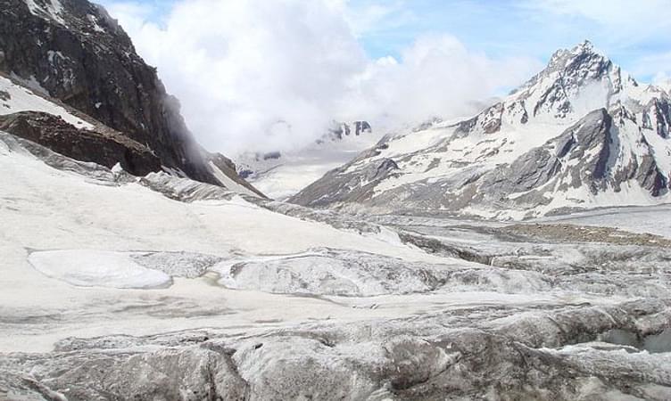
Pindari Glacier Trek
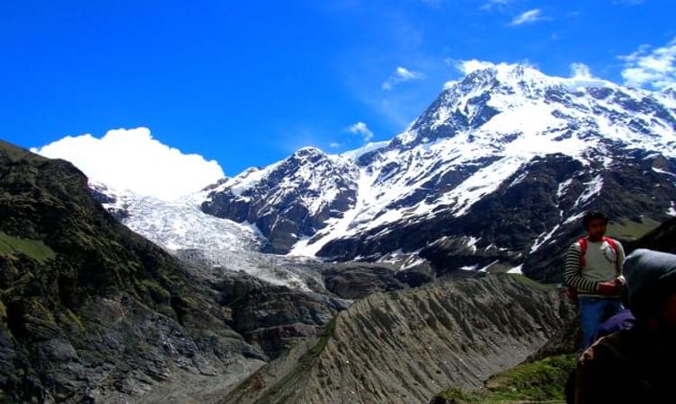
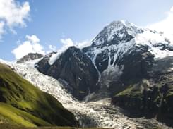
The Pindari Glacier trek is a relatively easy trekking trail. The Pindari glacier is situated between the Nanda Kot and Nanda Devi peaks and is a major destination for tourists and high altitude trekking in India. The pristine white glacier measures 3.2 km in length and 1.5 km in width and has gigantic mountains in its background.
The Pindari glacier trek is a must-do activity for all those who wish to experience nature very closely without compromising on peace and tranquility. The journey to the Pindari glacier begins at Nainital and goes on to Lahorekhet. Usually, night camps are set up and the evening is spent in these camps. On your way to the Pindari glacier, you will also come across Dhakuri, which is a place of great scenic splendour.
On moving ahead from Dhakuri, you come to the Khati village, which is the largest village in the region. Situated on the banks of the River Pinder, the village serves as a perfect spot for a night halt. From Khati you will need to trek another 11 kms to reach Dwali. Dwali has beautiful surroundings to offer and you can relish the beauty of the place as you trek on ahead to Phurkia, situated about 6 kms away.
Pindari glacier is situated at a distance of about 17 kms from Dwali. The vista opens into a beautiful view as you reach the Pindari glacier. Your efforts are paid off with the panoramic view of the surroundings that the Pindari Glacier offers you.
Best Season: March - October
Difficulty Level: Moderate
Max. Elevation: 3627 m


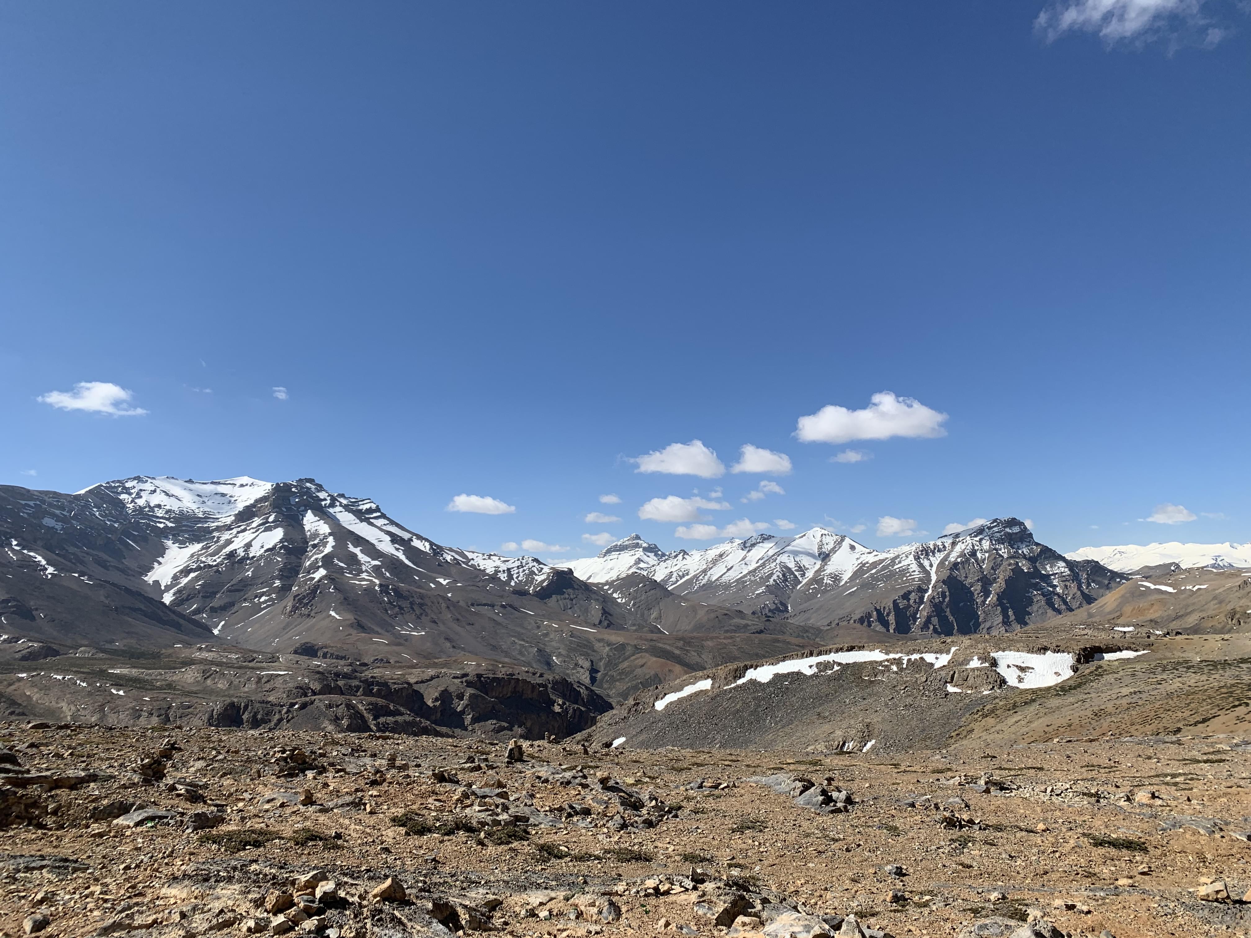
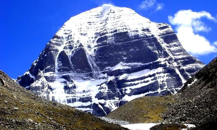
Kinner Kailash Circuit Trek
Situated in the beautiful state of Himachal Pradesh, Kinnaur is a picturesque district which is still untouched by the evils of mass tourism. Pristine and serene, Kinnaur is surrounded by the Spiti Valley in the north, the Garhwal Himalayas in the south, Tibet on the east and Kullu on the west.
Besides nature loves, Kinnaur Kailash circuit also attracts a large number of trekkers from all over the country and the world due to the excellent terrain it offers for trekking expeditions. Kinnaur also shows a great deal of Buddhist influence due to its proximity to Tibet and is often frequented by those who are interested in studying the Buddhist culture and heritage.
Kinnaur can be reached through the Indo-Tibet road which passes through the Kinnaur Valley. The trek offers one of the most interesting and memorable experiences that one can have while trekking in India. During the first half of the journey you will find a standard trekking path, while the remaining half will require you to manoeuvre boulders.
The trek begins from Thangi and moves to Lambar and then to Charang. You can explore the Charang temple and move on to Surting. The journey moves on ahead and you will need to cross icy streams and do some rock climbing to reach your destination.
The overall experience will leave you wanting for more. The Kinner Kailash Circuit trek is truly amazing as it not only tests your trekking skills but also opens up a vista of unimaginable natural beauty. Kinnaur is home to three of the world’s most majestic mountain ranges i.e. the Zanskar, the Greater Himalaya and the Dhauladhar ranges.
In addition, the Kinnaur Kailash Parbat, is considered to be of much religious importance to Hindu as it resembles a Shiva Lingam. It is believed to be one of the mythological abodes of Lord Shiva. Due to its religious significance, this circuit attracts pilgrims and devotees from all over the country and the world. The circumambulation of this sacred mountain is considered to be very auspicious and the trek begins at Kalpa via Triung valley and back to Kalpa via Sangla valley.
Best Season: May- September
Difficulty Level: Difficult
Max. Elevation: 5242 m
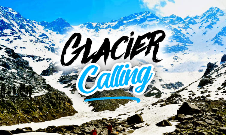
Khatling Glacier Trek
The Khatling Glacier is the source of the rivers Bhilangana, Sahasratal and Masartal. The Garhwal region of Uttarakhand has a number of trekking trails which attract trekkers from all over the country and world. The best part about these trekking trails is that they are still untouched by the evils of mass tourism and are ideal to visit if you wish for a quiet and peaceful trekking experience.
The trek to the Khatling Glacier begins at the Ghutu village and takes you through a beautiful route laced with alpine trees, lush green meadows, beautiful forests etc. You will also come across some interesting Hindu temples before you reach the Khatling cave.
From the Khatling cave, you will have to walk to the Khatling Glacier which allows you to have a spectacular view of the surroundings. This place is perfect for camping and will make you want to stay a few days here. Moving on ahead, you will reach Chowki, which also offers some splendid scenic beauty. On ascending a few feet more, you will reach the Masartal which allows you a breathtaking view of mountains such as the Jaonli, Thalay Sagar, Bharte Khunta and Kirti Stambh.
The peaceful atmosphere and serenity of the region make the trekking experience simply wonderful. A trekking experience in the Garhwal region is something you can never forget. The Garhwal region has some of the best trekking trails in India which make it a favourite haunt of trekkers from all over the world. Besides the natural beauty, you also get to learn more about the lives, cultures and traditions of this region which is held in high regard due to its religious significance.
Best Season: May - October
Difficulty Level: Medium
Max. Elevation: 4200 m
Kafni Glacier Trek
The Kafni glacier is located in the upper reaches of the Kumaon Himalayas and is the source of the River Kafni. It is situated on the southeast of the Nanda Devi and in the Bageshwar district of the Uttarakhand state. The trekking trail passes through places such as Bharadi, Loharkhet, Dhakuri Pass, Dwali and Khatiya. The beauty and tranquillity of the glacier are incomparable and hordes of tourists flock to this destination in search of peaceful trekking experience.
The Kafni trek is more or less similar to the Pindari trek and is quite easy. The peak of the Nanda Kot Mountain towers over the Kafni glacier making it look even more beautiful. The trekking experience is enthralling.
Due to the ease of access, the trekking experience can be enjoyed by anyone, even those who have limited or no experience of trekking. However, it is important that you maintain good health while undertaking this expedition. Do take care of safety aspects and follow the instructions shared carefully.
Best Season: June - September
Difficulty Level: Moderate
Max. Elevation: 3853 m
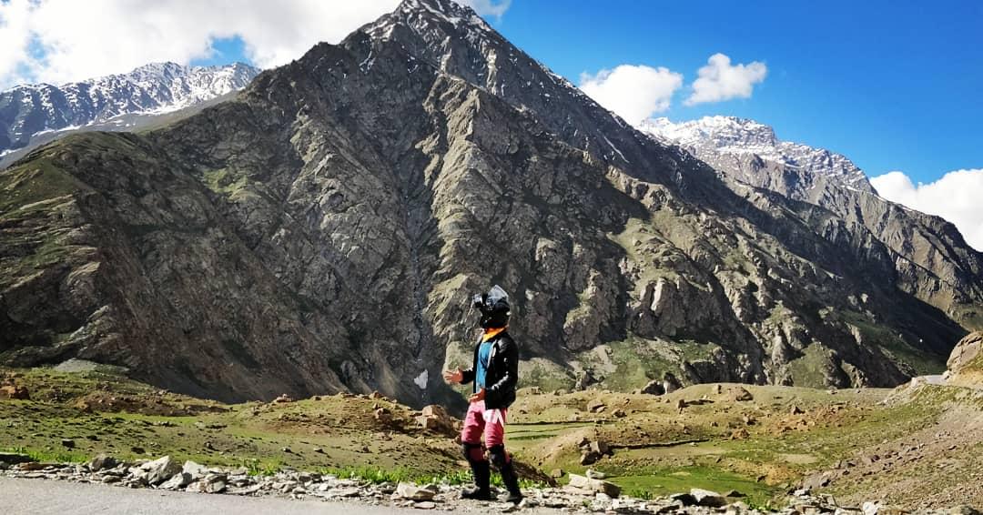
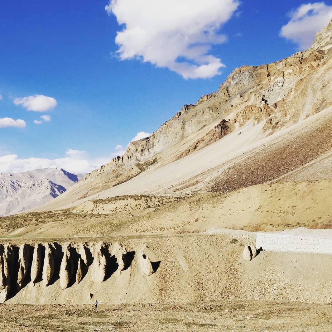
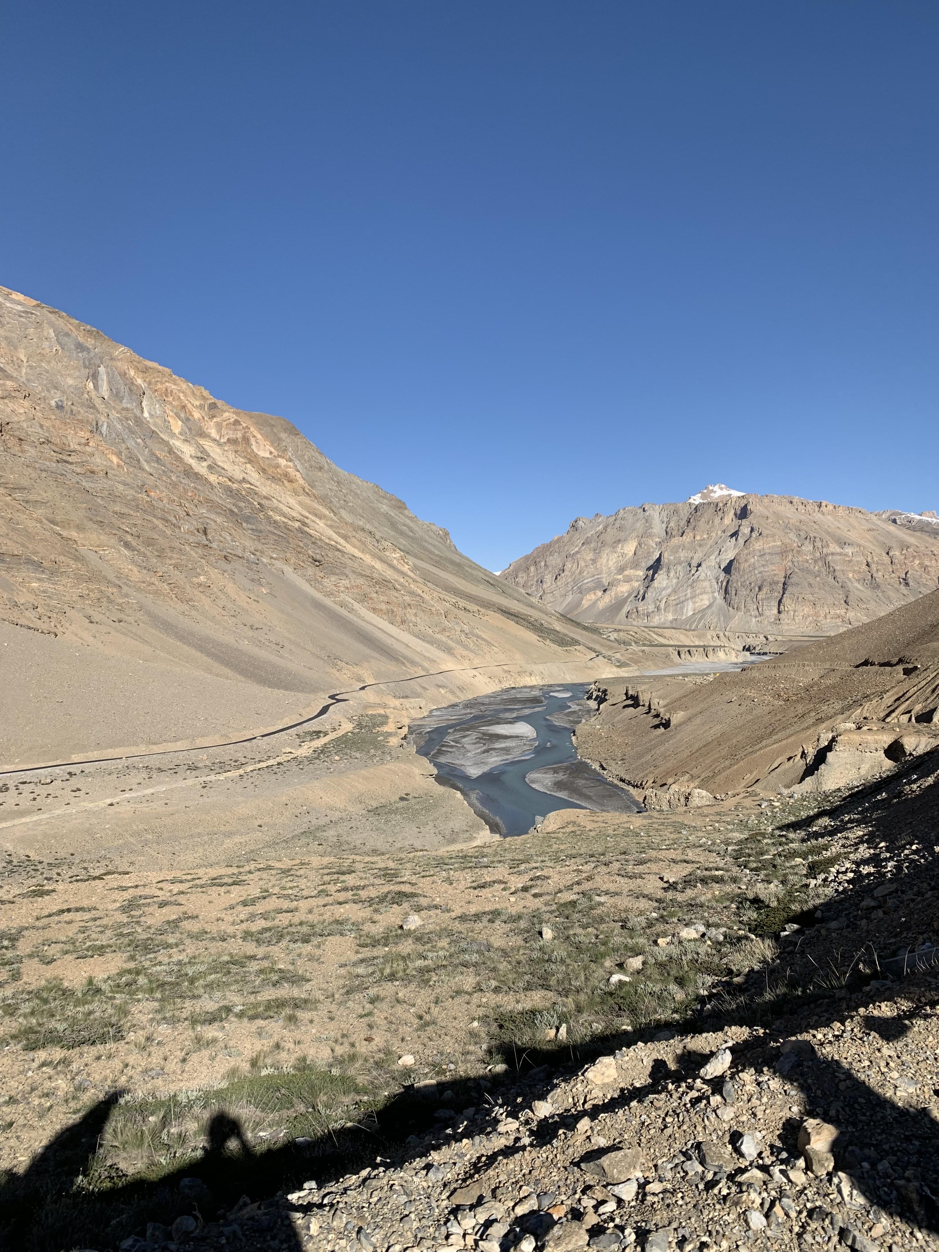
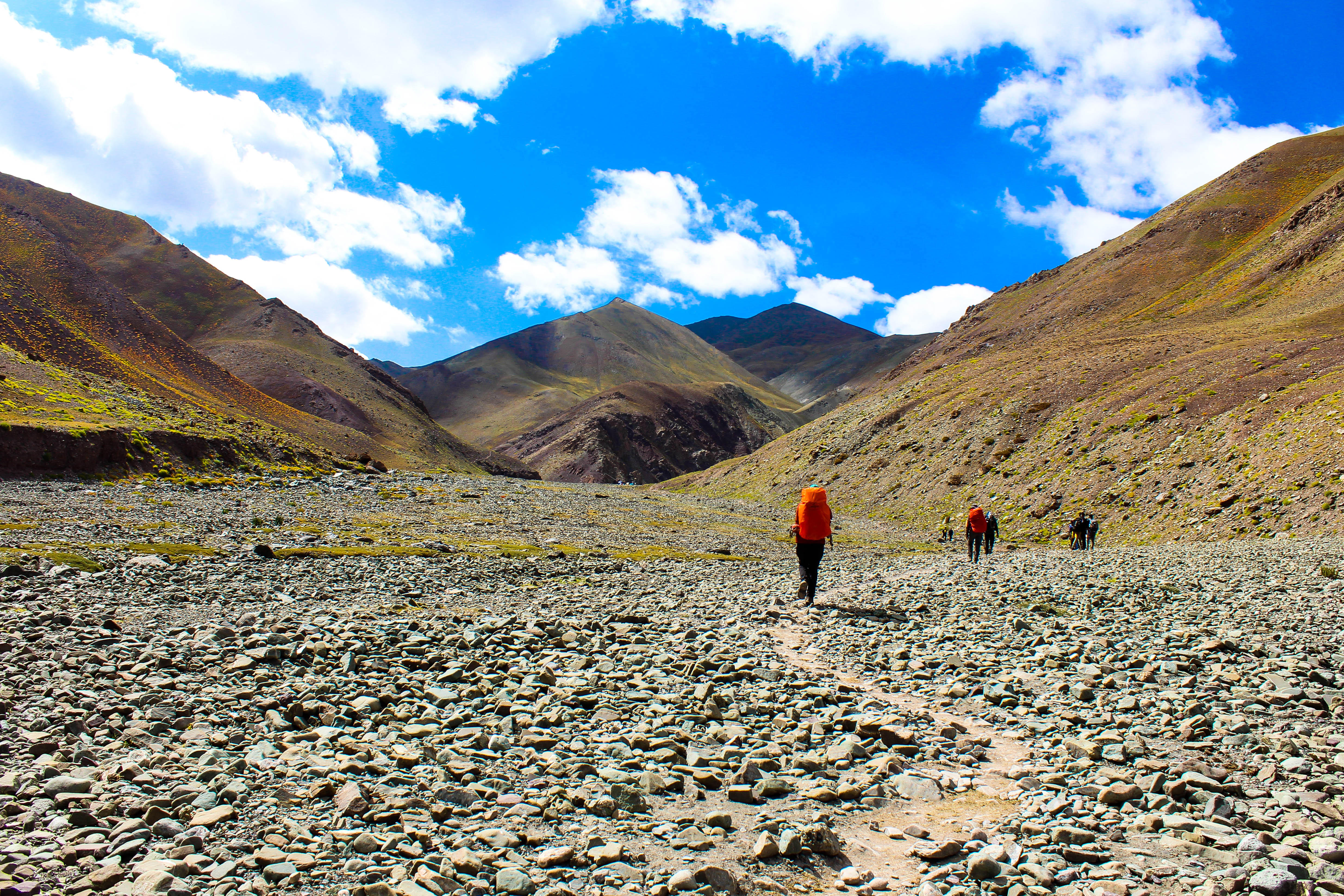
Padum-Darchha Trek
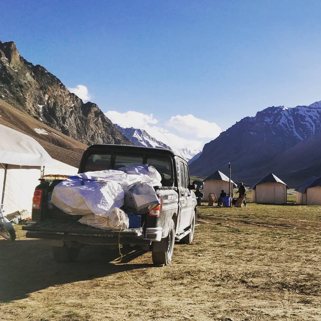
The Padam Darchcha Valley trek is an exhilarating experience. The trek involves a long trek from Darcha which is situated in the beautiful state of Himachal Pradesh to Padam, located in the mystical land of Zansak. Besides the thrill and excitement of trekking in the snowy slopes of the Himalayas, the trekking trail allows you to enjoy the beauty of the initial trail from Manali to Leh.
You can visit interesting Hindu temples in Manali which speak volumes about the history, culture and traditions of the region. This trek is a beautiful combination of adventure and sight-seeing and hence can be called one of the most exciting experiences of trekking in India.
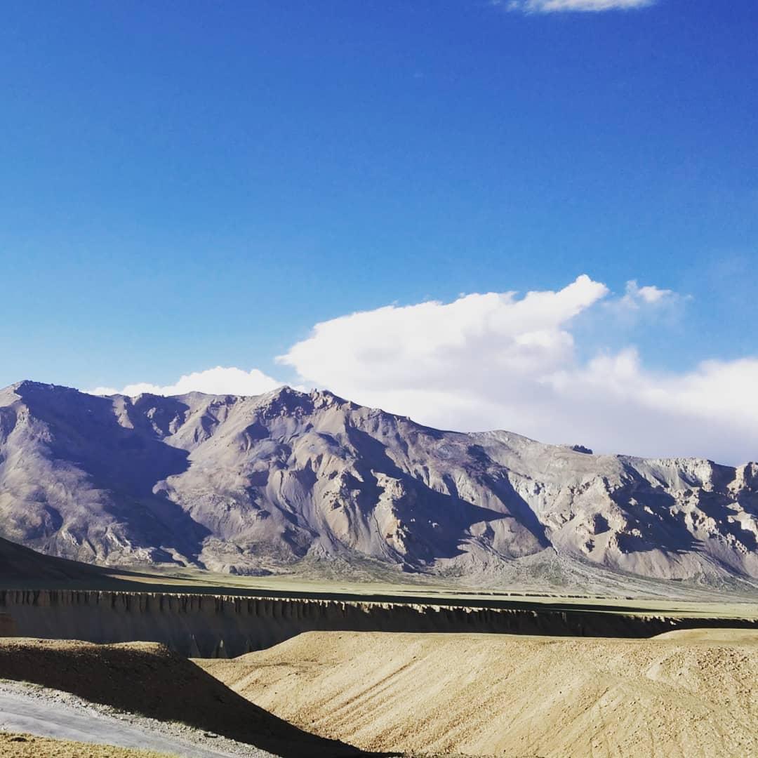
The trek begins at Chalang Tokpa, from where you will move on to Ramjak and Chumikanakpo. The trek from Ramjak to Chumikanakpo will give you a fabulous trekking experience by testing your strength and skills. From here you will move on to Lakong and pass through Kurgiak and Purne before reaching Padam, Leh. The most interesting change that you will notice on reaching the destination is the transformation of the landscape.
Best Season: June - September
Difficulty Level: Moderate
Max. Elevation: 5080 m
.jpg?w=305&h=230&dpr)


.png?w=350&h=210&dpr)


.jpg?gravity=center&width=255&height=270&crop=fill&quality=auto&fetch_format=auto&flags=strip_profile&format=jpg&sign_url=true)